Lac de Nantua

Log in to your account

AroundUs is a community-driven map of interesting places, built by curious explorers like you. It grows with every review, story, and photo you share.
Connect to save your favorite spots, contribute locations, and create personalized routes.
By continuing, you accept our Terms and Conditions and our Privacy Policy
Add to collection
Map
Suggest a change
Share

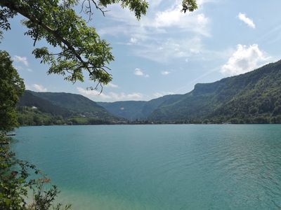
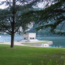
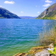
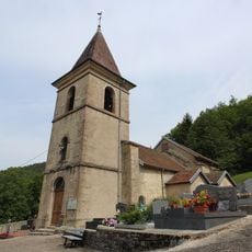
Lac de Nantua, Glacial lake in Nantua, France.
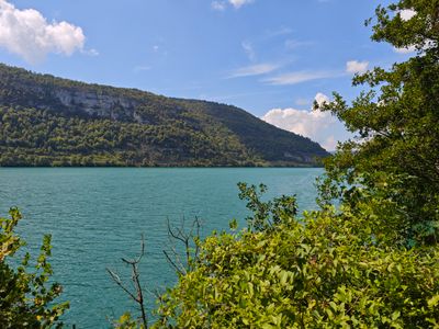
The lake extends for 2.7 kilometers between limestone cliffs in the Jura Mountains, reaching depths of 43 meters at its deepest points.

Work carried out in 1856 reduced the water level by one meter, transforming the lake from its original size to its current 141-hectare surface.

The lake plays a central role in local gastronomy, particularly with pike and crayfish that influenced traditional recipes of the Ain department.

Visitors can participate in water activities including swimming, kayaking, and sailing during summer months, while winter allows for ice skating.

Alexandre Dumas wrote about this lake in his 1834 book Travel Impressions, describing its position between the surrounding mountain formations.

Location: Nantua

Location: Port

Elevation above the sea: 475 m

Address: Lac de Nantua, Nantua, France

GPS coordinates: 46.16212,5.58826

Latest update: June 30, 2025 15:43

Lakes of Auvergne-Rhône-Alpes: volcanic craters, glacier waters, mountain dams

The Auvergne-Rhône-Alpes area has lakes from very different beginnings. Large lakes that formed from glaciers, like Lake Bourget or Lake Annecy, appeared after the glaciers in the Alps melted. They have deep water surrounded by mountains. In the Massif Central, volcanic lakes sit in old craters, such as Lake Pavin, which is nearly 7,000 years old, and Lake Issarlès, which goes down more than 100 meters deep. Some lakes are high up in the mountains, like Lake Guéry at 1250 meters, while others are in flat land or in deep valleys. There are also several artificial lakes built in the 20th century to make electricity or manage water flow. Lake Monteynard was created in 1962 on the Drac river, and Lake Saint-Étienne-Cantalès, held back by a dam on the Cère river since 1945, are popular spots for swimming, sailing, and fishing. Each lake feels different: clear and cold mountain waters, wooded shores in Jura, changing colors in volcanic craters. Visitors can walk around these places, go by boat, or just enjoy the views from the banks.

Reviews

Visited this place? Tap the stars to rate it and share your experience / photos with the community! Try now! You can cancel it anytime.

« Lac de Nantua - Glacial lake in Nantua, France » is provided by Around Us (aroundus.com). Images and texts are derived from Wikimedia project under a Creative Commons license. You are allowed to copy, distribute, and modify copies of this page, under the conditions set by the license, as long as this note is clearly visible.

Discover hidden gems everywhere you go!

From secret cafés to breathtaking viewpoints, skip the crowded tourist spots and find places that match your style. Our app makes it easy with voice search, smart filtering, route optimization, and insider tips from travelers worldwide. Download now for the complete mobile experience.

Around Us App Screenshot

A unique approach to discovering new places

Le Figaro

All the places worth exploring

France Info

A tailor-made excursion in just a few clicks

20 Minutes