Observatoire météorologique du Mont Aigoual
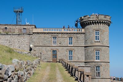
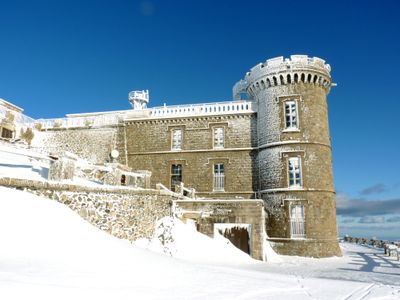
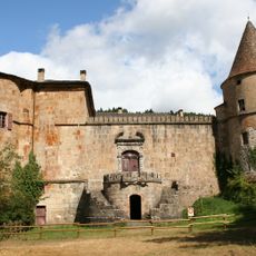
Observatoire météorologique du Mont Aigoual, Weather station and historic monument in Val-d'Aigoual, France
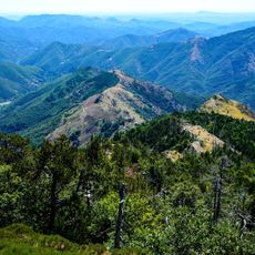
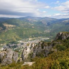
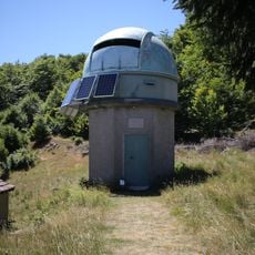
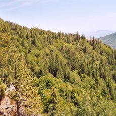
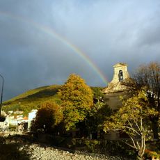
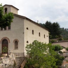
The Mont Aigoual meteorological observatory is a weather and research station located at 1567 meters (5141 feet) in the Gard department. The facility houses scientific exhibitions, meteorological instruments, and an orientation table with views of the surrounding Cevennes mountains.
The station was built between 1887 and 1894 as one of the most challenging construction projects of that era, with only 70 usable days per year due to extreme mountain conditions. This difficult beginning shaped the observatory's role as a center for understanding extreme weather.
The name reflects the mountain's identity as a place where science meets nature at a high altitude. Visitors experience how weather measurement connects directly to understanding the climate around them.
Access is easiest during the warmer months when the road is reliably open and mountain views are clearest. Visitors should bring warm clothing since temperatures at this elevation are significantly cooler than in the valley below.
In November 1968, wind speeds of 360 kilometers per hour (224 miles per hour) were recorded here, demonstrating how extreme conditions can become on this peak. Such measurements make the station a key location for understanding severe weather phenomena.
Location: Val-d'Aigoual
Elevation above the sea: 1,567 m
GPS coordinates: 44.12149,3.58183
Latest update: December 9, 2025 12:24
Mont Aigoual
40 m
The Causses and the Cévennes, Mediterranean agro-pastoral Cultural Landscape
14 km
Château de Roquedols
12.3 km
Pises Observatory
11.1 km
Château d'Ayres
13.2 km
Arboretum de l'Hort de Dieu
511 m
Saint-Marcel-de-Fontfouilhouse church
10.2 km
Temple protestant de Meyrueis
13.6 km
Maison du Viguier
13.8 km
Église Saint-Pierre de Meyrueis
13.7 km
Église Saint-Martin d'Aulas
13.5 km
Église Notre-Dame-de-l'Assomption de Gatuzières
11.3 km
Église Notre-Dame de Molezon
12.4 km
Église Saint-André de Saint-André-de-Majencoules
12.7 km
Église Saints-Pierre-et-Paul de Fraissinet-de-Fourques
11 km
Église Saint-Grégoire-et-Notre-Dame de Beaulieu
11.7 km
Église Saint-Sauveur de Camprieu
8.3 km
Église Notre-Dame-de-l'Assomption du Pompidou
10 km
Temple de l'Esperou
4.2 km
Église Notre-Dame de Dourbies
12.6 km
Temple de l'Église protestante unie de France de Rousses
9.4 km
Chapelle Notre-Dame-du-Rocher de Meyrueis
13.9 km
Pont des Six-Liards
13.5 km
Temple
13.2 km
Temple de l'église réformée de Gatuzières
11.3 km
Temple du Pompidou
10 km
Temple de Valleraugue
6.7 km
Temple de Saint-André-de-Valborgne
9 kmVisited this place? Tap the stars to rate it and share your experience / photos with the community! Try now! You can cancel it anytime.
Discover hidden gems everywhere you go!
From secret cafés to breathtaking viewpoints, skip the crowded tourist spots and find places that match your style. Our app makes it easy with voice search, smart filtering, route optimization, and insider tips from travelers worldwide. Download now for the complete mobile experience.
A unique approach to discovering new places❞
— Le Figaro
All the places worth exploring❞
— France Info
A tailor-made excursion in just a few clicks❞
— 20 Minutes