Enable Location

We need your location to show you interesting places around you

Discover nearby places

Find interesting locations and hidden gems around you

Precise directions

Get accurate directions and distances to places

Your location is never shared with other users. It's only used when you tap the location button.

Raichur district

Log in to your account

Start exploring — it's free

Trusted by 61,893 travelers worldwide

Continue with Google
Continue with Apple
or

We will send you a code to connect

By continuing, you accept our Terms and Conditions and our Privacy Policy

Check your inbox

We've sent a pincode in your inbox. Please enter the code below.

Raichur district

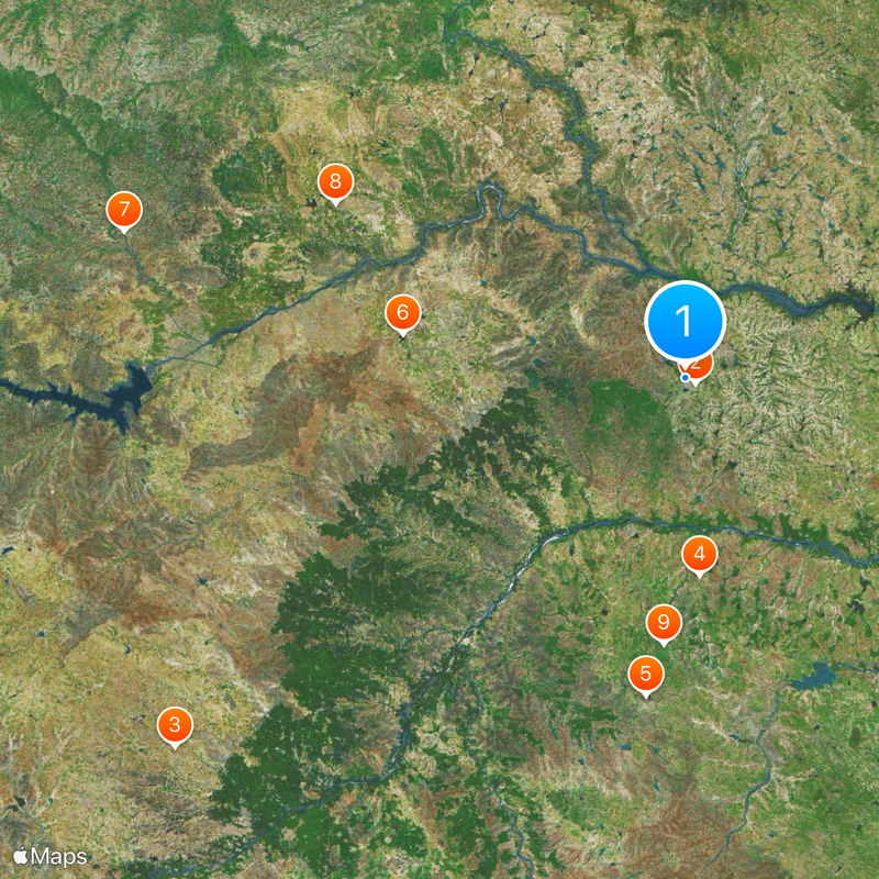
Raichur district, Administrative district in Karnataka, India

Raichur district is an administrative region in Karnataka situated between the Krishna River to the north and the Tungabhadra River to the south. These two rivers create a fertile area that supports agriculture and settlement.

Three rock edicts of Emperor Ashoka from the third century BC are found in the district, showing that this area was part of the ancient Mauryan Empire. These inscriptions are significant evidence of an early historical period.

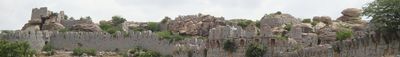
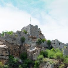
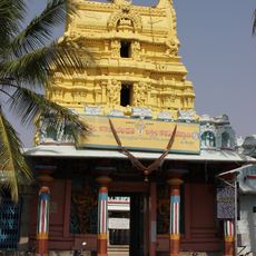
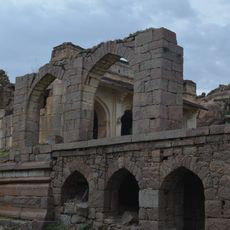
The region displays influences from multiple kingdoms in its temples and monuments that remain visible today. These structures tell the story of rulers who held power across many centuries.

The district is divided into seven administrative zones, with Raichur serving as the main city and administrative center. These different areas are well connected, making travel through the region straightforward.

The district is home to the Hatti Gold Mines, one of India's few active gold mining sites. At the same time, it remains the leading rice-growing center of Karnataka, combining mineral extraction with agricultural production.

The community of curious travelers

AroundUs brings together thousands of curated places, local tips, and hidden gems, enriched daily by 60,000 contributors worldwide.

Start exploring
Capital city
Raichur
Elevation above the sea
400 m
Shares border with
Vijaypura District, Kurnool district
GPS coordinates
16.21000,77.35000
Latest update
December 19, 2025 22:35
« Raichur district - Administrative district in Karnataka, India » is provided by Around Us (aroundus.com). Images and texts are derived from Wikimedia project under a Creative Commons license. You are allowed to copy, distribute, and modify copies of this page, under the conditions set by the license, as long as this note is clearly visible.

Discover hidden gems everywhere you go!

From secret cafés to breathtaking viewpoints, skip the crowded tourist spots and find places that match your style. Our app makes it easy with voice search, smart filtering, route optimization, and insider tips from travelers worldwide. Download now for the complete mobile experience.

Around Us App Screenshot

A unique approach to discovering new places

Le Figaro

All the places worth exploring

France Info

A tailor-made excursion in just a few clicks

20 Minutes

Around Us
Travel Guide & Maps
Download

Send to your phone

QR Code
1

Open the camera app on your mobile.

2

Point at the QR code with your camera. A notification will appear.

3

Tap the notification to open the link.