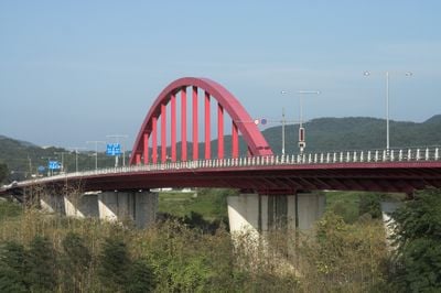
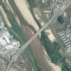
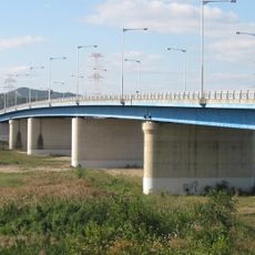
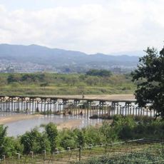
山城大橋, Steel arch bridge over Kizu River in Kyotanabe, Japan.
The Yamashiro Bridge is a steel arch bridge spanning the Kizu River between Joyo and Kyotanabe, carrying traffic on National Route 307. Its large central arch and overall span form a prominent structure across the river valley.
A ferry service began operating at this location in 1934, followed by the construction of the first bridge between 1959 and 1964. The current steel arch structure replaced this earlier crossing and became part of regional transportation development.
The bridge connects the cities of Joyo and Kyotanabe, serving as a vital link in the Kansai Science City development project.
The bridge carries daily traffic on National Route 307, with the busiest periods during commute hours. Pedestrians can cross the structure and enjoy views of the river and surrounding landscape from various points along the span.
The bridge structure incorporates a single-chord Lohse arch design with an 18-meter-high central span painted in colors reflecting the regional identity.
The community of curious travelers
AroundUs brings together thousands of curated places, local tips, and hidden gems, enriched daily by 60,000 contributors worldwide.