Enable Location

We need your location to show you interesting places around you

Discover nearby places

Find interesting locations and hidden gems around you

Precise directions

Get accurate directions and distances to places

Your location is never shared with other users. It's only used when you tap the location button.

Heira Bridge

Log in to your account

Start exploring — it's free

Trusted by 62,498 travelers worldwide

Continue with Google
Continue with Apple
or

We will send you a code to connect

By continuing, you accept our Terms and Conditions and our Privacy Policy

Check your inbox

We've sent a pincode in your inbox. Please enter the code below.

Heira Bridge

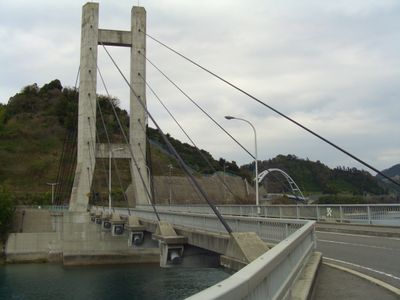
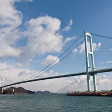
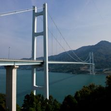
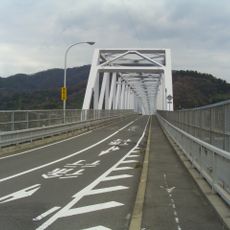
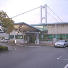
Heira Bridge, Road bridge in Kure, Japan

Heira Bridge connects the islands of Osakishimojima and Herashima by spanning a strait as part of the Akinada Tobishima Kaido transportation network. The structure carries both vehicle and pedestrian traffic across this waterway using modern engineering techniques.

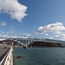
The bridge opened in 1995 and marked an advancement in Japanese infrastructure development. It significantly improved transportation connections between the island communities that were previously more isolated from each other.

The bridge, known as Heira-bashi in Japanese, represents the engineering capabilities of Hiroshima Prefecture while supporting local fishing communities.

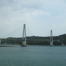
The bridge is accessible via the Higashi-Hiroshima Kure Expressway and takes about an hour to reach from the nearest major interchange. Visitors should note this is an active traffic route, so crossing is most pleasant outside peak travel times.

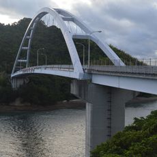
This bridge holds the distinction of being the first of its type in Japan, constructed using innovative precast concrete block methods. The building technique was groundbreaking at the time and demonstrated advanced engineering capabilities.

The community of curious travelers

AroundUs brings together thousands of curated places, local tips, and hidden gems, enriched daily by 60,000 contributors worldwide.

Start exploring
Location
Official opening
August 1, 1995
Part of
Akinada Tobishima Kaido
GPS coordinates
34.19194,132.84928
Latest update
December 14, 2025 12:25
« Heira Bridge - Road bridge in Kure, Japan » is provided by Around Us (aroundus.com). Images and texts are derived from Wikimedia project under a Creative Commons license. You are allowed to copy, distribute, and modify copies of this page, under the conditions set by the license, as long as this note is clearly visible.

Discover hidden gems everywhere you go!

From secret cafés to breathtaking viewpoints, skip the crowded tourist spots and find places that match your style. Our app makes it easy with voice search, smart filtering, route optimization, and insider tips from travelers worldwide. Download now for the complete mobile experience.

Around Us App Screenshot

A unique approach to discovering new places

Le Figaro

All the places worth exploring

France Info

A tailor-made excursion in just a few clicks

20 Minutes

Around Us
Travel Guide & Maps
Download

Send to your phone

QR Code
1

Open the camera app on your mobile.

2

Point at the QR code with your camera. A notification will appear.

3

Tap the notification to open the link.