Enable Location

We need your location to show you interesting places around you

Discover nearby places

Find interesting locations and hidden gems around you

Precise directions

Get accurate directions and distances to places

Your location is never shared with other users. It's only used when you tap the location button.

Kosoku daishi bridge

Log in to your account

Start exploring — it's free

Trusted by 63,907 travelers worldwide

Continue with Google
Continue with Apple
or

We will send you a code to connect

By continuing, you accept our Terms and Conditions and our Privacy Policy

Check your inbox

We've sent a pincode in your inbox. Please enter the code below.

Kosoku daishi bridge
Discussion Reviews 1 Photos
2.7k Popularity

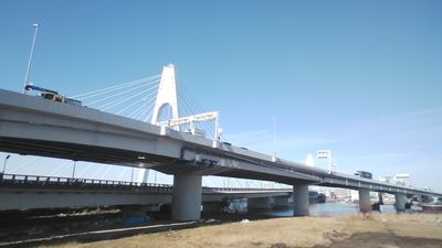
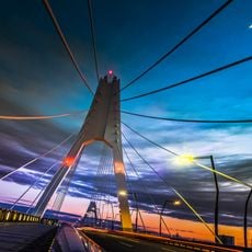
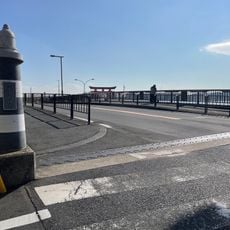
Kosoku daishi bridge, Transportation bridge across Tama River between Kawasaki-ku and Ota, Japan.

Kosoku daishi bridge is a highway crossing over the Tama River with multiple lanes for vehicles and a separate pedestrian walkway. The concrete structure efficiently handles daily traffic flow between these two districts while supporting both cars and foot traffic.

The bridge was built to address growing transportation needs between the two districts as part of Tokyo Bay region infrastructure improvements. Its completion strengthened connections and supported economic development in the surrounding areas.

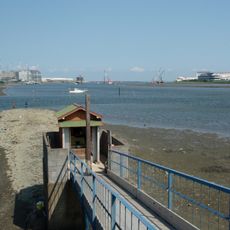
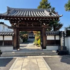
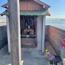
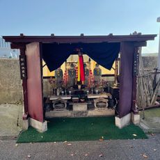
The bridge location near the Tama River banks provides access to local festivals, community gatherings, and traditional celebrations throughout the year.

The bridge is accessible during daylight hours and works well for both drivers and pedestrians. It is best to avoid peak hours if possible, as traffic can become quite heavy during commute times.

The bridge offers direct views of Mount Fuji and creates a structural connection point between Tokyo and Kanagawa prefectures across the Class 1 Tama River.

The community of curious travelers

AroundUs brings together thousands of curated places, local tips, and hidden gems, enriched daily by 60,000 contributors worldwide.

Start exploring
Location
Location
Ota
GPS coordinates
35.54306,139.74244
Latest update
December 12, 2025 14:20
Reviews
Share your experience

No review yet

Discussions
Start a discussion...

No discussion yet

« Kosoku daishi bridge - Transportation bridge across Tama River between Kawasaki-ku and Ota, Japan » is provided by Around Us (aroundus.com). Images and texts are derived from Wikimedia project under a Creative Commons license. You are allowed to copy, distribute, and modify copies of this page, under the conditions set by the license, as long as this note is clearly visible.

Discover hidden gems everywhere you go!

From secret cafés to breathtaking viewpoints, skip the crowded tourist spots and find places that match your style. Our app makes it easy with voice search, smart filtering, route optimization, and insider tips from travelers worldwide. Download now for the complete mobile experience.

Around Us App Screenshot

A unique approach to discovering new places

Le Figaro

All the places worth exploring

France Info

A tailor-made excursion in just a few clicks

20 Minutes

Around Us
Travel Guide & Maps
Download

Send to your phone

QR Code
1

Open the camera app on your mobile.

2

Point at the QR code with your camera. A notification will appear.

3

Tap the notification to open the link.