Oosterscheldekering

Log in to your account

AroundUs is a community-driven map of interesting places, built by curious explorers like you. It grows with every review, story, and photo you share.
Connect to save your favorite spots, contribute locations, and create personalized routes.
Continue with Google
Continue with Apple
Continue with X
Continue with Facebook
Continue with email
By continuing, you accept our Terms and Conditions and our Privacy Policy
Create an account

Oosterscheldekering

Add to collection
Map
Suggest a change
Share

Oosterscheldekering, Storm surge barrier in Zeeland, Netherlands

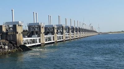
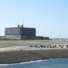
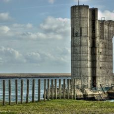
The Oosterscheldekering is a storm surge barrier stretching across the Oosterschelde channel, composed of large steel gates held up by reinforced concrete pillars placed in a line. During normal weather, the gates stay open to allow water movement, but they seal shut automatically when water levels pose a flooding risk.

The structure was built after a devastating flood in 1953 that killed thousands and prompted the country to rethink water defense. Construction took place from 1976 to 1986 and was considered one of the most challenging engineering projects of that era.

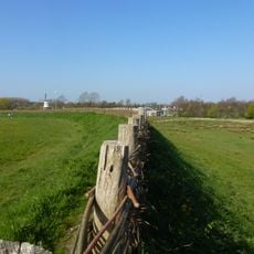
The barrier represents Dutch determination to live safely alongside water, and locals view it as a shared achievement in their fight against the sea. From observation points, you can see how the structure allows tidal flow during calm periods, maintaining the ecosystem that fishing communities depend on.

The visitor center on the artificial island of Neeltje-Jans offers the best views and educational exhibits about the structure and its purpose. Wear comfortable walking shoes since the site covers a large area and there is much to explore around the barrier.

Unusually, this barrier remains fully open during normal conditions so water flows freely and natural tides continue as before. This balance between flood protection and ecological health is what made the design innovative and attracted interest from water engineers worldwide.

Location: Schouwen-Duiveland

Location: Veere

Location: Noord-Beveland

Part of: N57 highway, Delta Works

GPS coordinates: 51.63000,3.70389

Latest update: December 6, 2025 19:01

Photos
Navigation locks: hydraulic structures, dams, and boat lifts

Navigation locks are engineering structures that enable ships to pass through significant elevation changes between seas, lakes, and rivers. From the Panama Canal, where vessels rise 86 feet (26 meters) to cross the Isthmus, to the Three Gorges Dam in China, featuring five-stage locks managing a...

Reviews

Visited this place? Tap the stars to rate it and share your experience / photos with the community! Try now! You can cancel it anytime.

« Oosterscheldekering - Storm surge barrier in Zeeland, Netherlands » is provided by Around Us (aroundus.com). Images and texts are derived from Wikimedia project under a Creative Commons license. You are allowed to copy, distribute, and modify copies of this page, under the conditions set by the license, as long as this note is clearly visible.

Discover hidden gems everywhere you go!

From secret cafés to breathtaking viewpoints, skip the crowded tourist spots and find places that match your style. Our app makes it easy with voice search, smart filtering, route optimization, and insider tips from travelers worldwide. Download now for the complete mobile experience.

Around Us App Screenshot

A unique approach to discovering new places

Le Figaro

All the places worth exploring

France Info

A tailor-made excursion in just a few clicks

20 Minutes