Otterøy og Hestholmen, protected area in Norway
Location: Bømlo Municipality
Inception: April 3, 1987
GPS coordinates: 59.72200,5.43000
Latest update: November 3, 2025 20:26
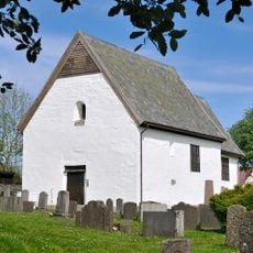
Old Moster Church
3.6 km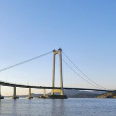
Stord Bridge
3.2 km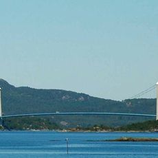
Bømla Bridge
3 km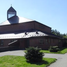
Nysæter Church
6.9 km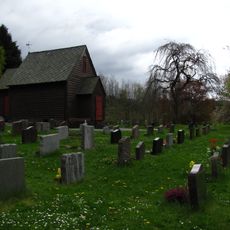
Valen Chapel
4 km
Spissøybrua
4.7 km
Halsnøyfjorden
6.7 km
Stora Brattaberg
5.2 km
Føyno - Lok. 65, Jensavikjo
2.8 km
Skimmeland - Fetts fk. 2, Kidling
4.6 km
Eidsvåg - Fetts fk. 1
4.7 km
Gramshaug - Fetts NB
4.6 km
Røyksund - Lok. 128, Skjeljaviketangen
4.9 km
Eventyrvegen
6.4 km
Fish Woman
7.3 km
Tittelsnes kystfort
4.5 km
Moster amfi
3.4 km
Stord Theather
7.3 km
Sætravikjo Strand
5.5 km
Sætravikjo Strand
5.5 km
Kristtornskogen Golfpark
5.9 km
Tora Mostrastong
3.5 km
Scenic viewpoint
4.4 km
Scenic viewpoint
4.3 km
Scenic viewpoint
4.3 km
Scenic viewpoint
5.4 km
Scenic viewpoint
2.6 km
Scenic viewpoint
2.4 kmReviews
Visited this place? Tap the stars to rate it and share your experience / photos with the community! Try now! You can cancel it anytime.
Discover hidden gems everywhere you go!
From secret cafés to breathtaking viewpoints, skip the crowded tourist spots and find places that match your style. Our app makes it easy with voice search, smart filtering, route optimization, and insider tips from travelers worldwide. Download now for the complete mobile experience.

A unique approach to discovering new places❞
— Le Figaro
All the places worth exploring❞
— France Info
A tailor-made excursion in just a few clicks❞
— 20 Minutes