
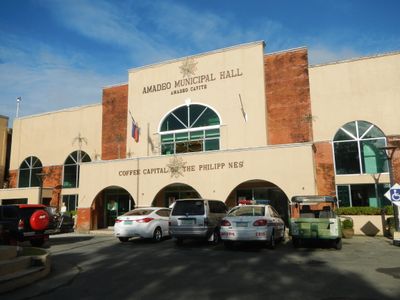
Amadeo Municipal Hall, government building in Amadeo, Cavite
Location: Amadeo
Address: A. Mabini Street
GPS coordinates: 14.17028,120.92222
Latest update: March 16, 2025 18:18
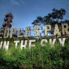
People's Park in the Sky
11.2 km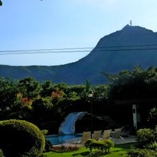
Mount Sungay
11.2 km
Silang Church
8.2 km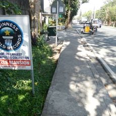
Puzzle Mansion
8.3 km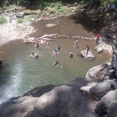
Matang Tubig
13.1 km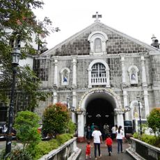
St. Gregory the Great Parish Church
9.6 km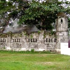
Cuartel de Santo Domingo
15.3 km
Sky Ranch
8.5 km
Kaytitinga Falls
12.3 km
Villa Colmenar Natural Spring Resort
6.8 km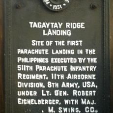
Tagaytay Ridge Landing historical marker
7.5 km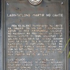
Thirteen Martyrs of Cavite historical marker
13.5 km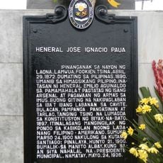
General Jose Ignacio Paua historical marker
10 km
Riverbank
16.5 km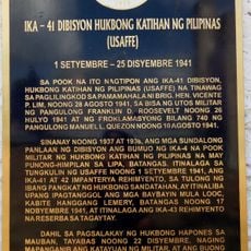
41st Division Philippine Army (USAFFE) historical marker
8.5 km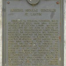
General Nicolas Gonzales y Lantin historical marker
11.2 km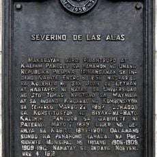
Severino de las Alas historical marker
5.6 km
Banio kreek
6.2 km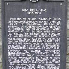
Vito Belarmino historical marker
7.7 km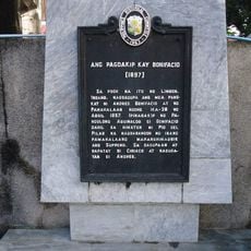
The Capture of Bonifacio historical marker
3.9 km
Bearseum
1.8 km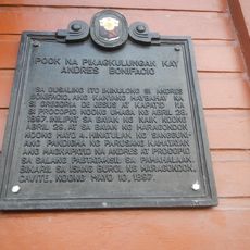
Site of Imprisonment of Andres Bonifacio historical marker
5.5 km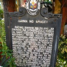
Town of Amadeo historical marker
20 m
Parish of Saint Mary Magdalene historical marker
59 m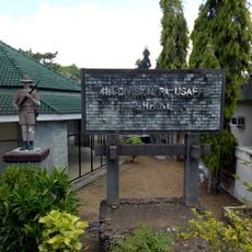
41st Division Philippine Army-USAFFE Shrine
8.5 km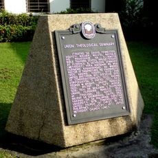
Union Theological Seminary historical marker
14.3 km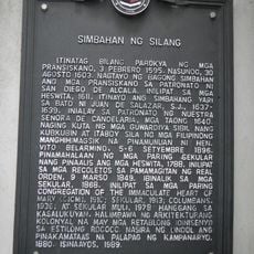
Church of Silang historical marker
8.2 km
Kidzworld
15.3 kmVisited this place? Tap the stars to rate it and share your experience / photos with the community! Try now! You can cancel it anytime.
Discover hidden gems everywhere you go!
From secret cafés to breathtaking viewpoints, skip the crowded tourist spots and find places that match your style. Our app makes it easy with voice search, smart filtering, route optimization, and insider tips from travelers worldwide. Download now for the complete mobile experience.

A unique approach to discovering new places❞
— Le Figaro
All the places worth exploring❞
— France Info
A tailor-made excursion in just a few clicks❞
— 20 Minutes