Chaurāma, summit in Pakistan
Location: Gilgit-Baltistan
Elevation above the sea: 4,666 m
GPS coordinates: 35.07667,75.20306
Latest update: October 27, 2025 08:25
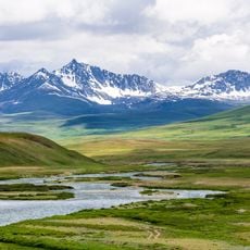
Deosai National Park
20.3 km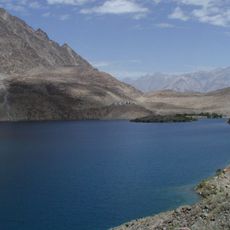
Satpara Lake
42.5 km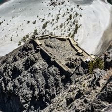
Skardu Fort
47 km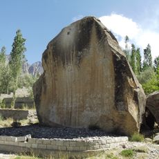
Manthal Buddha Rock
44.6 km
Chunda Valley
39.4 km
Eagle Statue
46.2 km
Burzil Top
22.4 km
Sand Dunes
43.9 km
City Park Sakardu
45.8 km
Polo Ground
46.7 km
Bazaar
46.3 km
Sapper bridge
46.7 km
Deosai Pass 4180 m
8.7 km
Polo Grounds
45.6 km
Roca de Buda Manthal
44.6 km
Boat Rental
46.7 km
Roca de Buda Manthal
44.6 km
Roca de Buda Manthal
44.6 km
Scenic viewpoint
45.8 km
Scenic viewpoint
46.5 km
City Viewpoint
45.6 km
View of K2 from 5050m hilltop
10.1 km
Scenic viewpoint
10.1 km
Skardu Viewpoint
39.7 km
Scenic viewpoint
45 km
I Love Skardu
44.5 km
Scenic viewpoint
43.2 km
Scenic viewpoint
28.6 kmReviews
Visited this place? Tap the stars to rate it and share your experience / photos with the community! Try now! You can cancel it anytime.
Discover hidden gems everywhere you go!
From secret cafés to breathtaking viewpoints, skip the crowded tourist spots and find places that match your style. Our app makes it easy with voice search, smart filtering, route optimization, and insider tips from travelers worldwide. Download now for the complete mobile experience.

A unique approach to discovering new places❞
— Le Figaro
All the places worth exploring❞
— France Info
A tailor-made excursion in just a few clicks❞
— 20 Minutes