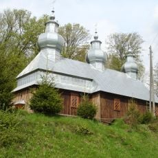
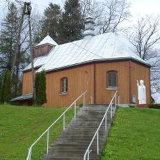
Bircza, Administrative town in Subcarpathian Voivodeship, Poland
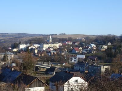
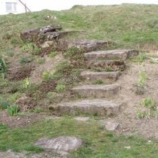
Bircza is a town in Subcarpathian Voivodeship, located roughly 24 kilometers southwest of Przemyśl at an elevation of 262 meters. The settlement functions as the administrative center for its surrounding gmina, which includes several smaller villages in the rural landscape.
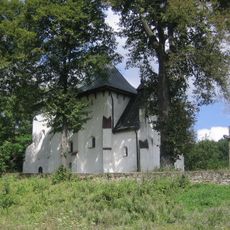
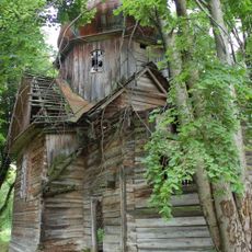
The settlement received formal town rights in 1464 and gradually became an important administrative center for the region. The 20th century brought major disruptions that transformed the community and reshaped the town's demographic composition.
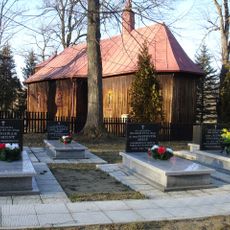
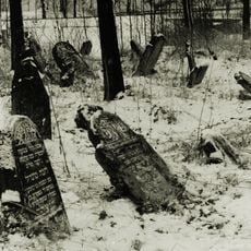
The town was a center for Jewish life and learning, particularly shaped by Dynów Hasidic traditions and practices. Walking through the streets today, visitors can sense the echoes of this community and the religious customs that once defined daily life here.
The State Archive in Przemyśl holds extensive records about the town, including birth, marriage, and death certificates from parish records. Researchers can access these documents to trace family connections and local genealogy with help from archivists.
The Association of Bircza Researchers brings together genealogists and descendants to document the town's heritage through photographs and personal accounts. This work preserves stories of residents whose histories might otherwise be forgotten.
Location: Gmina Bircza
Elevation above the sea: 262 m
Website: http://bircza.pl
GPS coordinates: 49.69222,22.47944
Latest update: December 7, 2025 20:23
Saint Onuphrius church, Posada Rybotycka
9.3 km
Castle in Bircza
399 m
St. Anne's Orthodox Church in Kotów
3.2 km
Saint Michael Archangel church in Brzeżawa
8.6 km
Old Cemetery
383 m
Cerkiew św. Dymitra w Kuźminie
9.3 km
Exaltation of the Holy Cross church in Rudawka
2.8 km
Saint Stanislaus Kostka church in Bircza
244 m
Saint Theodosius church in Malawa
5.2 km
Kościół św. Jana Chrzciciela w Leszczawie Dolnej
4.9 km
Our Lady of Perpetual Help church in Kuźmina
9.3 km
Cerkiew Soboru NMP w Birczy
166 m
Cmentarz żydowski w Birczy
457 m
Kościół Świętych Apostołów Piotra i Pawła w Roztoce
10.1 km
Paraskevi of Iconium church in Lipa
7.3 km
Saints Peter and Paul church in Roztoka
10.1 km
Kapliczka w Nowej Wsi
1.7 km
Kapliczka I w Brzusce
6.2 km
Kapliczka w Brzusce
7.1 km
Kapliczka II w Brzusce
6.4 km
Kapliczka przydrożna
101 m
Dom nr 38
63 m
Kaplica grobowa rodz. Pieściorowskich
9.3 km
Kaplica grobowa rodziny Zarębów
7.3 km
City fortifications
91 m
Kapliczka w Rudawce
1.9 km
Church of Saint Demetrius in Piątkowa
10.3 km
Zespół kościoła św. Stanisława Kostki
265 mVisited this place? Tap the stars to rate it and share your experience / photos with the community! Try now! You can cancel it anytime.
Discover hidden gems everywhere you go!
From secret cafés to breathtaking viewpoints, skip the crowded tourist spots and find places that match your style. Our app makes it easy with voice search, smart filtering, route optimization, and insider tips from travelers worldwide. Download now for the complete mobile experience.
A unique approach to discovering new places❞
— Le Figaro
All the places worth exploring❞
— France Info
A tailor-made excursion in just a few clicks❞
— 20 Minutes