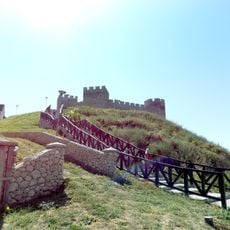
Židovar, Archaeological Site of Exceptional Importance in Orešac, Serbia.
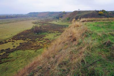
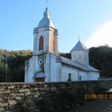
Židovar is an archaeological site in Orešac that sits on an irregular plateau overlooking the Caras River valley. The terrain contains layers of settlement from multiple time periods, with artifacts spread across a modest area.
The plateau was first recorded on a map made for Prince Eugene of Savoy in the early 18th century, marked as ancient ruins. Later investigation confirmed the site hosted successive waves of habitation across many centuries.
The location has long been recognized for its traces of early settlement and human occupation. Objects discovered here offer glimpses into how inhabitants lived and worked in this region.
The site is sometimes open to visitors during the digging season, especially when active research is underway. It is worth checking current conditions before visiting, as access can vary depending on ongoing archaeological work.
The plateau's location at the eastern edge of Deliblato Sands provided early inhabitants with natural defensive advantages. This geographic position made it a strategically valuable place for settlement and protection.
Location: Vršac municipality
GPS coordinates: 44.95034,21.26449
Latest update: December 14, 2025 09:41
Ram Fortress
16.2 km
Danube–Tisa–Danube Canal
14.9 km
Bela Crkva lakes
12.9 km
Saint Gerhard the Bishop and Martyr Roman Catholic Church, Vršac
18.9 km
Labudovo okno
16.4 km
Château de Vlajkovac
14.5 km
Bazjaš monastery
17.9 km
Vršac City Museum
19 km
Čardak
17 km
Grad
2.9 km
Maison natale de Jovan Sterija Popović
19.1 km
Maison Kod dva pištolja à Vršac
19.1 km
Église Saint-Pierre-et-Saint-Paul de Bela Crkva
14 km
Hôtel de ville de Vršac
19.1 kmÉglise Saint-Théodore-Tiron de Kuštilj
13 kmÉglise Saint-Nicolas de Ritiševo
12.8 km
Maison natale de Žarko Zrenjanin
10.1 km
Église de l'Ascension de Grebenac
6 km
Vršac City Library
19.1 kmBâtiment de l'école maternelle Anđa Ranković à Vršac
18.6 kmBâtiment de l'ancien Comité populaire municipal à Vršac
19.1 km
Bâtiment situé 5 Trg pobede à Vršac
19.1 km
Зграда „Конкордија“ у Вршцу
19 km
Église de l'Ascension de Potporanj
8.3 km
Зграда на Тргу Св. Теодора Вршачког бр. 33 у Вршцу
19.1 km
Кућа у Ул. Задружна бб
12.9 km
Bâtiment situé 21 rue Žarka Zrenjanina à Vršac
19 km
Zgrada muzejske jedinice u Beloj Crkvi
13.6 kmVisited this place? Tap the stars to rate it and share your experience / photos with the community! Try now! You can cancel it anytime.
Discover hidden gems everywhere you go!
From secret cafés to breathtaking viewpoints, skip the crowded tourist spots and find places that match your style. Our app makes it easy with voice search, smart filtering, route optimization, and insider tips from travelers worldwide. Download now for the complete mobile experience.
A unique approach to discovering new places❞
— Le Figaro
All the places worth exploring❞
— France Info
A tailor-made excursion in just a few clicks❞
— 20 Minutes