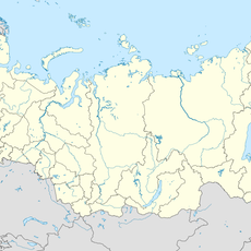
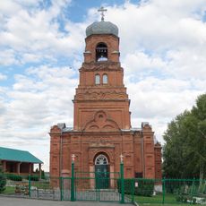
Sernovodny Hill, Natural monument in Sergiyevsky District, Samara Oblast, Russia
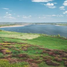
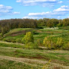
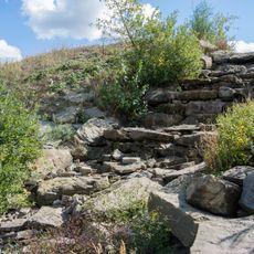
Sernovodny Hill is a table-shaped denudation remnant of marls, sandstones and dense clays of the Permian Kazanian stage, rising to 206 m above sea level. Its wavy plateau and steep slopes, shaped by erosion in the late Neogene Akchagyl Sea, drop toward the valleys of the Surgut and Shungut rivers. The protected area covers 179.66 ha in two sections: the hill's western and southern slopes, and a separate steppe plot.
The site was designated a regional natural monument by decision No. 201 of the Kuibyshev Regional Executive Committee on 14 June 1989. Its status was redefined by Samara Oblast government decree No. 838 of 29 December 2012. The protected area has varied from 30 hectares (the hill alone) to 206 hectares, and now covers 179.66 hectares.
The hill's name comes from the sulphur springs of Sernovodsk, the settlement 3 km to the north-west. Botanists have collected here since the 18th century: Peter Simon Pallas reported its plants in 1773 and 1776, Karl Klaus gathered 794 flowering species between 1834 and 1844, and Sergei Korzhinsky added 10 more at the end of the 19th century. Expeditions by the Institute of Ecology of the Volga Basin followed in 2008, 2011 and 2012.
Visitors can hike on marked trails and explore the natural environment while respecting the regulations of the protected area. Construction and logging are prohibited to keep the site and its resources intact.
The hill's flat top was once ploughed and now supports weed communities, while its steep southern slopes are cut into the shoreline of the Late Neogene Akchagyl Sea. The protected area covers 179.66 hectares, split between forest land and agricultural land.
The community of curious travelers
AroundUs brings together thousands of curated places, local tips, and hidden gems, enriched daily by 94,346 contributors worldwide.