Sovkhoz Ramenskoe town

Log in to your account

AroundUs is a community-driven map of interesting places, built by curious explorers like you. It grows with every review, story, and photo you share.
Connect to save your favorite spots, contribute locations, and create personalized routes.
Continue with Google
Continue with Apple
Continue with X
Continue with Facebook
Continue with email
By continuing, you accept our Terms and Conditions and our Privacy Policy
Create an account

Sovkhoz Ramenskoe town

Add to collection
Map
Suggest a change
Share

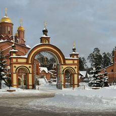
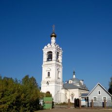
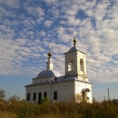
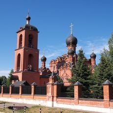
Sovkhoz Ramenskoe town, State farm settlement in Ramensky District, Moscow Oblast, Russia

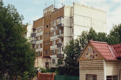
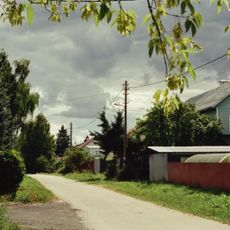
Sovkhoz Ramenskoe is a state farm settlement in Ramensky District, Moscow Oblast, featuring residential blocks mixed with agricultural facilities across the land. The settlement is characterized by five-story apartment buildings, open fields, and support structures that form the core of what was once a major farming operation.

The settlement was established during the Soviet period as part of state-controlled agricultural development in the region. It has since evolved through decades of changes in farming practices and demographic shifts across the community.

The settlement reflects its agricultural roots through the layout of homes close to working fields and equipment storage areas that define the landscape. Residents continue to maintain personal garden plots alongside their homes, a practice that shapes daily routines and the visible character of the streets.

The settlement is reachable by local transport and open for visitors to walk through the residential and agricultural areas at their own pace. The landscape is relatively flat, making it easy to navigate on foot and observe the daily workings of the community.

The settlement preserves a working example of Soviet-era agricultural organization, where workers lived in close proximity to their fields and shared communal services. This direct connection between home and workplace remains visible in the layout and infrastructure of the community today.

Location: Сельское поселение Заболотьевское

GPS coordinates: 55.55042,38.25373

Latest update: December 10, 2025 20:09

Photos
Around this place
Gzhel ceramics
Russian Federation

Gzhel ceramics

13.4 km
Saturn Stadium
Russian Federation

Saturn Stadium

3.4 km
Manufactory in Ramenskoye
Russian Federation

Manufactory in Ramenskoye

3.1 km
Old Believers churches
Russian Federation

Old Believers churches

10.9 km
Meteor Stadium
Russian Federation

Meteor Stadium

9.2 km
Saints Boris and Gleb Church
Russian Federation

Saints Boris and Gleb Church

3 km
Church of the Holy Trinity in Ramenskoye
Russian Federation

Church of the Holy Trinity in Ramenskoye

2.8 km
Cathedral of Archangel Michael
Russian Federation

Cathedral of Archangel Michael

13.8 km
House of Scientists TsAGI
Russian Federation

House of Scientists TsAGI

10.1 km
Saints Peter and Paul Orthodox church in Ilinsky
Russian Federation

Saints Peter and Paul Orthodox church in Ilinsky

12 km
Mass grave of Soviet soldiers in Ramenskoe
Russian Federation

Mass grave of Soviet soldiers in Ramenskoe

2 km
Church of Saint Demetrius of Thessaloniki
Russian Federation

Church of Saint Demetrius of Thessaloniki

12.8 km
Church of the Dormition of the Theotokos
Russian Federation

Church of the Dormition of the Theotokos

13.5 km
Saint Michael the Archangel Church, Zagornovo (Ramensky District)
Russian Federation

Saint Michael the Archangel Church, Zagornovo (Ramensky District)

4.7 km
Church of the Jerusalem Icon of the Theotokos
Russian Federation

Church of the Jerusalem Icon of the Theotokos

13.8 km
Church of the Theotokos of Smolensk, Krivtsy (Ramensky District)
Russian Federation

Church of the Theotokos of Smolensk, Krivtsy (Ramensky District)

9.8 km
Храм Великомученика Никиты в Лужках
Russian Federation

Храм Великомученика Никиты в Лужках

13.8 km
Poselok Sovkhoza Safonovskiy
Russian Federation

Poselok Sovkhoza Safonovskiy

2.9 km
Церковь Николая Чудотворца
Russian Federation

Церковь Николая Чудотворца

8.8 km
Жуковский, улица Кирова 3
Russian Federation

Жуковский, улица Кирова 3

7.6 km
Gzhel church
Russian Federation

Gzhel church

11.1 km
Церковь Покрова Пресвятой Богородицы
Russian Federation

Церковь Покрова Пресвятой Богородицы

9 km
Jukovsky monument
Russian Federation

Jukovsky monument

9.9 km
Улица Карла Маркса, 1
Russian Federation

Улица Карла Маркса, 1

2.8 km
Церковь Димитрия Солунского
Russian Federation

Церковь Димитрия Солунского

6.8 km
Церковь Николая Чудотворца
Russian Federation

Церковь Николая Чудотворца

13.6 km
Церковь Казанской иконы Божией Матери
Russian Federation

Церковь Казанской иконы Божией Матери

10.5 km
Prud Rybkhoz
Russian Federation

Prud Rybkhoz

6.2 km
Show the full map
Reviews

Visited this place? Tap the stars to rate it and share your experience / photos with the community! Try now! You can cancel it anytime.

« Sovkhoz Ramenskoe town - State farm settlement in Ramensky District, Moscow Oblast, Russia » is provided by Around Us (aroundus.com). Images and texts are derived from Wikimedia project under a Creative Commons license. You are allowed to copy, distribute, and modify copies of this page, under the conditions set by the license, as long as this note is clearly visible.

Discover hidden gems everywhere you go!

From secret cafés to breathtaking viewpoints, skip the crowded tourist spots and find places that match your style. Our app makes it easy with voice search, smart filtering, route optimization, and insider tips from travelers worldwide. Download now for the complete mobile experience.

Around Us App Screenshot

A unique approach to discovering new places

Le Figaro

All the places worth exploring

France Info

A tailor-made excursion in just a few clicks

20 Minutes