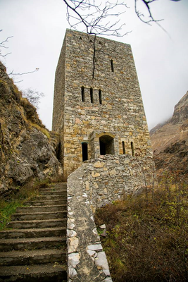
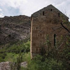
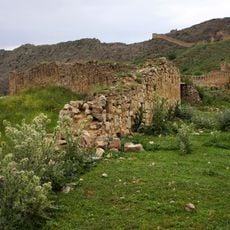
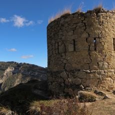
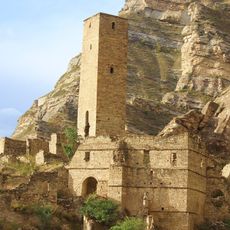
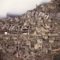
Gimry tower, Stone tower in Untsukulsky District, Russia.
Gimry Tower is a stone defensive tower in the Untsukulsky District of Dagestan, Russia, built in the traditional Avar style. It rises above the village of Gimry on a hillside that overlooks the surrounding mountain valley, constructed entirely from local stone.
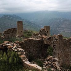
The tower was built by the Avars, one of the oldest peoples of the Caucasus, who constructed such structures to secure mountain passes and keep enemies at a distance. In the 19th century, Gimry became known as a starting point of armed resistance under Imam Shamil against the Russian army.
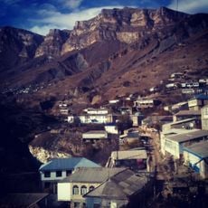
The tower stands in the village of Gimry, known as the birthplace of Imam Shamil, the most famous leader of the resistance against Russian expansion in the Caucasus in the 19th century. Visitors can see how the structure is woven into the fabric of the village and how local people still treat it as part of their identity.
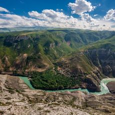
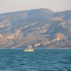
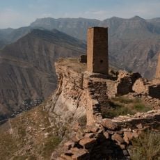
The site sits in mountain terrain, so sturdy footwear and a reasonable level of fitness are recommended to reach the tower on foot. The village is accessible from Makhachkala, but the roads are winding and may be in poor condition depending on the season.
Near the tower there is a spring that is still in use today and was once essential for supplying the defenders of the village. The combination of a water source and a defensive tower shows how carefully this location was chosen.
The community of curious travelers
AroundUs brings together thousands of curated places, local tips, and hidden gems, enriched daily by 60,000 contributors worldwide.