Chest opened
+${chestReward.xp} XP
Explorer
NOUVEAU ×${chestReward.collectible.quantity}
tapez pour fermer
Chest locked

Open chests in the app

Around Us is built for your phone — chests unlock when you walk, explore and capture nearby places.

Enable Location

We need your location to show you interesting places around you

Discover nearby places

Find interesting locations and hidden gems around you

Precise directions

Get accurate directions and distances to places

Your location is never shared with other users. It's only used when you tap the location button.

Log in to your account

Start exploring — it's free

Trusted by 73,029 travelers worldwide

Continue with Google
Continue with Apple
or

We will send you a code to connect

By continuing, you accept our Terms and Conditions and our Privacy Policy

Check your inbox

We've sent a pincode in your inbox. Please enter the code below.

Otkaznenskoye Vodokhranilishche
Discussion Reviews Photo
1.8k Popularity

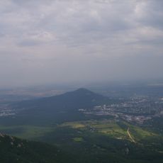
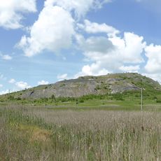
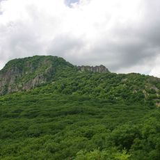
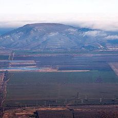
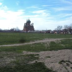
Otkaznenskoye Vodokhranilishche, reservoir in Russia

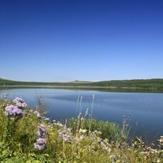
Otkaznenskoye Vodokhranilishche is a large water storage area on the Kum River in the Stavropol region, sitting at approximately 170 meters (560 feet) above sea level. The reservoir stretches roughly five kilometers long and four kilometers wide, held in place by a dam about 27 meters (90 feet) high that controls the river's water flow.

The reservoir was constructed in 1966 and has been a central part of the local water management system ever since. Over the decades, silt accumulated at the bottom, reducing storage capacity and shifting its primary use toward flood control during spring runoff.

The reservoir has been part of local life for many decades, serving as a familiar spot for fishermen and people who enjoy the outdoors. Stories about successful catches and past floods circulate among residents and reflect how the community views its connection to this water system.

Visit during cooler months when water levels are lower and the ground is less muddy. Respect protected areas, watch for overgrown sections, and note that fishing requires permits from local authorities.

In spring 2017, emergency authorities warned of a high risk of dam failure and opened water release to maximum capacity to prevent flooding downstream. This critical moment revealed how delicate the balance is between flood protection and infrastructure safety.

The community of curious travelers

AroundUs brings together thousands of curated places, local tips, and hidden gems, enriched daily by 60,000 contributors worldwide.

Start exploring
GPS coordinates
44.28556,43.82500
Latest update
February 9, 2026 08:20
Around this place
Mashuk
Russian Federation

Mashuk

64.4 km
Lake Proval
Russian Federation

Lake Proval

63.8 km
The place of Lermontov's duel
Russian Federation

The place of Lermontov's duel

64.8 km
Lake Tambukan
Russian Federation

Lake Tambukan

64.2 km
Gora Zmeyka
Russian Federation

Gora Zmeyka

59.7 km
Zheleznaya Mount
Russian Federation

Zheleznaya Mount

65.5 km
Lermontov Grotto
Russian Federation

Lermontov Grotto

65 km
Kinzhal
Russian Federation

Kinzhal

64.5 km
Pyatigorsk Cableway
Russian Federation

Pyatigorsk Cableway

64.8 km
Gora Razvalka
Russian Federation

Gora Razvalka

64.9 km
Operetta Theatre of Stavropol Krai
Russian Federation

Operetta Theatre of Stavropol Krai

65.3 km
Lysaya
Russian Federation

Lysaya

53.1 km
Mount Kokurtly
Russian Federation

Mount Kokurtly

62.8 km
Mamay-Majarian monastery
Russian Federation

Mamay-Majarian monastery

62.7 km
Saint Nicholas Church, Georgievsk
Russian Federation

Saint Nicholas Church, Georgievsk

31.7 km
Church of the Annunciation
Russian Federation

Church of the Annunciation

55.5 km
St. Nicholas Cathedral
Russian Federation

St. Nicholas Cathedral

60.2 km
Церковь Святого Николая Чудотворца (Минеральные Воды)
Russian Federation

Церковь Святого Николая Чудотворца (Минеральные Воды)

56.2 km
Церковь Казанской иконы Божией Матери (Будённовск)
Russian Federation

Церковь Казанской иконы Божией Матери (Будённовск)

61.2 km
Церковь Успения Пресвятой Богородицы (Пятигорск)
Russian Federation

Церковь Успения Пресвятой Богородицы (Пятигорск)

64.7 km
Stavropol stud
Russian Federation

Stavropol stud

64.2 km
Surb Poghos-Petros Armenian church in Georgievsk
Russian Federation

Surb Poghos-Petros Armenian church in Georgievsk

33.1 km
Церковь Архангела Михаила (Незлобная, Георгиевский район)
Russian Federation

Церковь Архангела Михаила (Незлобная, Георгиевский район)

39.4 km
Diana Grotto, Pyatigorsk
Russian Federation

Diana Grotto, Pyatigorsk

65.5 km
Zol'skiy Kar'yer
Russian Federation

Zol'skiy Kar'yer

39.7 km
Gate of officers' department of infirmary
Russian Federation

Gate of officers' department of infirmary

65.4 km
House for poor officers
Russian Federation

House for poor officers

65.4 km
Ostap Bender statue in Pyatigorsk
Russian Federation

Ostap Bender statue in Pyatigorsk

63.8 km
Show the full map
Reviews
Share your experience

No review yet

Discussions
Start a discussion...

No discussion yet

« Otkaznenskoye Vodokhranilishche - reservoir in Russia » is provided by Around Us (aroundus.com). Images and texts are derived from Wikimedia project under a Creative Commons license. You are allowed to copy, distribute, and modify copies of this page, under the conditions set by the license, as long as this note is clearly visible.

Discover hidden gems everywhere you go!

From secret cafés to breathtaking viewpoints, skip the crowded tourist spots and find places that match your style. Our app makes it easy with voice search, smart filtering, route optimization, and insider tips from travelers worldwide. Download now for the complete mobile experience.

Around Us App Screenshot

A unique approach to discovering new places

Le Figaro

All the places worth exploring

France Info

A tailor-made excursion in just a few clicks

20 Minutes

Around Us
Travel Guide & Maps
Download

Send to your phone

QR Code
1

Open the camera app on your mobile.

2

Point at the QR code with your camera. A notification will appear.

3

Tap the notification to open the link.