Enable Location

We need your location to show you interesting places around you

Discover nearby places

Find interesting locations and hidden gems around you

Precise directions

Get accurate directions and distances to places

Your location is never shared with other users. It's only used when you tap the location button.

Dyakovsky Ovrag

Log in to your account

Start exploring — it's free

Trusted by 62,391 travelers worldwide

Continue with Google
Continue with Apple
or

We will send you a code to connect

By continuing, you accept our Terms and Conditions and our Privacy Policy

Check your inbox

We've sent a pincode in your inbox. Please enter the code below.

Dyakovsky Ovrag

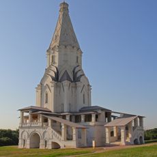
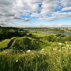
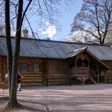
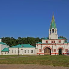
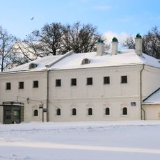
Dyakovsky Ovrag, river in Moscow, Russia

Dyakovsky Ovrag is a protected ravine in Moscow featuring gentle slopes lined with trees and a small stream running along its base. Wooden pathways and stairs have been added to allow visitors to walk safely through the valley and observe the natural surroundings.

Dyakovsky Ovrag has long served as a place where Moscow residents sought refuge in nature near the city. Pathway and stair improvements were made around 2006-2007 to make the site more accessible while preserving its natural character.

The name Dyakovsky Ovrag refers to a natural ravine that has long held meaning for local residents seeking refuge from city life. Visitors use the pathways and riverbanks as places for quiet contemplation and connection with the natural rhythm of Moscow.

The ravine is accessible via wooden pathways and stairs that guide visitors safely through the valley. Wear comfortable shoes and bring water if you plan to spend time exploring, as the terrain involves gentle slopes and natural walking routes.

Beneath the ravine runs a fault line that creates an unusually strong electromagnetic field, with measurements showing levels much higher than elsewhere in the city. Visitors have reported that phones and compasses may behave unpredictably in this location due to these underground geological forces.

The community of curious travelers

AroundUs brings together thousands of curated places, local tips, and hidden gems, enriched daily by 60,000 contributors worldwide.

Start exploring
Location
GPS coordinates
55.65429,37.66207
Latest update
February 9, 2026 07:45
Around this place

Church of the Ascension, Kolomenskoye
Russian Federation

Church of the Ascension, Kolomenskoye

1.5 km
Church of the Theotokos of Kazan in Kolomenskoye
Russian Federation

Church of the Theotokos of Kazan in Kolomenskoye

1.6 km
Dyakovo Ravine, Kolomenskoe
Russian Federation

Dyakovo Ravine, Kolomenskoe

274 m
Yuri Luzhkov Park
Russian Federation

Yuri Luzhkov Park

995 m
House of Peter I in Kolomenskoe
Russian Federation

House of Peter I in Kolomenskoe

1.5 km
Saburovo Road Bridge
Russian Federation

Saburovo Road Bridge

2.2 km
Church of Saint George in Kolomenskoe
Russian Federation

Church of Saint George in Kolomenskoe

1.5 km
Saviour Gates (Kolomenskoe)
Russian Federation

Saviour Gates (Kolomenskoe)

1.7 km
Church of Saint Thomas at Kantemirovskaya
Russian Federation

Church of Saint Thomas at Kantemirovskaya

1.4 km
Front Gate in Kolomenskoe
Russian Federation

Front Gate in Kolomenskoe

1.6 km
Upper Kolomensky Pond
Russian Federation

Upper Kolomensky Pond

1.3 km
Saburovsky Rail Bridges
Russian Federation

Saburovsky Rail Bridges

2.3 km
Church of Dmitry Donskoy in Sadovniki
Russian Federation

Church of Dmitry Donskoy in Sadovniki

1 km
Water Tower in Kolomenskoye Residence
Russian Federation

Water Tower in Kolomenskoye Residence

1.5 km
Church of Great Martyr St. George the Victorious
Russian Federation

Church of Great Martyr St. George the Victorious

2.2 km
Palace Pavilion in Kolomenskoe
Russian Federation

Palace Pavilion in Kolomenskoe

1.7 km
Church of the Beheading of Saint John the Baptist in Dyakovo
Russian Federation

Church of the Beheading of Saint John the Baptist in Dyakovo

1.2 km
Приказные палаты (Нагатинский Затон)
Russian Federation

Приказные палаты (Нагатинский Затон)

1.6 km
North Vestibule of Kashirskaya
Russian Federation

North Vestibule of Kashirskaya

788 m
Кормовой (Сытный) двор (Нагатинский Затон)
Russian Federation

Кормовой (Сытный) двор (Нагатинский Затон)

1.5 km
Часовой столб (Челобитный столб) (Нагатинский Затон)
Russian Federation

Часовой столб (Челобитный столб) (Нагатинский Затон)

1.5 km
Трапезная (Нагатинский Затон)
Russian Federation

Трапезная (Нагатинский Затон)

1.5 km
Colonel palace (Kolomenskoe)
Russian Federation

Colonel palace (Kolomenskoe)

1.5 km
Brew-House in Kolomenskoe
Russian Federation

Brew-House in Kolomenskoe

1.6 km
Nagatinsky Zaton
Russian Federation

Nagatinsky Zaton

1.5 km
Wooden tower of Bratsk Stocaded Fort relocated to Kolomenskoye
Russian Federation

Wooden tower of Bratsk Stocaded Fort relocated to Kolomenskoye

2.3 km
South Vestibule of Kashirskaya
Russian Federation

South Vestibule of Kashirskaya

902 m
Show the full map
« Dyakovsky Ovrag - river in Moscow, Russia » is provided by Around Us (aroundus.com). Images and texts are derived from Wikimedia project under a Creative Commons license. You are allowed to copy, distribute, and modify copies of this page, under the conditions set by the license, as long as this note is clearly visible.

Discover hidden gems everywhere you go!

From secret cafés to breathtaking viewpoints, skip the crowded tourist spots and find places that match your style. Our app makes it easy with voice search, smart filtering, route optimization, and insider tips from travelers worldwide. Download now for the complete mobile experience.

Around Us App Screenshot

A unique approach to discovering new places

Le Figaro

All the places worth exploring

France Info

A tailor-made excursion in just a few clicks

20 Minutes

Around Us
Travel Guide & Maps
Download

Send to your phone

QR Code
1

Open the camera app on your mobile.

2

Point at the QR code with your camera. A notification will appear.

3

Tap the notification to open the link.