·

Enable Location

We need your location to show you interesting places around you

Discover nearby places

Find interesting locations and hidden gems around you

Precise directions

Get accurate directions and distances to places

Your location is never shared with other users. It's only used when you tap the location button.

Fort Graf Miljutin

Log in to your account

Start exploring — it's free

Trusted by 62,647 travelers worldwide

Continue with Google
Continue with Apple
or

We will send you a code to connect

By continuing, you accept our Terms and Conditions and our Privacy Policy

Check your inbox

We've sent a pincode in your inbox. Please enter the code below.

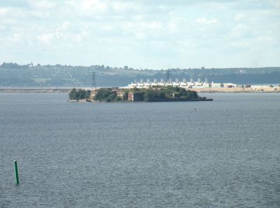
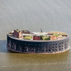
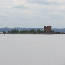
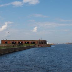
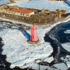
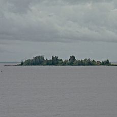
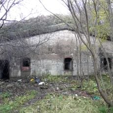
Fort Graf Miljutin, historisches Artilleriefort im Finnischen Meerbusen südlich von Kronstadt

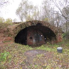
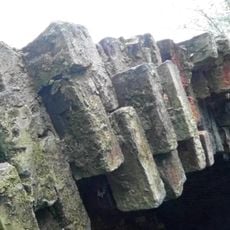
Fort Graf Miljutin is a coastal fortification built on an artificial island in Kronstadt, Russia, featuring thick walls and heavy metal doors. It was equipped with rotating armored gun turrets powered by steam mechanisms that allowed defenders to fire at enemy ships from great distances.

Construction began in the mid-1800s following the Crimean War, when Russia needed to strengthen coastal defenses against enemy fleets. The fort was later equipped with modern artillery and served during both World Wars before being gradually disarmed after 1945.

The fort honors Dmitry Milutin, a Russian military reformer whose legacy shaped the nation's defense strategy. Today, visitors can see how this place reflects Russia's commitment to coastal protection and military innovation during the 19th century.

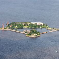
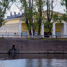
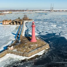
The fort is best reached by boat tours during warmer months, allowing visitors to arrive directly at the site. In winter, experienced visitors sometimes walk across the ice when it is thick enough, offering a unique way to approach the fortification.

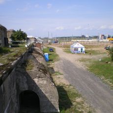
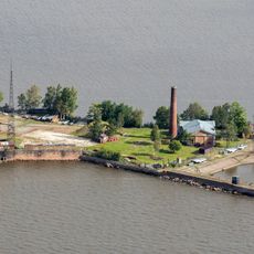
In the early 1900s, phenomena were discovered at this location that contributed to radio technology development, showing how the fortress supported scientific progress beyond military purposes. Today, some old guns serve as boat moorings, giving the site a distinctive character.

The community of curious travelers

AroundUs brings together thousands of curated places, local tips, and hidden gems, enriched daily by 60,000 contributors worldwide.

Start exploring
Location
Inception
1855
GPS coordinates
59.97222,29.69583
Latest update
February 9, 2026 07:44
Around this place
Fort Alexander I
Russian Federation

Fort Alexander I

2.3 km
Kronslot
Russian Federation

Kronslot

3 km
Konstantin
Russian Federation

Konstantin

2.4 km
Risbank Fort
Russian Federation

Risbank Fort

1.2 km
Peter I
Russian Federation

Peter I

2.9 km
Dutch Kitchen, Kronstadt
Russian Federation

Dutch Kitchen, Kronstadt

4.1 km
Menshikov battery
Russian Federation

Menshikov battery

3.6 km
Fish Row (Kronstadt)
Russian Federation

Fish Row (Kronstadt)

4 km
Posadskaya Street, 49
Russian Federation

Posadskaya Street, 49

4.1 km
Leuchtfeuer Petersburger Damm
Russian Federation

Leuchtfeuer Petersburger Damm

2.1 km
Kabotazhnaya Gavan Range Rear Lighthouse
Russian Federation

Kabotazhnaya Gavan Range Rear Lighthouse

3.9 km
Нижний Николаевский створный маяк (Кронштадт)
Russian Federation

Нижний Николаевский створный маяк (Кронштадт)

2.8 km
Southern battery No 1
Russian Federation

Southern battery No 1

2.6 km
Траверс (Кронштадт)
Russian Federation

Траверс (Кронштадт)

4 km
Lower Sea Channel range light
Russian Federation

Lower Sea Channel range light

2 km
Upper Sea Channel range light
Russian Federation

Upper Sea Channel range light

3.9 km
Жилой дом домкратного мастера Вестфалена (Кронштадт)
Russian Federation

Жилой дом домкратного мастера Вестфалена (Кронштадт)

4.1 km
Парк (Кронштадт)
Russian Federation

Парк (Кронштадт)

4 km
Комплекс казарменных построек (3 корпуса) (Кронштадт)
Russian Federation

Комплекс казарменных построек (3 корпуса) (Кронштадт)

3.9 km
Жилой дом (Кронштадт)
Russian Federation

Жилой дом (Кронштадт)

4 km
Lunette 'Admiral Litke'
Russian Federation

Lunette 'Admiral Litke'

4.1 km
Пороховой погреб (Кронштадт)
Russian Federation

Пороховой погреб (Кронштадт)

4 km
Канал (морская часть) (Кронштадт)
Russian Federation

Канал (морская часть) (Кронштадт)

4.1 km
Posadskaya Street, 47
Russian Federation

Posadskaya Street, 47

4.1 km
Передний маяк створа Кронштадтских маяков (бывший верхний Николаевский маяк) (Кронштадт)
Russian Federation

Передний маяк створа Кронштадтских маяков (бывший верхний Николаевский маяк) (Кронштадт)

3 km
Жилой дом (Кронштадт)
Russian Federation

Жилой дом (Кронштадт)

4.1 km
Lenin Avenue, 61
Russian Federation

Lenin Avenue, 61

4.1 km
Южное батардо (Кронштадт)
Russian Federation

Южное батардо (Кронштадт)

3.9 km
Show the full map
« Fort Graf Miljutin - historisches Artilleriefort im Finnischen Meerbusen südlich von Kronstadt » is provided by Around Us (aroundus.com). Images and texts are derived from Wikimedia project under a Creative Commons license. You are allowed to copy, distribute, and modify copies of this page, under the conditions set by the license, as long as this note is clearly visible.

Discover hidden gems everywhere you go!

From secret cafés to breathtaking viewpoints, skip the crowded tourist spots and find places that match your style. Our app makes it easy with voice search, smart filtering, route optimization, and insider tips from travelers worldwide. Download now for the complete mobile experience.

Around Us App Screenshot

A unique approach to discovering new places

Le Figaro

All the places worth exploring

France Info

A tailor-made excursion in just a few clicks

20 Minutes

Around Us
Travel Guide & Maps
Download

Send to your phone

QR Code
1

Open the camera app on your mobile.

2

Point at the QR code with your camera. A notification will appear.

3

Tap the notification to open the link.