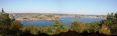
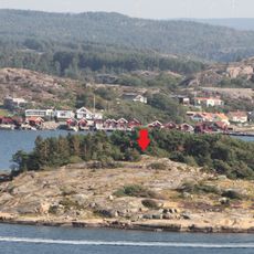
Fjällbacka inner archipelago coastal water body, Coastal water system in Tanum Municipality, Sweden
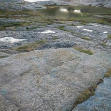
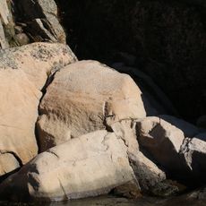
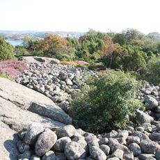
Fjällbacka inner archipelago is a network of small granite islands and waterways along Sweden's western coast. The protected marine environment features numerous natural harbors and narrow passages between rocky islands that create a sheltered seascape.
These waters were a center of intensive herring fishing in the 18th century, establishing trade routes and building maritime communities in the region. Economic activity around fishing shaped the development of surrounding coastal settlements for generations.
Local fishermen maintain traditional fishing practices in these waters, contributing to the preservation of maritime customs dating back multiple generations.
These waters are well-suited for boating and have several natural harbors for shelter. Visitors should check tide conditions and visibility before navigating the narrow passages between islands.
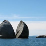
Harbor seals regularly visit the islands and establish colonies there, with researchers monitoring their movement patterns. These marine mammals use the rocky islands as resting places and breeding grounds for their young.
Location: Skagerrak and Kattegat Water District
Location: Tanum Municipality
Shares border with: Hamburgsund area coastal water body, Fjällbacka outer archipelago coastal water body, Grebbestad inner archipelago coastal water body
GPS coordinates: 58.57873,11.29441
Latest update: December 6, 2025 19:08
Cliffs rank among Earth's most striking geological formations, ranging from coastal precipices to inland mountain faces. Along oceans, they shape coastlines for thousands of miles, while in mountain regions they form vertical walls that draw climbers from around the world. This collection documents significant cliffs across six continents, including Ireland's 214-meter (702-foot) Cliffs of Moher, England's white chalk cliffs at Dover, and Norway's Preikestolen, which rises 604 meters (1,982 feet) above Lysefjord. Among the locations are some of Earth's highest vertical walls. Hawaii's Kalaupapa Cliffs on Molokai reach 1,010 meters (3,315 feet), while Pakistan's Trango Towers rise above 6,000 meters (19,685 feet) with nearly vertical rock faces. Coastal formations like Normandy's Étretat cliffs, Ireland's Slieve League, and Australia's Bunda Cliffs along the Nullarbor Plain demonstrate the power of marine erosion. Inland, formations such as California's El Capitan, China's Zhangjiajie National Forest Park towers, and South Africa's Table Mountain create distinctive landscape features shaped by different geological processes over millions of years.
Kville Church
4.4 km
Hornborgs slottsruin
4.8 km
Fjällbacka Church
2.4 km
Saltskär
8.3 km
Veddöarkipelagen
4.3 km
Norra Ejgde randlövskog
2 km
Kville 511:1
4.1 km
Kville 165:1
4.1 km
Bottna 88:1
8.5 km
Gotte-Lars stuga
6.5 km
Kville 156:1
4.1 km
Kville 157:1
4.1 km
Kville 158:1
4.1 km
Kville 159:1
4.1 km
Kville 935:4
6.3 km
Svenneby 136:1
8.4 km
Kville 935
6.3 km
Kville 935:2
6.2 km
Kville 124:1
7.4 km
Bottna 139:1
8.4 km
Bottna 140:1
8.5 km
Kville 616:1
3.2 km
Kville 617:1
2.1 km
Stenstugan på banken
6.6 km
Kville 438:1
4.8 km
Kville 314:1
7.8 km
Kville 813:1
1.1 km
Kville 151:1
4.3 kmVisited this place? Tap the stars to rate it and share your experience / photos with the community! Try now! You can cancel it anytime.
Discover hidden gems everywhere you go!
From secret cafés to breathtaking viewpoints, skip the crowded tourist spots and find places that match your style. Our app makes it easy with voice search, smart filtering, route optimization, and insider tips from travelers worldwide. Download now for the complete mobile experience.
A unique approach to discovering new places❞
— Le Figaro
All the places worth exploring❞
— France Info
A tailor-made excursion in just a few clicks❞
— 20 Minutes