Enable Location

We need your location to show you interesting places around you

Discover nearby places

Find interesting locations and hidden gems around you

Precise directions

Get accurate directions and distances to places

Your location is never shared with other users. It's only used when you tap the location button.

Doi Phu Kha

Log in to your account

Start exploring — it's free

Trusted by 64,031 travelers worldwide

Continue with Google
Continue with Apple
or

We will send you a code to connect

By continuing, you accept our Terms and Conditions and our Privacy Policy

Check your inbox

We've sent a pincode in your inbox. Please enter the code below.

Doi Phu Kha
Discussion Reviews 1 Photos
1.4k Popularity

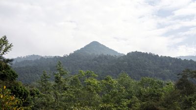
Doi Phu Kha, Mountain summit in Nan Province, Thailand

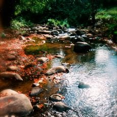
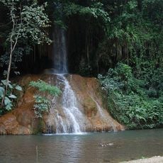
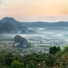
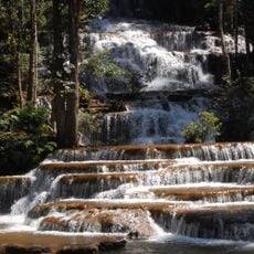
Doi Phu Kha rises to 1,980 meters within the Luang Prabang Range and forms the highest point of the largest national park in Northern Thailand. The mountain is surrounded by dense, untouched forest and provides habitat for many plant and animal species within a large protected area.

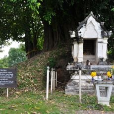
The mountain and surrounding national park received official protection status in 1999. This marked an important step in preserving this large natural landscape in the Nan region.

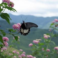
The mountain takes its name from the native chomphu phu kha tree, whose pink flowers bloom throughout the protected forest areas. These trees shape the landscape and show visitors the natural diversity of the region.

Access to the mountain summit requires private transportation, as no public transport serves the area. The nearest city with flight connections is Nan, located about 85 kilometers away.

The mountain hosts several rare snake species found nowhere else in Thailand, including the Laotian bearded snake and the Red River krait. These species are typical of the mountain forests in this border region and highlight the biological uniqueness of the place.

The community of curious travelers

AroundUs brings together thousands of curated places, local tips, and hidden gems, enriched daily by 60,000 contributors worldwide.

Start exploring
Elevation above the sea
1,980 m
GPS coordinates
19.12826,101.05989
Latest update
December 14, 2025 16:45
Reviews
Share your experience

No review yet

Discussions
Start a discussion...

No discussion yet

« Doi Phu Kha - Mountain summit in Nan Province, Thailand » is provided by Around Us (aroundus.com). Images and texts are derived from Wikimedia project under a Creative Commons license. You are allowed to copy, distribute, and modify copies of this page, under the conditions set by the license, as long as this note is clearly visible.

Discover hidden gems everywhere you go!

From secret cafés to breathtaking viewpoints, skip the crowded tourist spots and find places that match your style. Our app makes it easy with voice search, smart filtering, route optimization, and insider tips from travelers worldwide. Download now for the complete mobile experience.

Around Us App Screenshot

A unique approach to discovering new places

Le Figaro

All the places worth exploring

France Info

A tailor-made excursion in just a few clicks

20 Minutes

Around Us
Travel Guide & Maps
Download

Send to your phone

QR Code
1

Open the camera app on your mobile.

2

Point at the QR code with your camera. A notification will appear.

3

Tap the notification to open the link.