Land's End, Cape and headland in Cornwall, England
Description
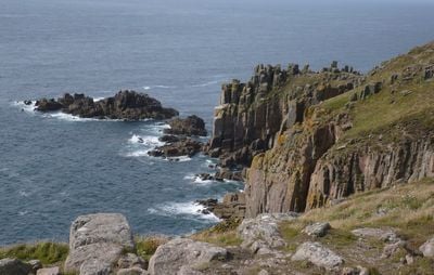
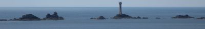
Land's End is a promontory at the far southwestern corner of Cornwall, where the coastline ends in tall granite cliffs that drop into the ocean. Trails wind along the edge of the escarpments, offering views toward the Longships lighthouse that rises from a rocky outcrop offshore.
History
Sailors from Brittany relied on this headland during medieval voyages to British harbors, using it as a marker for the western edge of familiar coastlines. Ships adjusted their course after spotting the cliffs, either turning north along the English coast or steering east into the Channel.
Culture
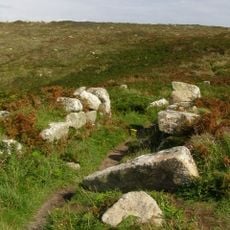
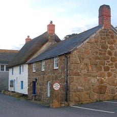
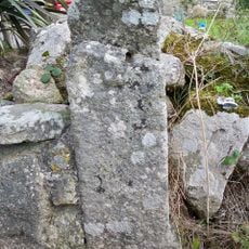
The landscape bears the marks of Cornwall's former mining industry, with the ruins of buildings and facilities that recall the time when tin and copper extraction dominated the local economy. These mining remnants blend into the coastal scenery and demonstrate the historical link between resource exploitation and the region's unique geology.
Practical
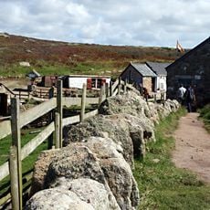
Multiple marked paths follow the clifftops at different distances from the edge, with lookout points toward the lighthouse and the currents below. Sturdy footwear helps on the uneven terrain, especially when the wind picks up along the exposed sections.
Did you know?
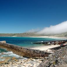
The meeting point of the Atlantic and the Channel creates visible lines on the water surface, where different currents push against each other and form shifting patterns. Cornish fishermen once tracked these moving lines to locate schools of mackerel feeding along the boundary.
AroundUs brings together thousands of curated places, local tips, and hidden gems, enriched daily by 60,000 contributors worldwide. Discover all places nearby (Cornwall).
Maen Castle
867 m
First And Last Inn
1.5 km
First And Last House
206 mThe Old Cottage
1.4 km
Albatross Captains Cottage Dolphin Gull Cottage The Old Coastguard Cottages And Adjoining Outbuildings Trelew
1.4 km
Capstan Cottage
1.5 km
Breakwater, Adjoining Slipway And Retaining Walls
1.5 km
Milestone on the north side of the B3315 in the boundary wall entrance to Trevescan Farm Café
1.4 kmTregean And Well Cottage And Adjoining Cartshed
1.5 km
Greeb Cottage
512 mJohns Headstone At Approximately 3 Metres North Of West End Of Church Of St Sennen
1.5 kmChurchtown House Including Forecourt Walls And Railings
1.5 kmGate-Piers And Stile At Approximately 10 Metres South Of Church Of St Sennen
1.5 km
Tinker Taylor
1.5 kmTrevescan Cross 340m SSW of Sennen Church
1.4 kmStanding stone 230m west of the Old Manor
1.3 km
The Round House
1.5 kmTwo barrows and circular enclosure on Pordenack Point
954 mBuilding At Approximately 40 Metres West Of Capstan Cottage
1.4 kmLewcott
1.4 kmBuilding At Approximately 15 Metres North West Of The Round House
1.5 kmWayside cross 170m north of Trevilley
1.5 kmGreeb Farm
496 mAardman presents: A Grand Experience
101 mThe Original Cornwall Air Ambulance
94 mWork of art, sculpture
45 mLand's End
86 mScenic viewpoint
26 mDiscover hidden gems everywhere you go!
From secret cafés to breathtaking viewpoints, skip the crowded tourist spots and find places that match your style. Our app makes it easy with voice search, smart filtering, route optimization, and insider tips from travelers worldwide. Download now for the complete mobile experience.
A unique approach to discovering new places❞
— Le Figaro
All the places worth exploring❞
— France Info
A tailor-made excursion in just a few clicks❞
— 20 Minutes