Enable Location

We need your location to show you interesting places around you

Discover nearby places

Find interesting locations and hidden gems around you

Precise directions

Get accurate directions and distances to places

Your location is never shared with other users. It's only used when you tap the location button.

Burtonwood

Log in to your account

Start exploring — it's free

Trusted by 68,255 travelers worldwide

Continue with Google
Continue with Apple
or

We will send you a code to connect

By continuing, you accept our Terms and Conditions and our Privacy Policy

Check your inbox

We've sent a pincode in your inbox. Please enter the code below.

Burtonwood
Discussion Reviews 1 Photos
54.4k Popularity

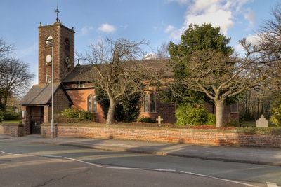
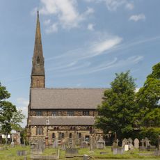
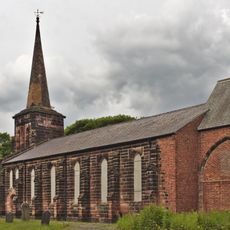
Burtonwood, Village in Burtonwood and Westbrook, England

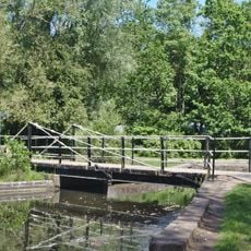
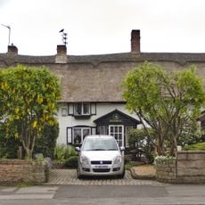
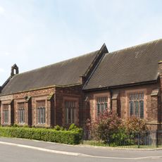
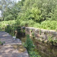
Burtonwood is a village in the Borough of Warrington, Cheshire, surrounded by green spaces that include two parks and three nature reserves. The settlement spreads between open fields and residential areas, with most buildings dating from the 20th century and connected by quiet streets.

The settlement gained recognition during World War II when RAF Burtonwood became the largest United States Air Force base in Europe. The base remained operational until 1958 and shaped the village through the arrival of American personnel and infrastructure.

The local brewery started operations in 1867 and produced Burtonwood ales for over a century. It developed a network of public houses across the region before closing in 1998.

Two primary schools operate in the village: Burtonwood Community Primary School and St Paul of the Cross Primary School. For secondary education, students travel to neighboring towns accessible by public transport.

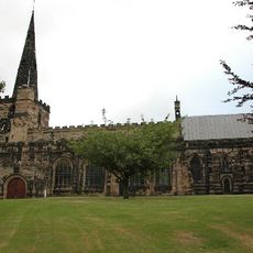
The village name combines Old English words 'tun' for farmstead and 'burh' for fortified manor. References to the royal forest in the area complete the toponym, linking the place to medieval land use.

The community of curious travelers

AroundUs brings together thousands of curated places, local tips, and hidden gems, enriched daily by 60,000 contributors worldwide.

Start exploring
GPS coordinates
53.43117,-2.65455
Latest update
December 14, 2025 17:34
Around this place
Gulliver's World Resort
United Kingdom

Gulliver's World Resort

3.7 km
Sankey Viaduct
United Kingdom

Sankey Viaduct

1.8 km
St Oswald's Church, Winwick
United Kingdom

St Oswald's Church, Winwick

3.8 km
St John the Baptist's Church, Earlestown
United Kingdom

St John the Baptist's Church, Earlestown

2.6 km
Earlestown Town Hall
United Kingdom

Earlestown Town Hall

2.5 km
All Saints' Church, St Helens
United Kingdom

All Saints' Church, St Helens

3.3 km
Church of St Mary and St John, Newton-le-Willows
United Kingdom

Church of St Mary and St John, Newton-le-Willows

3.1 km
Emmanuel Wargrave Church
United Kingdom

Emmanuel Wargrave Church

2.4 km
Church of St Michael and All Angels, Burtonwood
United Kingdom

Church of St Michael and All Angels, Burtonwood

104 m
Newton-le-Willows United Reformed Chapel
United Kingdom

Newton-le-Willows United Reformed Chapel

3.4 km
Mill Lane viaduct, Newton-le-Willows
United Kingdom

Mill Lane viaduct, Newton-le-Willows

3.6 km
Wood Pit and Lyme Pit disasters memorial
United Kingdom

Wood Pit and Lyme Pit disasters memorial

3.7 km
Bradlegh Old Hall
United Kingdom

Bradlegh Old Hall

1.1 km
Evans memorial, Newton-le-Willows United Reformed Chapel
United Kingdom

Evans memorial, Newton-le-Willows United Reformed Chapel

3.4 km
Bradley Swing Bridge, Sankey Canal
United Kingdom

Bradley Swing Bridge, Sankey Canal

1.8 km
St Patrick's Church, Earlestown
United Kingdom

St Patrick's Church, Earlestown

2.4 km
Earlestown War Memorial
United Kingdom

Earlestown War Memorial

2.5 km
Waiting room at Earlestown railway station
United Kingdom

Waiting room at Earlestown railway station

2.5 km
159 - 163 Crow Lane East, Newton-le-Willows
United Kingdom

159 - 163 Crow Lane East, Newton-le-Willows

3.2 km
Newton-le-Willows railway station building
United Kingdom

Newton-le-Willows railway station building

3.7 km
Newton-le-Willows Library
United Kingdom

Newton-le-Willows Library

3 km
St David's Church, Newton-le-Willows
United Kingdom

St David's Church, Newton-le-Willows

2.5 km
All Saints, Newton-le-Willows
United Kingdom

All Saints, Newton-le-Willows

3 km
Earlestown Market Cross
United Kingdom

Earlestown Market Cross

2.6 km
Entrance archway To Randall's Nursery
United Kingdom

Entrance archway To Randall's Nursery

3.7 km
Fairbrothers Farmhouse
United Kingdom

Fairbrothers Farmhouse

3.5 km
Bradley Lock, Sankey Canal
United Kingdom

Bradley Lock, Sankey Canal

1.7 km
Milestone, Newton Road
United Kingdom

Milestone, Newton Road

3.5 km
Show the full map
Reviews
Share your experience

No review yet

Discussions
Start a discussion...

No discussion yet

« Burtonwood - Village in Burtonwood and Westbrook, England » is provided by Around Us (aroundus.com). Images and texts are derived from Wikimedia project under a Creative Commons license. You are allowed to copy, distribute, and modify copies of this page, under the conditions set by the license, as long as this note is clearly visible.

Discover hidden gems everywhere you go!

From secret cafés to breathtaking viewpoints, skip the crowded tourist spots and find places that match your style. Our app makes it easy with voice search, smart filtering, route optimization, and insider tips from travelers worldwide. Download now for the complete mobile experience.

Around Us App Screenshot

A unique approach to discovering new places

Le Figaro

All the places worth exploring

France Info

A tailor-made excursion in just a few clicks

20 Minutes

Around Us
Travel Guide & Maps
Download

Send to your phone

QR Code
1

Open the camera app on your mobile.

2

Point at the QR code with your camera. A notification will appear.

3

Tap the notification to open the link.