Chest opened
+${chestReward.xp} XP
Explorer
NOUVEAU ×${chestReward.collectible.quantity}
tapez pour fermer
Chest locked

Open chests in the app

Around Us is built for your phone — chests unlock when you walk, explore and capture nearby places.

Enable Location

We need your location to show you interesting places around you

Discover nearby places

Find interesting locations and hidden gems around you

Precise directions

Get accurate directions and distances to places

Your location is never shared with other users. It's only used when you tap the location button.

Municipal Borough of Southall

Log in to your account

Start exploring — it's free

Trusted by 72,876 travelers worldwide

Continue with Google
Continue with Apple
or

We will send you a code to connect

By continuing, you accept our Terms and Conditions and our Privacy Policy

Check your inbox

We've sent a pincode in your inbox. Please enter the code below.

Municipal Borough of Southall
Discussion Reviews 1 Photos
2.9k Popularity

Municipal Borough of Southall, Former municipal borough in Middlesex, United Kingdom

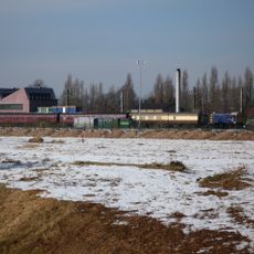
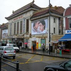
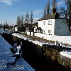
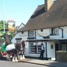
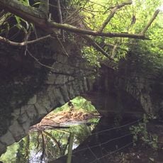
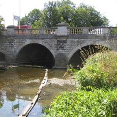
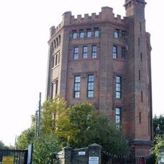
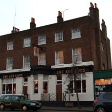
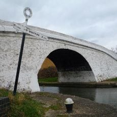
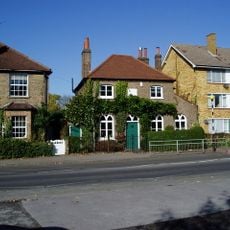
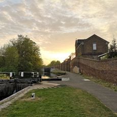
The Municipal Borough of Southall was a former administrative district in Middlesex that contained residential neighborhoods mixed with commercial and industrial areas. The district featured buildings ranging from homes and shops to factories, with the Grand Union Canal running through it as a key feature.

The area started as Southall Norwood in 1891 and gained municipal borough status in 1936, reflecting its growing importance in the region. It remained independent until London's administrative reorganization, when it merged into the Borough of Ealing.

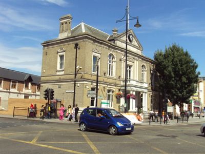
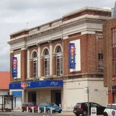
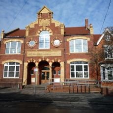
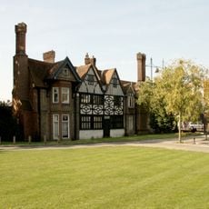
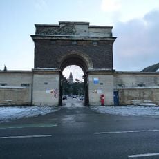
The Town Hall served as the social hub where residents gathered for civic matters and community events throughout the borough's lifetime. The building represented the local pride and importance that Southall held during the mid-20th century.

The former Town Hall is located centrally in Southall and remains easy to reach on foot, with the surrounding area well connected by public transport. Visitors can walk through the neighborhoods to see how the district's layout combined residential streets with commercial areas along the canal.

The coat of arms created in 1936 displayed thorn trees representing Elthorne Hundred and a red griffin symbolizing the connection to the London transport system. These symbols reflected how the community linked its local identity to broader London infrastructure and history.

The community of curious travelers

AroundUs brings together thousands of curated places, local tips, and hidden gems, enriched daily by 60,000 contributors worldwide.

Start exploring
GPS coordinates
51.51130,-0.37530
Latest update
March 6, 2026 16:53
Around this place
Gurdwara Sri Guru Singh Sabha
United Kingdom

Gurdwara Sri Guru Singh Sabha

1.3 km
Windmill Bridge
United Kingdom

Windmill Bridge

1.6 km
Wharncliffe Viaduct
United Kingdom

Wharncliffe Viaduct

2.2 km
Southall Railway Centre
United Kingdom

Southall Railway Centre

632 m
Southall Gas Works
United Kingdom

Southall Gas Works

1.3 km
St. Mary's Church, Hanwell
United Kingdom

St. Mary's Church, Hanwell

1.9 km
St Anselm's Church, Southall
United Kingdom

St Anselm's Church, Southall

918 m
Palace Cinema
United Kingdom

Palace Cinema

97 m
Savoy Cinema
United Kingdom

Savoy Cinema

2.5 km
Church of St George
United Kingdom

Church of St George

659 m
Church of St Mary
United Kingdom

Church of St Mary

1.9 km
Southall Library (Dominion Centre and Library)
United Kingdom

Southall Library (Dominion Centre and Library)

1.1 km
Water Pump (On The South Side Of West Middlesex Golf Course, Nearly Opposite Lyndhurst Avenue)
United Kingdom

Water Pump (On The South Side Of West Middlesex Golf Course, Nearly Opposite Lyndhurst Avenue)

945 m
Walls, Gates, Sluices And Bridge At Lock (90)
United Kingdom

Walls, Gates, Sluices And Bridge At Lock (90)

1.3 km
Southall War Memorial
United Kingdom

Southall War Memorial

1 km
The Plough Public House
United Kingdom

The Plough Public House

1.9 km
Roman Bridge
United Kingdom

Roman Bridge

2.1 km
Hanwell Bridge
United Kingdom

Hanwell Bridge

2.3 km
The Water Tower
United Kingdom

The Water Tower

722 m
Red Lion Public House
United Kingdom

Red Lion Public House

281 m
Bull's Bridge Number 21 Over Grand Union Canal And Grand Union Canal (Paddington Branch) Junction
United Kingdom

Bull's Bridge Number 21 Over Grand Union Canal And Grand Union Canal (Paddington Branch) Junction

2.5 km
Greenford War Memorial
United Kingdom

Greenford War Memorial

2.4 km
Stable Block At Brent Lodge Park
United Kingdom

Stable Block At Brent Lodge Park

1.9 km
Former Norwood Free School
United Kingdom

Former Norwood Free School

1.9 km
Main Up Side Building and Downside Island Platform at Hanwell Station
United Kingdom

Main Up Side Building and Downside Island Platform at Hanwell Station

2.5 km
Southall Manor House
United Kingdom

Southall Manor House

1.1 km
Hanwell flight of locks and brick boundary wall of St Bernard's Hospital
United Kingdom

Hanwell flight of locks and brick boundary wall of St Bernard's Hospital

2 km
Entrance Archway And 2 Lodges, (One Each Side Of Entrance) To St Bernard's Hospital
United Kingdom

Entrance Archway And 2 Lodges, (One Each Side Of Entrance) To St Bernard's Hospital

1.8 km
Show the full map
Reviews
Share your experience

No review yet

Discussions
Start a discussion...

No discussion yet

« Municipal Borough of Southall - Former municipal borough in Middlesex, United Kingdom » is provided by Around Us (aroundus.com). Images and texts are derived from Wikimedia project under a Creative Commons license. You are allowed to copy, distribute, and modify copies of this page, under the conditions set by the license, as long as this note is clearly visible.

Discover hidden gems everywhere you go!

From secret cafés to breathtaking viewpoints, skip the crowded tourist spots and find places that match your style. Our app makes it easy with voice search, smart filtering, route optimization, and insider tips from travelers worldwide. Download now for the complete mobile experience.

Around Us App Screenshot

A unique approach to discovering new places

Le Figaro

All the places worth exploring

France Info

A tailor-made excursion in just a few clicks

20 Minutes

Around Us
Travel Guide & Maps
Download

Send to your phone

QR Code
1

Open the camera app on your mobile.

2

Point at the QR code with your camera. A notification will appear.

3

Tap the notification to open the link.