Enable Location

We need your location to show you interesting places around you

Discover nearby places

Find interesting locations and hidden gems around you

Precise directions

Get accurate directions and distances to places

Your location is never shared with other users. It's only used when you tap the location button.

Wharncliffe Viaduct

Log in to your account

Start exploring — it's free

Trusted by 62,171 travelers worldwide

Continue with Google
Continue with Apple
or

We will send you a code to connect

By continuing, you accept our Terms and Conditions and our Privacy Policy

Check your inbox

We've sent a pincode in your inbox. Please enter the code below.

Wharncliffe Viaduct

Wharncliffe Viaduct, Railway viaduct in Hanwell, United Kingdom.

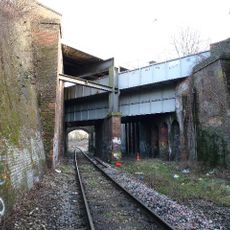
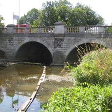
Wharncliffe Viaduct is a brick structure that carries railway lines across the Brent Valley on eight semi-elliptical arches. The viaduct now holds four standard gauge tracks and forms a prominent part of the landscape with its solid Victorian engineering.

The structure was built between 1836 and 1837 as Isambard Kingdom Brunel's first major engineering project for the Great Western Railway. In 1892 it was modified to shift from the original broad gauge system to standard gauge tracks.

The central pier displays the coat of arms of Lord Wharncliffe, who championed the railway legislation in the House of Lords. It stands as a reminder of the political backing that made Victorian rail expansion possible.

The viaduct is accessible from above via a public footpath that crosses the structure and offers views of its construction. The best way to explore it is by walking along the pathways that run through the Brent Valley alongside the railway.

The viaduct housed the world's first commercial electrical telegraph system, installed in 1839, which revolutionized railway communication. This made it a hub for early experimental communication technology on the railways.

The community of curious travelers

AroundUs brings together thousands of curated places, local tips, and hidden gems, enriched daily by 60,000 contributors worldwide.

Start exploring
Part of
Great Western Main Line
GPS coordinates
51.51083,-0.34424
Latest update
December 8, 2025 19:59
Around this place
Windmill Bridge
United Kingdom

Windmill Bridge

1.1 km
Southall Railway Centre
United Kingdom

Southall Railway Centre

1.9 km
City of Westminster Cemetery, Hanwell
United Kingdom

City of Westminster Cemetery, Hanwell

937 m
St. Mary's Church, Hanwell
United Kingdom

St. Mary's Church, Hanwell

400 m
Royal Borough of Kensington and Chelsea Cemetery, Hanwell
United Kingdom

Royal Borough of Kensington and Chelsea Cemetery, Hanwell

867 m
St Stephen's Church
United Kingdom

St Stephen's Church

2 km
Church of St Thomas the Apostle
United Kingdom

Church of St Thomas the Apostle

1.4 km
The Forester
United Kingdom

The Forester

1.7 km
St John's Church
United Kingdom

St John's Church

1.9 km
The Hermitage
United Kingdom

The Hermitage

384 m
Ealing Amman Temple
United Kingdom

Ealing Amman Temple

1.8 km
Roman Catholic Church of SS Peter and Paul
United Kingdom

Roman Catholic Church of SS Peter and Paul

2.1 km
Palace Cinema
United Kingdom

Palace Cinema

2.2 km
Church of St Mellitus
United Kingdom

Church of St Mellitus

663 m
St Paul's Ealing
United Kingdom

St Paul's Ealing

2.2 km
Water Pump (On The South Side Of West Middlesex Golf Course, Nearly Opposite Lyndhurst Avenue)
United Kingdom

Water Pump (On The South Side Of West Middlesex Golf Course, Nearly Opposite Lyndhurst Avenue)

1.2 km
Walls, Gates, Sluices And Bridge At Lock (90)
United Kingdom

Walls, Gates, Sluices And Bridge At Lock (90)

1.6 km
Hanwell Bridge
United Kingdom

Hanwell Bridge

300 m
Hanwell Community Centre
United Kingdom

Hanwell Community Centre

1.3 km
Roman Bridge
United Kingdom

Roman Bridge

1.5 km
Red Lion Public House
United Kingdom

Red Lion Public House

1.9 km
Greenford War Memorial
United Kingdom

Greenford War Memorial

2.1 km
Stable Block At Brent Lodge Park
United Kingdom

Stable Block At Brent Lodge Park

356 m
Milepost (Outside Number 173)
United Kingdom

Milepost (Outside Number 173)

1.9 km
Main Up Side Building and Downside Island Platform at Hanwell Station
United Kingdom

Main Up Side Building and Downside Island Platform at Hanwell Station

409 m
86, Mattock Lane W13
United Kingdom

86, Mattock Lane W13

2.2 km
Hanwell flight of locks and brick boundary wall of St Bernard's Hospital
United Kingdom

Hanwell flight of locks and brick boundary wall of St Bernard's Hospital

713 m
Entrance Archway And 2 Lodges, (One Each Side Of Entrance) To St Bernard's Hospital
United Kingdom

Entrance Archway And 2 Lodges, (One Each Side Of Entrance) To St Bernard's Hospital

432 m
Show the full map
« Wharncliffe Viaduct - Railway viaduct in Hanwell, United Kingdom » is provided by Around Us (aroundus.com). Images and texts are derived from Wikimedia project under a Creative Commons license. You are allowed to copy, distribute, and modify copies of this page, under the conditions set by the license, as long as this note is clearly visible.

Discover hidden gems everywhere you go!

From secret cafés to breathtaking viewpoints, skip the crowded tourist spots and find places that match your style. Our app makes it easy with voice search, smart filtering, route optimization, and insider tips from travelers worldwide. Download now for the complete mobile experience.

Around Us App Screenshot

A unique approach to discovering new places

Le Figaro

All the places worth exploring

France Info

A tailor-made excursion in just a few clicks

20 Minutes

Around Us
Travel Guide & Maps
Download

Send to your phone

QR Code
1

Open the camera app on your mobile.

2

Point at the QR code with your camera. A notification will appear.

3

Tap the notification to open the link.