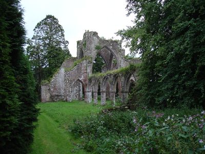
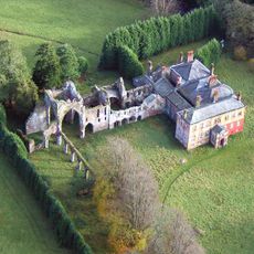
Calder Abbey, Cistercian abbey in Ponsonby, England
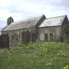
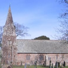
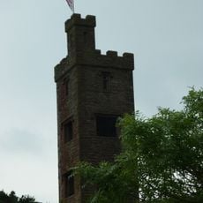
Calder Abbey stands near Calderbridge village and displays a range of surviving structures. These include a nave with arcading, a tower base, the eastern cloister wing, and an old stone bridge that connects to the site.
The foundation took place in 1134 by Ranulf de Gernon, with the monastery later shifting from Savigniac to Cistercian rule. It met its end under Henry VIII, marking the closure of many religious houses during this period.
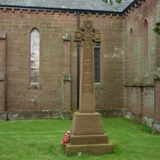
The church displays Norman features such as the western portal and columns decorated with plant motifs in their capitals. These ornamental details reflect the Romanesque architecture typical of the 12th century and shape how the ruins look today.
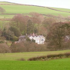
The site is difficult to access as the ruins sit on private property and are partially integrated into a modern house. Anyone wishing to explore the remains should arrange access in advance, and sturdy shoes are recommended for uneven ground.
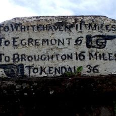
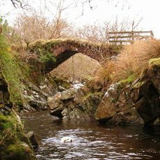
The Monk's Bridge, also known as a packhorse bridge, ranks among the oldest stone structures of its kind in the region and once served as a key trading route. Visitors can still walk across this historic bridge today and observe how it connected the monks with the surrounding landscape.
Location: Ponsonby
Inception: 12 century
Founders: Ranulf de Gernon, 4th Earl of Chester
GPS coordinates: 54.44410,-3.46466
Latest update: December 12, 2025 12:01
Gosforth Cross
3.5 km
Thermal Oxide Reprocessing Plant
4 km
Magnox Reprocessing Plant
4 km
St Mary's Church, Gosforth
3.5 km
Cold Fell
2.9 km
St Bridget's Church, Calder Bridge
1 km
Haile Church (No Dedication)
3.2 km
Church of St Cuthbert
5.4 km
Church of St John the Baptist
3.2 km
Church of St Bridget
3.6 km
Ponsonby Church
1.2 km
Braystones Tower
4.3 km
Milestone On Wall To North West Of High School House
3 km
Calderbridge War Memorial
1 km
Gosforth Hall
3.4 km
Calder Abbey House
35 m
Old Water Tower To North Of Seascale Sports Hall
5.5 km
Milestone At Ny 033087
2.9 km
Milestone At Ny 033084
2.7 km
Monk's Bridge 320m south east of Farthwaite
4.1 km
Seascale War Memorial
5.4 km
Haile Hall
3.2 km
Yeorton Farmhouse
2.8 km
17, Bridge End
5.5 km
Milestone At Ny 055101
3.8 km
Tongue How prehistoric stone hut circle settlements, field systems, funerary cairns, cemetery and cairnfield, Romano-British far
3.9 km
Two high cross shafts in St Bridget's churchyard
3.6 km
Gatepiers To South Of Gosforth Hall
3.5 kmVisited this place? Tap the stars to rate it and share your experience / photos with the community! Try now! You can cancel it anytime.
Discover hidden gems everywhere you go!
From secret cafés to breathtaking viewpoints, skip the crowded tourist spots and find places that match your style. Our app makes it easy with voice search, smart filtering, route optimization, and insider tips from travelers worldwide. Download now for the complete mobile experience.
A unique approach to discovering new places❞
— Le Figaro
All the places worth exploring❞
— France Info
A tailor-made excursion in just a few clicks❞
— 20 Minutes