Enable Location

We need your location to show you interesting places around you

Discover nearby places

Find interesting locations and hidden gems around you

Precise directions

Get accurate directions and distances to places

Your location is never shared with other users. It's only used when you tap the location button.

Cissbury Ring

Log in to your account

Start exploring — it's free

Trusted by 61,445 travelers worldwide

Continue with Google
Continue with Apple
or

We will send you a code to connect

By continuing, you accept our Terms and Conditions and our Privacy Policy

Check your inbox

We've sent a pincode in your inbox. Please enter the code below.

Cissbury Ring, Iron Age hillfort and Neolithic flint mine in West Sussex, England.

Description

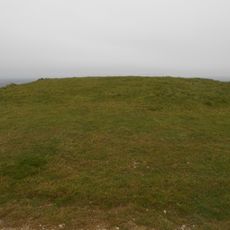
Cissbury Ring is a hilltop enclosure and ancient flint extraction site in West Sussex. The site features visible earthen banks, ditches, and around 270 shallow depressions scattered across the slopes where stone tools were mined thousands of years ago.

History

Mining for flint tools started during the Neolithic period, then fortifications were built much later during the Iron Age. The layers of activity show this hilltop served different purposes across many centuries.

Culture

The site's name comes from the rounded shape of its fortifications, and it remains a place where people feel connected to ancient life. Visitors walk the same ridges that miners and settlers once used for trade and daily work.

Practical

The site has open walking paths with signage and informational panels placed at key spots. Visitors should expect uneven ground and windy conditions on the exposed hilltop, so sturdy footwear and weather protection help.

Did you know?

The mine shafts descend deep into chalk layers, showing the extraordinary effort ancient people put into extraction work. This labor produced sharp-edged tools that became essential for survival and trade across the region.

Location
Part of
Cissbury Ring hillfort, prehistoric flint mine and associated remains
Address
Findon, Valley, Worthing BN14 0HT, UK
GPS coordinates
50.86198,-0.38055
Latest update
December 8, 2025 13:40

AroundUs brings together thousands of curated places, local tips, and hidden gems, enriched daily by 60,000 contributors worldwide. Discover all places nearby (West Sussex).

Sussex: coasts, castles and villages in the south of England

Sussex extends along the south coast of England, between London and the Channel. This area has different types of scenery: white chalk cliffs that rise above the sea, gentle hills of the South Downs, old forests, and valleys with quiet rivers. There are seaside towns such as Brighton and Eastbourne,...

« Cissbury Ring - Iron Age hillfort and Neolithic flint mine in West Sussex, England » is provided by Around Us (aroundus.com). Images and texts are derived from Wikimedia project under a Creative Commons license. You are allowed to copy, distribute, and modify copies of this page, under the conditions set by the license, as long as this note is clearly visible.

Discover hidden gems everywhere you go!

From secret cafés to breathtaking viewpoints, skip the crowded tourist spots and find places that match your style. Our app makes it easy with voice search, smart filtering, route optimization, and insider tips from travelers worldwide. Download now for the complete mobile experience.

Around Us App Screenshot

A unique approach to discovering new places

Le Figaro

All the places worth exploring

France Info

A tailor-made excursion in just a few clicks

20 Minutes

Around Us
Travel Guide & Maps
Download

Send to your phone

QR Code
1

Open the camera app on your mobile.

2

Point at the QR code with your camera. A notification will appear.

3

Tap the notification to open the link.