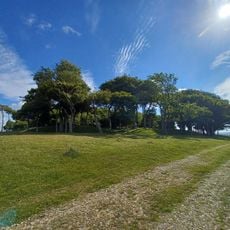
Chanctonbury Ring, Iron Age hillfort in Washington, United Kingdom.
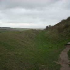
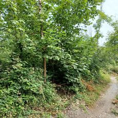
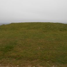
Chanctonbury Ring is an Iron Age hillfort located on a rounded summit in West Sussex, surrounded by distinctive beech trees that form a circular grove. The site commands views across the South Downs and the rolling countryside of the Weald below.
The site began as a defensive Iron Age settlement around 400 BC, then gradually transformed into a religious center during the Roman period. Two Romano-Celtic temples were built here during the first century AD, showing how sacred purposes replaced military ones.
The beech trees crowning the hilltop have become symbols of the landscape and connect the place to generations of local memory. Visitors often gather here to experience the stories and legends that locals have passed down through centuries.
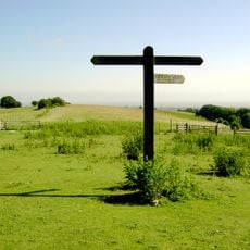
Parking is available at the base of the hill, with well-marked walking routes leading up to the ring and connecting to the South Downs Way. The paths are clear and suitable for most visitors, though the climb requires some physical effort.
Fragments of mosaics and animal bones found during excavations suggest that ritual practices and worship took place here beyond typical defensive purposes. These archaeological discoveries reveal how residents honored their beliefs at this elevated sanctuary.
Location: West Sussex
Location: Washington
Location: Wiston
Elevation above the sea: 242 m
Part of: Chanctonbury Ring hillfort and Romano-Celtic temples
GPS coordinates: 50.89692,-0.38132
Latest update: December 7, 2025 10:03
South Downs National Park
1.9 km
Cissbury Ring
3.9 km
Wiston House
1.6 km
All Saints Church, Buncton
1.9 km
Rock Mill
2 km
Chantry House
3.9 km
Worthing Downland Estate
4.1 km
Steyning Methodist Church
4 km
Jarvis Hall, Steyning
4.1 km
Muntham Court Romano-British site
4 km
Chequer Inn
3.8 km
38, High Street
3.8 km
The Parish Church of St Peter and St Paul
4 km
The Parish Church of St Andrew
4 km
The Parish Church of St Mary
2.2 km
The Parish Church of St Mary
1.6 km
7, Church Street
3.9 km
11 Church Street
3.9 km
The Frankland Arms Public House
1.9 km
Romano-Celtic temples in Chanctonbury Ring
14 m
The Stone House
3.9 km
Cross dyke 760m WNW of Pepperscoombe
2.4 km
120 And 122, High Street
3.6 km
1 3 and 5, Church Street
3.9 km
The Willows
3.7 km
Bowl barrow 200m west of Chanctonbury Ring hillfort
198 m
95 And 97, High Street
3.6 km
Windlesham House School
2.7 kmVisited this place? Tap the stars to rate it and share your experience / photos with the community! Try now! You can cancel it anytime.
Discover hidden gems everywhere you go!
From secret cafés to breathtaking viewpoints, skip the crowded tourist spots and find places that match your style. Our app makes it easy with voice search, smart filtering, route optimization, and insider tips from travelers worldwide. Download now for the complete mobile experience.
A unique approach to discovering new places❞
— Le Figaro
All the places worth exploring❞
— France Info
A tailor-made excursion in just a few clicks❞
— 20 Minutes