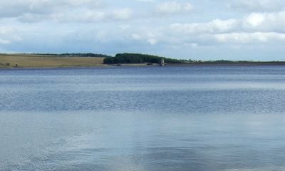
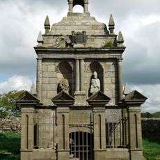
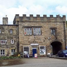
Derwent Reservoir, Water reservoir at the border of Northumberland and County Durham, England
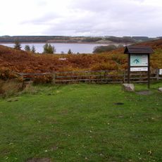
Derwent Reservoir is a large water storage basin located at the boundary between Northumberland and County Durham. The body of water is surrounded by walking and cycling paths, with multiple access points distributed along the shoreline for visitors to explore.
The project arose in the mid-20th century to secure water supplies for industrial regions in the northeast. Its opening in 1967 represented a turning point for how the area managed its water resources for future growth.
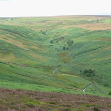
The reservoir serves as a gathering place for water sports enthusiasts and recreational fishers throughout the year. Its shoreline has become central to how local communities spend their leisure time and connect with nature.
The site is easily accessible on foot and offers wide paths suitable for walking and cycling activities. Visit during drier periods when the paths are in better condition and visibility around the water is clearest.
The lake bed carries traces of past mining activity that influence water composition and underwater plant growth in subtle ways. This industrial legacy remains invisible to most visitors but shapes the ecological conditions beneath the surface.
Location: Northumberland
Location: County Durham
Inception: July 1967
Official opening: July 18, 1967
Elevation above the sea: 222 m
GPS coordinates: 54.86667,-1.98333
Latest update: December 8, 2025 19:52
The Lord Crewe Arms Hotel
5 km
Blanchland Abbey
5 km
Minsteracres
3.5 km
St Andrew's Church
4.3 km
Burnhope Burn
2.4 km
Pow Hill Bog
624 m
Church of St Edmund
2.5 km
Church of St Mary
5 km
Churchyard Cross 17 Metres West Of Door Of Church Of St. Mary
5 km
Church of All Saints
4.1 km
Ruffside Hall
1.9 km
Remains Of Manor House At Priory Farm
4.1 km
Milestone 110 Metres North Of Entrance To Eddisbridge Farm
3 km
Hopper Mausoleum north-east of Church of St Andrew
4.4 km
Shotley Low Quarter War Memorial
5.1 km
War Memorial Outside St Marys Abbey
5 km
Boundary Stone At Ngr Ny 97255421
4.3 km
Boundary Stone At Ngr Ny 98635454
3.3 km
Boundary Stone On South Side Of Road At Ngr Ny 99315478
3 km
House Adjacent To Abbey Gatehouse
5 km
Grange Farmhouse And Gin Gang
4.2 km
Boundary Stone 10 Metres North Of Road 700 Metres East Of Farmhouse
3 km
Crooked Oak Farmhouse
5.1 km
The Hare Stone
3.4 km
Boundary Stone At Ngr Ny 97305443
4.4 km
Donald's Grave, On South Side Of Road 10 Metres East Of Track To Slaley Hall
2.7 km
Boundary Stone At Ngr Ny 97365466
4.4 km
Abbey Gatehouse With Post Office
5 kmVisited this place? Tap the stars to rate it and share your experience / photos with the community! Try now! You can cancel it anytime.
Discover hidden gems everywhere you go!
From secret cafés to breathtaking viewpoints, skip the crowded tourist spots and find places that match your style. Our app makes it easy with voice search, smart filtering, route optimization, and insider tips from travelers worldwide. Download now for the complete mobile experience.
A unique approach to discovering new places❞
— Le Figaro
All the places worth exploring❞
— France Info
A tailor-made excursion in just a few clicks❞
— 20 Minutes