St Andrew's Church

Log in to your account

AroundUs is a community-driven map of interesting places, built by curious explorers like you. It grows with every review, story, and photo you share.
Connect to save your favorite spots, contribute locations, and create personalized routes.
Continue with Google
Continue with Apple
Continue with X
Continue with Facebook
Continue with email
By continuing, you accept our Terms and Conditions and our Privacy Policy
Create an account
Add to collection
Map
Suggest a change
Share

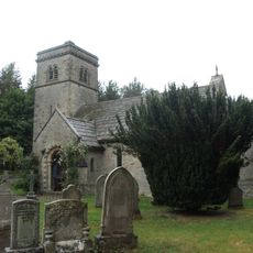
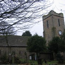
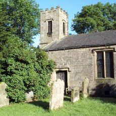
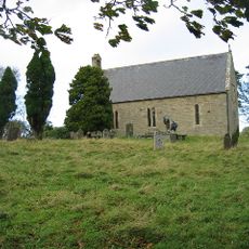
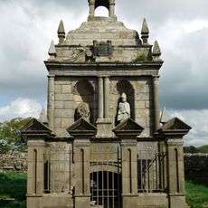
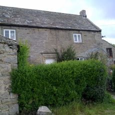
St Andrew's Church, Grade II listed parish church in Shotley Low Quarter, England

St Andrew's Church is a stone building with a cross shape featuring four equal arms, comprising a nave, chancel, and two transepts. All four side arms have round-topped windows arranged in a traditional manner.

The building was constructed in 1769 and replaced an earlier place of worship on this site. A century later, it underwent major repairs due to damage caused by mining activities underground.

The church displays craftsmanship from different periods that visitors can see on the walls and inside the building. These works tell the story of people who shaped this place over many generations.

The building sits on an elevated hilltop and is now cared for by a foundation dedicated to protecting historic churches. Visitors should expect steep approaches and an exposed location.

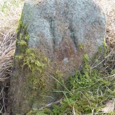
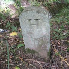
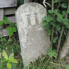
The graveyard surrounding the building contains several other protected structures, including a special building for storing hearses. A noble tomb northeast of it belongs to the highest protection category.

Location: Shotley Low Quarter

Inception: 1892

Website: http://visitchurches.org.uk/Ourchurches/Completelistofchurches/St-Andrews-Church-Shotley-Northumberland

GPS coordinates: 54.89150,-1.93100

Latest update: December 14, 2025 18:07

Photos
Around this place
Derwent Reservoir
United Kingdom

Derwent Reservoir

4.3 km
Minsteracres
United Kingdom

Minsteracres

2.1 km
Burnhope Burn
United Kingdom

Burnhope Burn

4.7 km
Shotley Hall
United Kingdom

Shotley Hall

5 km
Shotley Park
United Kingdom

Shotley Park

5.2 km
Pow Hill Bog
United Kingdom

Pow Hill Bog

4.9 km
Hindley Hall
United Kingdom

Hindley Hall

4 km
Church of St John
United Kingdom

Church of St John

4.4 km
Church of St Ebba
United Kingdom

Church of St Ebba

5.8 km
St Philip & St James
United Kingdom

St Philip & St James

3.3 km
Church of All Saints
United Kingdom

Church of All Saints

5.3 km
Hopper Mausoleum north-east of Church of St Andrew
United Kingdom

Hopper Mausoleum north-east of Church of St Andrew

21 m
Shotley Low Quarter War Memorial
United Kingdom

Shotley Low Quarter War Memorial

3.2 km
Allensford Mill Farmhouse And Adjacent Outbuildings
United Kingdom

Allensford Mill Farmhouse And Adjacent Outbuildings

5.8 km
Remains Of Manor House At Priory Farm
United Kingdom

Remains Of Manor House At Priory Farm

5.2 km
Milestone 110 Metres North Of Entrance To Eddisbridge Farm
United Kingdom

Milestone 110 Metres North Of Entrance To Eddisbridge Farm

3.9 km
Boundary Stone At Ngr Ny 98635454
United Kingdom

Boundary Stone At Ngr Ny 98635454

5.9 km
Boundary Stone On South Side Of Road At Ngr Ny 99315478
United Kingdom

Boundary Stone On South Side Of Road At Ngr Ny 99315478

5.2 km
Grange Farmhouse And Gin Gang
United Kingdom

Grange Farmhouse And Gin Gang

5.1 km
Shotley Bridge
United Kingdom

Shotley Bridge

5.2 km
Crooked Oak Farmhouse
United Kingdom

Crooked Oak Farmhouse

5.6 km
The Hare Stone
United Kingdom

The Hare Stone

4.8 km
Boundary Stone About 500 Metres North East Of Shotley Spa
United Kingdom

Boundary Stone About 500 Metres North East Of Shotley Spa

5.1 km
Boundary Stone At Ngr Nz 09705632, On West Side Of Mill Burn
United Kingdom

Boundary Stone At Ngr Nz 09705632, On West Side Of Mill Burn

5.3 km
Boundary Stone On South Side Of Mill Barn
United Kingdom

Boundary Stone On South Side Of Mill Barn

4.7 km
Donald's Grave, On South Side Of Road 10 Metres East Of Track To Slaley Hall
United Kingdom

Donald's Grave, On South Side Of Road 10 Metres East Of Track To Slaley Hall

4.5 km
Boundary Stone 10 Metres North Of Road 700 Metres East Of Farmhouse
United Kingdom

Boundary Stone 10 Metres North Of Road 700 Metres East Of Farmhouse

1.6 km
Milestone, Carterway Heads, Burnmill Bank, Fell Gate
United Kingdom

Milestone, Carterway Heads, Burnmill Bank, Fell Gate

3.1 km
Show the full map
Reviews

Visited this place? Tap the stars to rate it and share your experience / photos with the community! Try now! You can cancel it anytime.

« St Andrew's Church - Grade II listed parish church in Shotley Low Quarter, England » is provided by Around Us (aroundus.com). Images and texts are derived from Wikimedia project under a Creative Commons license. You are allowed to copy, distribute, and modify copies of this page, under the conditions set by the license, as long as this note is clearly visible.

Discover hidden gems everywhere you go!

From secret cafés to breathtaking viewpoints, skip the crowded tourist spots and find places that match your style. Our app makes it easy with voice search, smart filtering, route optimization, and insider tips from travelers worldwide. Download now for the complete mobile experience.

Around Us App Screenshot

A unique approach to discovering new places

Le Figaro

All the places worth exploring

France Info

A tailor-made excursion in just a few clicks

20 Minutes