Ladybower Reservoir

Log in to your account

AroundUs is a community-driven map of interesting places, built by curious explorers like you. It grows with every review, story, and photo you share.
Connect to save your favorite spots, contribute locations, and create personalized routes.
Continue with Google
Continue with Apple
Continue with X
Continue with Facebook
Continue with email
By continuing, you accept our Terms and Conditions and our Privacy Policy
Create an account

Ladybower Reservoir

Add to collection
Map
Suggest a change
Share

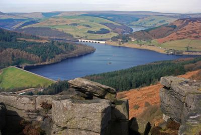
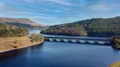
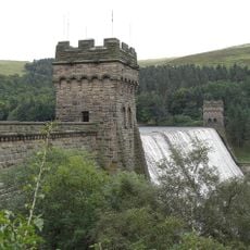
Ladybower Reservoir, Water reservoir in Peak District National Park, England.

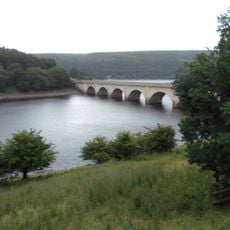
Ladybower Reservoir is a water reservoir in the Peak District National Park, Derbyshire, England, forming a Y-shape that covers roughly 210 hectares and sits surrounded by wooded hillsides. Two concrete towers rise from the water near the shores, marking the overflow structures of the dam that forms part of a water supply network.

Construction ran from 1935 to 1943 and required flooding two villages, Ashopton and Derwent, whose residents were relocated before the water rose. Completion happened during the Second World War, and the site later served as a training ground for air raids on German dams.

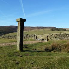
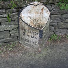
The name Ladybower comes from a natural valley that once held a winding stream before the area was flooded. Today walkers use the shore paths as starting points for hikes into the surrounding moorlands, and the water itself has become a quiet place where people pause to watch reflections on calm days.

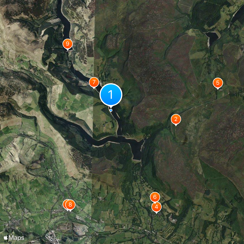
Several hiking trails circle the shore and offer a loop of about 8 miles (13 kilometers) that suits a half-day walk. The paths are mostly level and easy to follow, though some sections can turn muddy after rain.

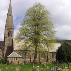
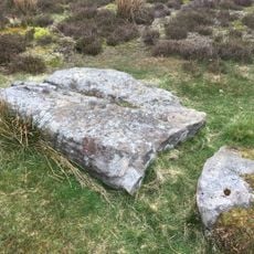
During extreme droughts the remains of the submerged village of Derwent rise from the water, drawing curious visitors to see foundations and low walls. The church was demolished before flooding, so only the lower structures appear when the water level drops.

GPS coordinates: 53.38333,-1.71667

Latest update: December 13, 2025 15:37

Photos
Around this place
Hordron Edge stone circle
United Kingdom

Hordron Edge stone circle

2.6 km
Church of St Peter
United Kingdom

Church of St Peter

4.3 km
St John the Baptist church
United Kingdom

St John the Baptist church

4.4 km
Moscar Cross
United Kingdom

Moscar Cross

4.3 km
Roman Catholic Church of Our Lady of Sorrows and Attached Presbytery
United Kingdom

Roman Catholic Church of Our Lady of Sorrows and Attached Presbytery

4.1 km
Derwent Woodlands War Memorial
United Kingdom

Derwent Woodlands War Memorial

1.1 km
Hope War Memorial
United Kingdom

Hope War Memorial

4.3 km
Derwent Dam
United Kingdom

Derwent Dam

2.9 km
Toll Cottage
United Kingdom

Toll Cottage

3.8 km
Hope Cross at OS 162 874 approximately 1 mile off Edale Road
United Kingdom

Hope Cross at OS 162 874 approximately 1 mile off Edale Road

2.8 km
Old Hall Hotel
United Kingdom

Old Hall Hotel

4.3 km
Ashopton Viaduct
United Kingdom

Ashopton Viaduct

1 km
Aston Hall
United Kingdom

Aston Hall

3.5 km
Killhill Farmhouse
United Kingdom

Killhill Farmhouse

4 km
Milepost Approximately 80 Metres West Of Driveway To Moscar Cross Farm
United Kingdom

Milepost Approximately 80 Metres West Of Driveway To Moscar Cross Farm

4.5 km
Take Off Stone Approx 85 Metres To North Of Strines Public House
United Kingdom

Take Off Stone Approx 85 Metres To North Of Strines Public House

4.7 km
Yorkshire Bridge
United Kingdom

Yorkshire Bridge

2.6 km
Mile Post at SK 176 834
United Kingdom

Mile Post at SK 176 834

4.3 km
Edale End Farmhouse and attached barn
United Kingdom

Edale End Farmhouse and attached barn

3 km
Barns to the north of Rowlee Farmhouse
United Kingdom

Barns to the north of Rowlee Farmhouse

4.1 km
Prehistoric standing stone 1,030m south west of triangulation point on High Neb
United Kingdom

Prehistoric standing stone 1,030m south west of triangulation point on High Neb

4.1 km
Stone circle, 960m north east of High Lees Farm
United Kingdom

Stone circle, 960m north east of High Lees Farm

2.6 km
Standing cross in the churchyard of St Peter's Church
United Kingdom

Standing cross in the churchyard of St Peter's Church

4.3 km
Anglian high cross in the churchyard of St Peter's Church
United Kingdom

Anglian high cross in the churchyard of St Peter's Church

4.3 km
Rectory And Attached Coach House
United Kingdom

Rectory And Attached Coach House

4.5 km
Guidestone, Sheepfold, SW of Moscar House Farm
United Kingdom

Guidestone, Sheepfold, SW of Moscar House Farm

3 km
Milestone, near Hagglee Ford
United Kingdom

Milestone, near Hagglee Ford

2.5 km
Milestone, W of Bellhag Wood
United Kingdom

Milestone, W of Bellhag Wood

3.8 km
Show the full map
Reviews

Visited this place? Tap the stars to rate it and share your experience / photos with the community! Try now! You can cancel it anytime.

« Ladybower Reservoir - Water reservoir in Peak District National Park, England » is provided by Around Us (aroundus.com). Images and texts are derived from Wikimedia project under a Creative Commons license. You are allowed to copy, distribute, and modify copies of this page, under the conditions set by the license, as long as this note is clearly visible.

Discover hidden gems everywhere you go!

From secret cafés to breathtaking viewpoints, skip the crowded tourist spots and find places that match your style. Our app makes it easy with voice search, smart filtering, route optimization, and insider tips from travelers worldwide. Download now for the complete mobile experience.

Around Us App Screenshot

A unique approach to discovering new places

Le Figaro

All the places worth exploring

France Info

A tailor-made excursion in just a few clicks

20 Minutes