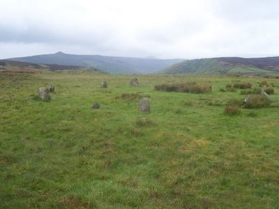
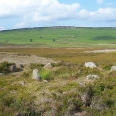
Hordron Edge stone circle, Bronze Age stone circle near Cutthroat Bridge in Derwent, England
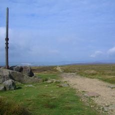
Hordron Edge is a Bronze Age stone circle situated on Moscar Moor near Cutthroat Bridge. It comprises eleven stones of varying heights arranged in a formation roughly 15 meters across.
The circle was built around 2000 BC when populations began settling in the Peak District following climate shifts. This Bronze Age construction marks a period when communities chose to inhabit this moorland area.
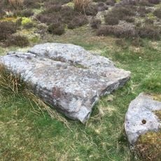
The site holds local folklore, particularly centered on the prominent Fairy Stone positioned at its southwest point, which locals associate with strange light occurrences. These stories have shaped how people experience and remember the place over generations.
The stone circle sits on Moscar Moor, roughly 540 meters southeast of Cutthroat Bridge, accessible via moorland paths. Visitors should be prepared for boggy ground and variable weather conditions typical of upland areas.
Excavations have uncovered additional stones buried beneath the peat, suggesting the original formation may have contained up to 26 stones. This discovery reveals the circle was once larger and more complex than its visible remains indicate today.
Location: Derwent
GPS coordinates: 53.37810,-1.67791
Latest update: December 11, 2025 18:06
Ladybower Reservoir
2.6 km
Strines Reservoir
3.8 km
Sugworth Hall
3.2 km
Stanedge Pole
4 km
St John the Baptist church
3.6 km
Moscar Cross
2.2 km
Roman Catholic Church of Our Lady of Sorrows and Attached Presbytery
3.2 km
Derwent Woodlands War Memorial
3.6 km
Sugworth Tower
3.4 km
North Lees Chapel
3.8 km
North Lees Hall
4 km
Ashopton Viaduct
2.3 km
Aston Hall
4.1 km
Milepost Approximately 80 Metres West Of Driveway To Moscar Cross Farm
2.2 km
Take Off Stone Approx 85 Metres To North Of Strines Public House
3.9 km
Yorkshire Bridge
2.5 km
Former Gamekeepers Lodge At Brookfield Manor
4.2 km
Mile Post Approximately 90 Metres West Of Driveway To Swinglee Ford
4.9 km
Rectory And Attached Coach House
3.6 km
Mile Post Approximately 140 Metres East Of Black Rock
3.5 km
Barns at North Lees Hall
3.9 km
Prehistoric standing stone 1,030m south west of triangulation point on High Neb
2.2 km
Stone circle, 960m north east of High Lees Farm
2 m
Brookfield Manor
4.2 km
Guidestone, Sheepfold, SW of Moscar House Farm
926 m
Milestone, in top Redmires reservoir, usually submerged
4.6 km
Guidestone, Wet Shaw Lane, jct with Stake Hill Road
4.6 km
Milepost, Hope Road, Mytham, just W of Mytham Leadmill Bridge
4.4 kmVisited this place? Tap the stars to rate it and share your experience / photos with the community! Try now! You can cancel it anytime.
Discover hidden gems everywhere you go!
From secret cafés to breathtaking viewpoints, skip the crowded tourist spots and find places that match your style. Our app makes it easy with voice search, smart filtering, route optimization, and insider tips from travelers worldwide. Download now for the complete mobile experience.
A unique approach to discovering new places❞
— Le Figaro
All the places worth exploring❞
— France Info
A tailor-made excursion in just a few clicks❞
— 20 Minutes