Enable Location

We need your location to show you interesting places around you

Discover nearby places

Find interesting locations and hidden gems around you

Precise directions

Get accurate directions and distances to places

Your location is never shared with other users. It's only used when you tap the location button.

Shankill Road

Log in to your account

Start exploring — it's free

Trusted by 60,645 travelers worldwide

Continue with Google
Continue with Apple
or

We will send you a code to connect

By continuing, you accept our Terms and Conditions and our Privacy Policy

Check your inbox

We've sent a pincode in your inbox. Please enter the code below.

Shankill Road

Shankill Road, Main thoroughfare in West Belfast, Northern Ireland

Description

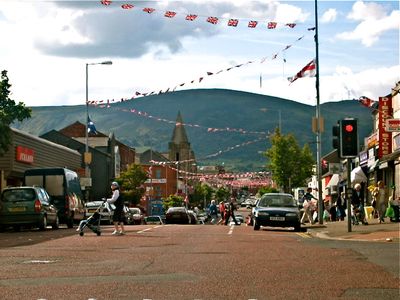
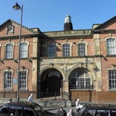
Shankill Road is a main artery in West Belfast, Northern Ireland, running about 1.5 miles (2.4 kilometers) from the city center into the western neighborhoods. Shops, cafés, and rows of terraced homes line both sides, while large wall paintings with political and historical themes cover many building facades.

History

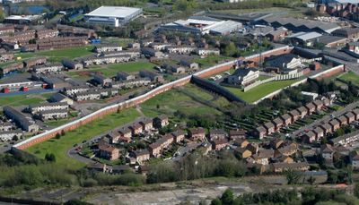
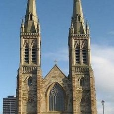
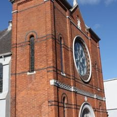
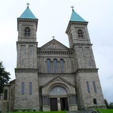
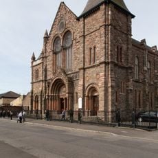
An early 5th-century church stood here, giving Shankill its name, and several smaller chapels lined the western riverbank. The peace lines went up in 1969 to separate neighboring communities and limit contact during the Troubles.

Culture

The name comes from Old Irish, meaning "old church," recalling the early places of worship that once stood here. Local residents still reference this past through street names and community centers that honor the district's original character.

Practical

Tour buses stop regularly during daytime hours, giving visitors time for photo breaks and a walk around. The street is easy to explore on foot with no major inclines, and curbs are lowered throughout.

Did you know?

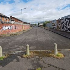
Tall concrete barriers have separated this street from neighboring Falls Road for decades, illustrating the physical division between two communities. Some sections are fitted with metal gates that close in the evening.

Location
GPS coordinates
54.60417,-5.95146
Latest update
December 13, 2025 16:33

AroundUs brings together thousands of curated places, local tips, and hidden gems, enriched daily by 60,000 contributors worldwide. Discover all places nearby (Belfast).

Around this place
HM Prison Crumlin Road
United Kingdom

HM Prison Crumlin Road

813 m
Divis Tower
United Kingdom

Divis Tower

756 m
St Anne's Cathedral, Belfast
United Kingdom

St Anne's Cathedral, Belfast

1.5 km
St Peter's Cathedral
United Kingdom

St Peter's Cathedral

730 m
Bank Buildings, Belfast
United Kingdom

Bank Buildings, Belfast

1.4 km
Clonard Monastery
United Kingdom

Clonard Monastery

549 m
Crumlin Road Courthouse
United Kingdom

Crumlin Road Courthouse

722 m
St. Mary's Church, Belfast
United Kingdom

St. Mary's Church, Belfast

1.3 km
Irish Republican History Museum
United Kingdom

Irish Republican History Museum

576 m
Peace Wall
United Kingdom

Peace Wall

491 m
Clifton House
United Kingdom

Clifton House

1.2 km
Belfast Central Library
United Kingdom

Belfast Central Library

1.3 km
Church House
United Kingdom

Church House

1.4 km
Holy Cross Church, Ardoyne
United Kingdom

Holy Cross Church, Ardoyne

1.2 km
Northern Ireland Music Archive
United Kingdom

Northern Ireland Music Archive

1.3 km
Queen's Arcade
United Kingdom

Queen's Arcade

1.4 km
Duncairn Centre for Culture and Arts
United Kingdom

Duncairn Centre for Culture and Arts

1.3 km
William Conor statue
United Kingdom

William Conor statue

270 m
89-101 Royal Avenue And 92-102 North St. Belfast (aka Sinclair House)
United Kingdom

89-101 Royal Avenue And 92-102 North St. Belfast (aka Sinclair House)

1.3 km
Falls Road Library
United Kingdom

Falls Road Library

706 m
Presbyterian Church Townsend St. Belfast
United Kingdom

Presbyterian Church Townsend St. Belfast

800 m
College Of Technology College Square East Belfast Bt1 6dj
United Kingdom

College Of Technology College Square East Belfast Bt1 6dj

1.3 km
No Pasaran sculpture
United Kingdom

No Pasaran sculpture

1.4 km
Tesco (former Provincial Bank Of Ireland) 2 Royal Avenue Belfast
United Kingdom

Tesco (former Provincial Bank Of Ireland) 2 Royal Avenue Belfast

1.4 km
First Presbyterian Church (non-subscribing) 41 Rosemary St. Belfast
United Kingdom

First Presbyterian Church (non-subscribing) 41 Rosemary St. Belfast

1.5 km
Belfast Charitable Institution (clifton House), Clifton St. Belfast
United Kingdom

Belfast Charitable Institution (clifton House), Clifton St. Belfast

1.2 km
Dominican Convent Falls Road Belfast
United Kingdom

Dominican Convent Falls Road Belfast

1.2 km
Old Museum Buildings 7 College Square North Belfast
United Kingdom

Old Museum Buildings 7 College Square North Belfast

1.1 km
Show the full map
« Shankill Road - Main thoroughfare in West Belfast, Northern Ireland » is provided by Around Us (aroundus.com). Images and texts are derived from Wikimedia project under a Creative Commons license. You are allowed to copy, distribute, and modify copies of this page, under the conditions set by the license, as long as this note is clearly visible.

Discover hidden gems everywhere you go!

From secret cafés to breathtaking viewpoints, skip the crowded tourist spots and find places that match your style. Our app makes it easy with voice search, smart filtering, route optimization, and insider tips from travelers worldwide. Download now for the complete mobile experience.

Around Us App Screenshot

A unique approach to discovering new places

Le Figaro

All the places worth exploring

France Info

A tailor-made excursion in just a few clicks

20 Minutes

Around Us
Travel Guide & Maps
Download

Send to your phone

QR Code
1

Open the camera app on your mobile.

2

Point at the QR code with your camera. A notification will appear.

3

Tap the notification to open the link.