South Park, Public park in east Oxford, England.
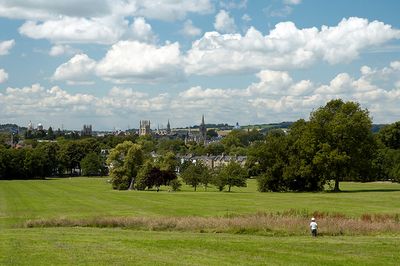
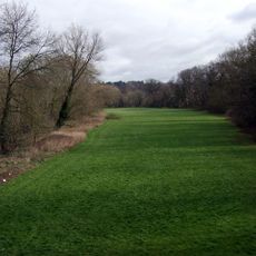
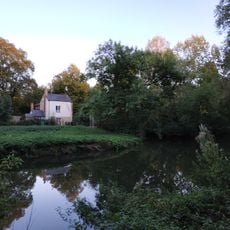
South Park is a public park on Headington Hill in east Oxford, spreading across green spaces with trees, open lawns, and maintained paths. From its elevated location, the park offers wide views of the city's university buildings and towers below.
The land was owned by the Morrell family until 1932 when a local preservation organization purchased it to ensure public access. In 1951, the organization handed the site over to Oxford city, where it has remained a public park ever since.
The park serves as a gathering place where visitors enjoy walking, sitting, and taking in the views of the city below. The open spaces invite people to pause and spend quiet time with friends or family.
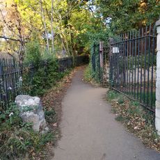
Multiple entrances are located along Morrell Avenue, Headington Road, Cheney Lane, and Warneford Lane, giving visitors several ways to enter. The park is open daily and accessible throughout the week.
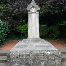
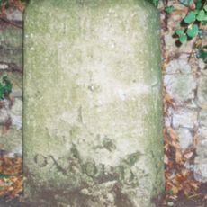
A carved stone by artist Eric Gill marks an important moment in the park's history, honoring those who supported its preservation. The inscription recognizes the contributions of different organizations that made the land's acquisition possible.
Location: Oxford
GPS coordinates: 51.75140,-1.23111
Latest update: December 10, 2025 20:03
Headington Hill Hall
412 m
O2 Academy Oxford
555 m
Ultimate Picture Palace
637 m
The Oxford Artisan Distillery
513 m
St John the Evangelist Church, Oxford
806 m
St Bartholomew's Chapel, Oxford
740 m
St Clement's Church, Oxford
508 m
Headington Hill Park
379 m
Angel & Greyhound Meadow, Oxford
753 m
Church of St Mary and St John
676 m
Bridge Over Headington Road At Headington Hill Hall
347 m
Cowley Road Methodist Church
655 m
The Warneford Hospital Chapel
534 m
Presbytery Of The Church Of St John The Evangelist
812 m
Regal Cinema
780 m
16, James Street
775 m
New Marston War Memorial
843 m
St Bartholomews Farmhouse
712 m
Hilltop
470 m
Stone In Warneford Lane Opposite The Entrance To The Warneford Hospital
704 m
Kings Mill
742 m
Stones Almshouses (8 Tenements)
675 m
St Clement's, Oxford War Memorial
451 m
81, St Clements Street
601 m
Stone At The Junction Of Marston Road And The Footpath To Pullens Lane
576 m
Stone On The South Side Of Headington Road 50 Yards East Of Hilltop
512 m
Headington Hill Hall Lodge House
459 m
Stone On The North Side Of Headington Hill 20 Yards To The East Of The Bridge
379 mVisited this place? Tap the stars to rate it and share your experience / photos with the community! Try now! You can cancel it anytime.
Discover hidden gems everywhere you go!
From secret cafés to breathtaking viewpoints, skip the crowded tourist spots and find places that match your style. Our app makes it easy with voice search, smart filtering, route optimization, and insider tips from travelers worldwide. Download now for the complete mobile experience.
A unique approach to discovering new places❞
— Le Figaro
All the places worth exploring❞
— France Info
A tailor-made excursion in just a few clicks❞
— 20 Minutes