Enable Location

We need your location to show you interesting places around you

Discover nearby places

Find interesting locations and hidden gems around you

Precise directions

Get accurate directions and distances to places

Your location is never shared with other users. It's only used when you tap the location button.

Bow Castle Broch

Log in to your account

Start exploring — it's free

Trusted by 64,888 travelers worldwide

Continue with Google
Continue with Apple
or

We will send you a code to connect

By continuing, you accept our Terms and Conditions and our Privacy Policy

Check your inbox

We've sent a pincode in your inbox. Please enter the code below.

Discussion Reviews 1 Photos
1.7k Popularity

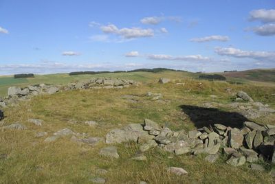
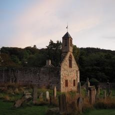
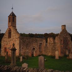
Bow Castle Broch, Iron Age broch near Gala Water, Scottish Borders, United Kingdom.

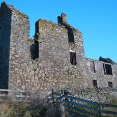
Bow Castle Broch is a circular stone ruin from the Iron Age situated on flat ground next to a steep slope. Its thick remaining walls enclose a central space from which one can look out across the Gala Water valley.

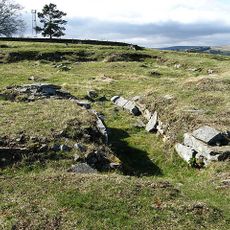
The structure was built during the Iron Age as a dwelling and later became a point of contact with Roman traders and travelers. Excavations in the 19th century uncovered objects that show how active this exchange was.

The site was home to people who maintained connections across distances, as objects from different cultures found here reveal. These items tell of exchange and encounters that shaped daily life for the inhabitants.

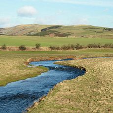
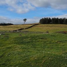
Visiting is free and possible at any time since the ruin stands on open ground and is freely accessible. From here you can explore walking routes in the area or simply enjoy the views across the valley.

Only a few of these round structures survive in this region, and this site is among the rare examples you can still visit today. What makes it special is that you can study the building method and early Scottish culture directly at this location.

The community of curious travelers

AroundUs brings together thousands of curated places, local tips, and hidden gems, enriched daily by 60,000 contributors worldwide.

Start exploring
Location
Location
GPS coordinates
55.66598,-2.85721
Latest update
December 14, 2025 12:20
Around this place
Gala Water
United Kingdom

Gala Water

3.8 km
Torwoodlee Broch
United Kingdom

Torwoodlee Broch

3.3 km
Galashiels Baptist Church
United Kingdom

Galashiels Baptist Church

5.9 km
Townfoot, Town Hall
United Kingdom

Townfoot, Town Hall

2.9 km
Torwoodlee House
United Kingdom

Torwoodlee House

3.9 km
St Andrew's Arts Centre (Former Ladhope Free Church), Bridge Street
United Kingdom

St Andrew's Arts Centre (Former Ladhope Free Church), Bridge Street

6.1 km
Stow, Galashiels Road, Old Stow Kirk And Churchyard
United Kingdom

Stow, Galashiels Road, Old Stow Kirk And Churchyard

2.9 km
High Tweed Mill, Former High Tweed Mill, King Street
United Kingdom

High Tweed Mill, Former High Tweed Mill, King Street

5.2 km
Stow, Galashiels Road, Stow Kirk
United Kingdom

Stow, Galashiels Road, Stow Kirk

2.7 km
Lugate Bridge
United Kingdom

Lugate Bridge

2 km
Stow Old Bridge
United Kingdom

Stow Old Bridge

2.7 km
Workshop & House,  Union Street, Galashiels
United Kingdom

Workshop & House, Union Street, Galashiels

5.9 km
Kinloss Abbey and Burial Ground, Abbot's Lodging
United Kingdom

Kinloss Abbey and Burial Ground, Abbot's Lodging

4 km
Walkways And Railings, Steps, 74, 75, 76 Kirk Brae Including Boundary Walls
United Kingdom

Walkways And Railings, Steps, 74, 75, 76 Kirk Brae Including Boundary Walls

5.9 km
The Pirns, Former High Tweed Mill, King Street
United Kingdom

The Pirns, Former High Tweed Mill, King Street

5.2 km
69, 72 (Inclusive) Kirk Brae
United Kingdom

69, 72 (Inclusive) Kirk Brae

5.9 km
St Mary's Church, Stow
United Kingdom

St Mary's Church, Stow

2.8 km
Craigend
United Kingdom

Craigend

4 km
Gates, St Andrew's Arts Centre (Former Ladhope Free Church), Bridge Street
United Kingdom

Gates, St Andrew's Arts Centre (Former Ladhope Free Church), Bridge Street

6.1 km
Buckholm Tower
United Kingdom

Buckholm Tower

4.4 km
1-5 Roxburgh Street, Galashiels
United Kingdom

1-5 Roxburgh Street, Galashiels

6 km
Galashiels, High Street, West Relief Church
United Kingdom

Galashiels, High Street, West Relief Church

6.1 km
73, 77 (Inclusive) Kirk Brae
United Kingdom

73, 77 (Inclusive) Kirk Brae

5.9 km
British Linen Bank, 46-48 High Street, Galashiels
United Kingdom

British Linen Bank, 46-48 High Street, Galashiels

6.1 km
High Mill, Botany Mill
United Kingdom

High Mill, Botany Mill

6 km
Botany Lane Block
United Kingdom

Botany Lane Block

6 km
Roxburgh Street Block
United Kingdom

Roxburgh Street Block

6 km
Galashiels, Botany Lane, Glasite Chapel
United Kingdom

Galashiels, Botany Lane, Glasite Chapel

6 km
Show the full map
Reviews
Share your experience

No review yet

Discussions
Start a discussion...

No discussion yet

« Bow Castle Broch - Iron Age broch near Gala Water, Scottish Borders, United Kingdom » is provided by Around Us (aroundus.com). Images and texts are derived from Wikimedia project under a Creative Commons license. You are allowed to copy, distribute, and modify copies of this page, under the conditions set by the license, as long as this note is clearly visible.

Discover hidden gems everywhere you go!

From secret cafés to breathtaking viewpoints, skip the crowded tourist spots and find places that match your style. Our app makes it easy with voice search, smart filtering, route optimization, and insider tips from travelers worldwide. Download now for the complete mobile experience.

Around Us App Screenshot

A unique approach to discovering new places

Le Figaro

All the places worth exploring

France Info

A tailor-made excursion in just a few clicks

20 Minutes

Around Us
Travel Guide & Maps
Download

Send to your phone

QR Code
1

Open the camera app on your mobile.

2

Point at the QR code with your camera. A notification will appear.

3

Tap the notification to open the link.