Enable Location

We need your location to show you interesting places around you

Discover nearby places

Find interesting locations and hidden gems around you

Precise directions

Get accurate directions and distances to places

Your location is never shared with other users. It's only used when you tap the location button.

Cushendall

Log in to your account

Start exploring — it's free

Trusted by 68,100 travelers worldwide

Continue with Google
Continue with Apple
or

We will send you a code to connect

By continuing, you accept our Terms and Conditions and our Privacy Policy

Check your inbox

We've sent a pincode in your inbox. Please enter the code below.

Cushendall
Discussion Reviews 1 Photos
16.1k Popularity

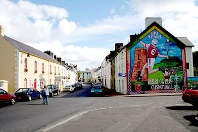
Cushendall, village in County Antrim, Northern Ireland, UK

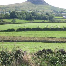
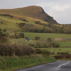
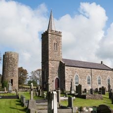
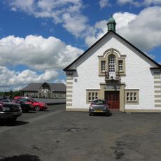
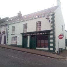
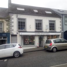
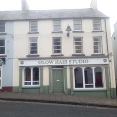
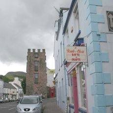
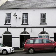
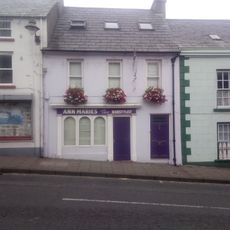
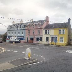
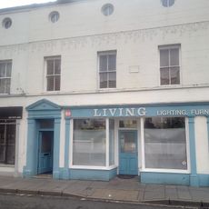
Cushendall is a small village on the coast of County Antrim, situated between green valleys and the sea. It is dominated by the flat-topped Lurigethan Mountain and consists of old stone buildings with whitewashed walls lining four main streets, preserving a quiet, timeless appearance.

The village was founded in the 17th century and grew significantly when Francis Turnly purchased land in 1809 and built many of the houses and the coastal road still visible today. In the 20th century, the village was affected by conflict during the Troubles, notably in 1922 when soldiers fired on a crowd, killing three men.

The name comes from the Irish 'Cois Abhann Dala', meaning 'foot of the river Dall', which flows down through the valley into the sea. The village is shaped by its whitewashed Georgian houses from the 19th century that line the streets, creating a sense of continuity with how people have lived here for generations.

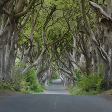
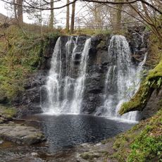
The village sits along the Antrim Coast Road and is easy to explore on foot, with most shops and restaurants along the four main streets. The nearby beach is small and quiet, while Glenariff Forest Park with walking trails of varying lengths is just a short drive away.

On clear days, visitors can see Scotland from the village shores, including the Mull of Kintyre and Sanda Island across the water. The village became a Conservation Area in 1973, one of the first in Northern Ireland, which has helped preserve its historic character over the decades.

The community of curious travelers

AroundUs brings together thousands of curated places, local tips, and hidden gems, enriched daily by 60,000 contributors worldwide.

Start exploring
Location
GPS coordinates
55.08290,-6.05896
Latest update
February 19, 2026 22:40
Reviews
Share your experience

No review yet

Discussions
Start a discussion...

No discussion yet

« Cushendall - village in County Antrim, Northern Ireland, UK » is provided by Around Us (aroundus.com). Images and texts are derived from Wikimedia project under a Creative Commons license. You are allowed to copy, distribute, and modify copies of this page, under the conditions set by the license, as long as this note is clearly visible.

Discover hidden gems everywhere you go!

From secret cafés to breathtaking viewpoints, skip the crowded tourist spots and find places that match your style. Our app makes it easy with voice search, smart filtering, route optimization, and insider tips from travelers worldwide. Download now for the complete mobile experience.

Around Us App Screenshot

A unique approach to discovering new places

Le Figaro

All the places worth exploring

France Info

A tailor-made excursion in just a few clicks

20 Minutes

Around Us
Travel Guide & Maps
Download

Send to your phone

QR Code
1

Open the camera app on your mobile.

2

Point at the QR code with your camera. A notification will appear.

3

Tap the notification to open the link.