Haytor Granite Tramway, Historic granite tramway in Ilsington, England
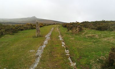
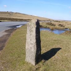
The Haytor Granite Tramway is an old stone transport route across Dartmoor with rails carved directly into the rock to guide wagons. The track runs from the quarry to a canal connection and is now used as a hiking path.
The route was built around 1820 to move stones from the quarry more efficiently to distant markets. This project opened up trade in granite across wider regions and supported growing demand.
The granite from this quarry reached important buildings across London, shaping how the city developed during its growth period. Visitors can trace how a moorland industry once connected to distant urban centers through this transport link.
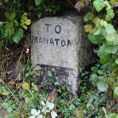
The route is easy to reach on foot with several entry points across Dartmoor near the tramway. The area is open to visitors, but it is important to bring weather-resistant gear since the moorland is exposed and can be quite windy.
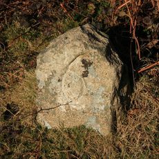
The rails are carved as an L-shaped groove directly into the granite bedrock, which mechanically guided wagon wheels without needing separate metal tracks. This clever engineering solution allowed heavy loads to move across rough moorland using the natural rock surface as infrastructure.
Location: Ilsington
Official opening: 1820
GPS coordinates: 50.58640,-3.76556
Latest update: December 8, 2025 19:54
Becky Falls
2.5 km
Ring cairn south west of Hound Tor, 215m east of East Lodge
1.4 km
Church of St Michael
3.8 km
Drakeford Bridge
4.5 km
Bridge And Section Of Haytor Granite Tramway Crossing Bovey Pottery Leat About 250 Metres South-East Of Chapple Farm
5.2 km
Dartmoor Cottage
4.4 km
Colehayes Park Hotel
4 km
Hound Tor Deserted Medieval Village
1.1 km
West Horridge Farmhouse
3.8 km
Beckaford Bridge
2.2 km
Coaxial fields, prehistoric settlements and cairns on Halshanger and Horridge Commons, forming part of the Rippon Tor coaxial fi
3 km
Barn Cottage
4.6 km
Direction Post At Centre Of Five Crossroads
4.2 km
Direction Post On South East Side Of Haytor Down, On North West Side Of The Road About 60 Metres North East Of The Turning To Haytor Vale
1.8 km
Moormede
4.9 km
Direction Post At South East Corner Of Lane From Ilsington Methodist Church To Lewthorn Crossroads
3.4 km
Compass Cottage Honeysuckle Little Thatch
4.6 km
Earthwork in Houndtor Wood
3.3 km
Milestone And Section Of Track Of Granite Tramway On North-West Side Of Road To Haytor, About 90M North-East Of Junction With Road To Green Lane
3 km
Stentifords Cross, About 70 Metres South East Of Hemsworthy Gate Crossroads
2 km
Direction Post At North East Side Of Hemsworthy Gate Crossroads
1.9 km
Ash House About 18 Metres South-East Of Lower Hisley Farmhouse
4.1 km
Direction Post At North East Corner Of Woodhouse Crossroads
4.5 km
Swallerton Gate
1.8 km
Direction Post At North East Corner Of Sigford Crossroads
3.6 km
Southcott Farmhouse
2.5 km
Guidestone, Reddaford Water Cross, by UC road to Lustleigh, W of bridge
3.9 km
Byways
4.9 kmVisited this place? Tap the stars to rate it and share your experience / photos with the community! Try now! You can cancel it anytime.
Discover hidden gems everywhere you go!
From secret cafés to breathtaking viewpoints, skip the crowded tourist spots and find places that match your style. Our app makes it easy with voice search, smart filtering, route optimization, and insider tips from travelers worldwide. Download now for the complete mobile experience.
A unique approach to discovering new places❞
— Le Figaro
All the places worth exploring❞
— France Info
A tailor-made excursion in just a few clicks❞
— 20 Minutes