Chester city walls, City walls in Chester, England
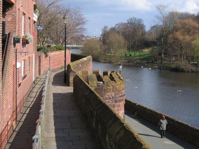
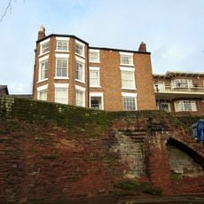
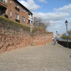
The city walls form a closed circuit of about two miles around the historic center, with elevated sandstone walkways and views over streets and rooftops. The structure alternates between wide sections and narrower passages as it follows the shape of the old town.
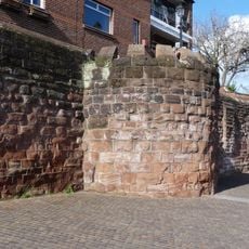
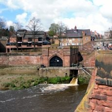
The Romans laid the first fortifications between 70 and 80 CE to protect their garrison. The Saxons reinforced the structure in 907, and the Normans completed the ring in the 12th century with gates and towers.
Locals use the circuit for morning walks or after-work strolls, as the elevated passages above street level offer a quiet route through the center. Along the way visitors sit on the old stones and watch activity in the squares below.
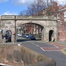
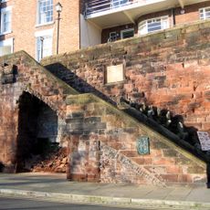
Four main gates provide access to the circuit, and several staircases lead up from streets to the walkway. Most sections are freely walkable, but some steps and uneven surfaces make passage difficult for pushchairs or wheelchairs.
The circuit is the longest fully preserved medieval wall ring in Britain. Every corner shows building techniques from different centuries, from Roman foundations to later additions.
Location: Cheshire West and Chester
Location: Chester Castle
GPS coordinates: 53.18640,-2.88869
Latest update: December 5, 2025 22:27
Old Dee Bridge
100 m
Chester Weir
57 m
Bear and Billet
62 m
Bridgegate
46 m
Gamul House
133 m
St Olave's Church, Chester
129 m
Recorder's Steps
129 m
Ye Olde Edgar
75 m
Shipgate House
93 m
Unnamed drum tower 50 metres east of the Bridgegate
1 m
51, Lower Bridge Street
147 m
3, Bridge Place
44 m
Cross Keys Public House and raised forecourt
54 m
70, 70A, 72 and 74, Lower Bridge Street
109 m
4, Duke Street
57 m
Number 7, 9 and 11 and railings to forecourt
26 m
19, City Walls
85 m
Pumping Station
62 m
53, Lower Bridge Street
138 m
5, Castle Street
153 m
1 and 3, Castle Street
146 m
Part of City Walls from Bridgegate to Drum Tower 50 Metres East
10 m
Richard House
100 m
1, Bridge Place
49 m
13, Bridge Place
22 m
Number 5 and rear dwelling and attached wall
33 m
76, Lower Bridge Street
104 m
Part Of City Wall From Barnabys Tower To Tower East Of Bridgegate
83 mReviews
Visited this place? Tap the stars to rate it and share your experience / photos with the community! Try now! You can cancel it anytime.
Discover hidden gems everywhere you go!
From secret cafés to breathtaking viewpoints, skip the crowded tourist spots and find places that match your style. Our app makes it easy with voice search, smart filtering, route optimization, and insider tips from travelers worldwide. Download now for the complete mobile experience.
A unique approach to discovering new places❞
— Le Figaro
All the places worth exploring❞
— France Info
A tailor-made excursion in just a few clicks❞
— 20 Minutes