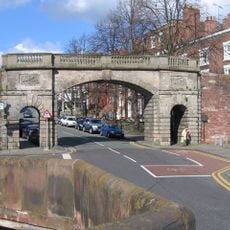
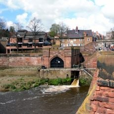
Old Dee Bridge, Medieval road bridge in Chester, England.
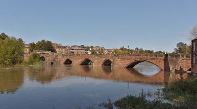
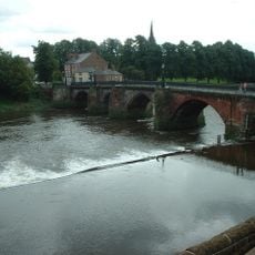
The Old Dee Bridge is a medieval road crossing that spans the River Dee with seven red sandstone arches. It connects Lower Bridge Street to the Handbridge area and underwent modifications in 1826 to add a footpath for both vehicle and pedestrian use.
The structure was built in 1387, replacing earlier Roman and wooden bridges that served as vital crossing points during military campaigns into Wales. It became an essential passage controlling movement between Chester and Welsh territories during medieval times.
The structure displays medieval engineering with varying arch sizes and the use of local red sandstone that creates a distinctive appearance throughout the crossing.
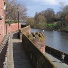
The bridge is accessible to pedestrians at all times as it primarily carries local traffic. It is best experienced on foot, allowing visitors to observe the architectural details and the surrounding historic city from above.
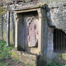
A defensive tower stood on the crossing from 1407 to 1781, controlling entry to Chester through a drawbridge and portcullis mechanism. This fortification served as a military checkpoint to prevent unauthorized passage into the city.
Location: Cheshire West and Chester
Inception: 14 century
Made from material: red sandstone
GPS coordinates: 53.18551,-2.88872
Latest update: December 11, 2025 11:05
Chester city walls
100 m
Minerva's Shrine, Chester
140 m
Chester Weir
95 m
Bear and Billet
106 m
Chester Crown Court
212 m
Bridgegate
86 m
Gamul House
206 m
St. Mary's Centre, Chester
182 m
County Hall, Chester
167 m
St Olave's Church, Chester
215 m
Recorder's Steps
217 m
Ye Olde Edgar
132 m
Shipgate House
148 m
Unnamed drum tower 50 metres east of the Bridgegate
99 m
3, Bridge Place
128 m
Cross Keys Public House and raised forecourt
140 m
19, City Walls
178 m
Pumping Station
67 m
4, Duke Street
146 m
70, 70A, 72 and 74, Lower Bridge Street
176 m
Number 7, 9 and 11 and railings to forecourt
109 m
1 and 3, Castle Street
219 m
Richard House
160 m
1, Bridge Place
134 m
Part of City Walls from Bridgegate to Drum Tower 50 Metres East
100 m
Number 5 and rear dwelling and attached wall
115 m
76, Lower Bridge Street
167 m
Part Of City Wall From Barnabys Tower To Tower East Of Bridgegate
174 mVisited this place? Tap the stars to rate it and share your experience / photos with the community! Try now! You can cancel it anytime.
Discover hidden gems everywhere you go!
From secret cafés to breathtaking viewpoints, skip the crowded tourist spots and find places that match your style. Our app makes it easy with voice search, smart filtering, route optimization, and insider tips from travelers worldwide. Download now for the complete mobile experience.
A unique approach to discovering new places❞
— Le Figaro
All the places worth exploring❞
— France Info
A tailor-made excursion in just a few clicks❞
— 20 Minutes