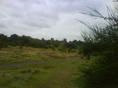
Kersal Moor, Moorland in Salford, England.
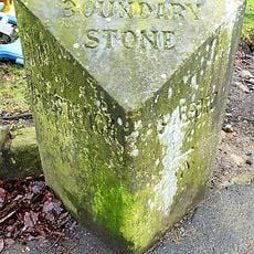
Kersal Moor is moorland in Salford featuring sandhill formations along the Irwell Valley with mixed vegetation on sandy and gravelly ground. The area spans roughly eight hectares bounded by local roads and natural waterways.
Human activity on the moor dates back to the Neolithic period, revealed through flint tool discoveries during late 19th century excavations. The site remained important to the region across centuries as settlements and communities developed nearby.
The moor served as a gathering place where communities assembled for important events and political meetings throughout its history. Today visitors walk here to experience open landscape and connect with the area's public heritage.
The moor is open for visitors throughout the year and best explored on foot across its open terrain. The boundaries are marked by surrounding roads and waterways, making navigation straightforward for walkers.
The Manchester Golf Club established one of the earliest golf courses outside Scotland here in 1818, marking a pivotal moment in English sports history. This early venture showed how the game spread beyond its Scottish origins into new territories.
Location: Salford
GPS coordinates: 53.51528,-2.27639
Latest update: December 10, 2025 16:20
Drinkwater Park
1.6 km
Greek Orthodox Church of the Annunciation, Manchester
1.5 km
Church of St Hilda
1.6 km
Church of St John Evangelist
1.5 km
Church of St Paul
276 m
Church of St Gabriel
978 m
Former Chapel Adjacent To Main Entrance At Salford Northern Cemetry
1.2 km
Gateway, Lodge And Adjoining Office At Salford Northern Cemetery
1.3 km
437, Lower Broughton Road
1.2 km
Former Kersal Bar Toll House
489 m
Boundary stone at SD8090601825 at the junction with Singleton Brook
907 m
464, Lower Broughton Road
1.2 km
Thirlmere Aqueduct Over The River Irwell
1.1 km
Cliff House
1.2 km
466, Lower Broughton Road
1.2 km
Prestwich Operatic Society War Memorial
1.6 km
388 And 390, Lower Broughton Road
1.5 km
Kersal Cell
986 m
Grand Lodge To South South West Of Heaton Hall With Screen Walls And Wall Attached To West
1.4 km
Scarr Wheel House
1.3 km
457 And 459, Lower Broughton Road
1.2 km
Boundary Stone At Sd 830 023
1.3 km
453, Lower Broughton Road
1.2 km
Boundary Stone At Sd 829 023 (Junction With Bury Old Road)
1.3 km
260, Great Clowes Street
1.6 km
455, Lower Broughton Road
1.2 km
Rookwood Wrenwood
708 m
Number 451 And Attached Former Coach House
1.2 kmVisited this place? Tap the stars to rate it and share your experience / photos with the community! Try now! You can cancel it anytime.
Discover hidden gems everywhere you go!
From secret cafés to breathtaking viewpoints, skip the crowded tourist spots and find places that match your style. Our app makes it easy with voice search, smart filtering, route optimization, and insider tips from travelers worldwide. Download now for the complete mobile experience.
A unique approach to discovering new places❞
— Le Figaro
All the places worth exploring❞
— France Info
A tailor-made excursion in just a few clicks❞
— 20 Minutes