Log in to your account

AroundUs is a community-driven map of interesting places, built by curious explorers like you. It grows with every review, story, and photo you share.
Connect to save your favorite spots, contribute locations, and create personalized routes.
Continue with Google
Continue with Apple
Continue with X
Continue with Facebook
Continue with email
By continuing, you accept our Terms and Conditions and our Privacy Policy
Create an account

Drinkwater Park

Add to collection
Map
Suggest a change
Share

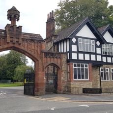
Drinkwater Park, Urban park in Prestwich, England

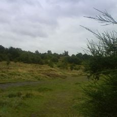
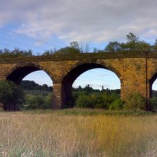
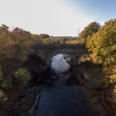
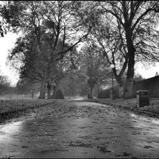
Drinkwater Park is an urban park set along the Irwell Valley, notable for a disused railway viaduct with 13 monolithic stone arches. A long narrow reservoir runs through its center, crossed by flat, well-maintained pathways.

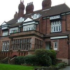
The land was owned by Peter Drinkwater, a Manchester textile mill operator who built Irwell House in 1790. The property passed to local councils in 1902.

The site is part of the Kingfisher Trail, where visitors can spot kingfishers at Damshead Lodge and various birds of prey near the viaduct. These bird populations have adapted to the water features and historic structures, shaping what people notice when walking through the grounds.

The park can be accessed through Park Lane in Whitefield or Buckley Lane in Prestwich, with flat, quality paths particularly available from the Buckley Lane entrance. The level walkways make the grounds accessible to visitors of varying mobility.

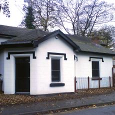
Damshead Lodge was hand-dug in the 1780s and contains a deep overflow drain shaft resembling a submerged mill chimney, around 15 meters (50 feet) deep. This hidden water engineering detail is a rare glimpse of early industrial water management.

Location: Bury

GPS coordinates: 53.52111,-2.29889

Latest update: December 11, 2025 11:02

Photos
Around this place
Kersal Moor
United Kingdom

Kersal Moor

1.6 km
Church of St Mary the Virgin, Prestwich
United Kingdom

Church of St Mary the Virgin, Prestwich

1.2 km
Clifton Viaduct
United Kingdom

Clifton Viaduct

1.2 km
Clifton Aqueduct
United Kingdom

Clifton Aqueduct

1.4 km
St. Augustine's Church, Pendlebury
United Kingdom

St. Augustine's Church, Pendlebury

1.9 km
Victoria Park
United Kingdom

Victoria Park

2.3 km
Besses United Reformed Church
United Kingdom

Besses United Reformed Church

2.5 km
Heaton Park Congregational Church
United Kingdom

Heaton Park Congregational Church

2.3 km
Church of St Hilda
United Kingdom

Church of St Hilda

2.2 km
Church Inn
United Kingdom

Church Inn

1.3 km
Christ Church
United Kingdom

Christ Church

2.1 km
Church of St John the Evangelist
United Kingdom

Church of St John the Evangelist

2.1 km
Church of St Gabriel
United Kingdom

Church of St Gabriel

2.2 km
Church of St Paul
United Kingdom

Church of St Paul

1.9 km
War Memorial, St Mary's Churchyard
United Kingdom

War Memorial, St Mary's Churchyard

1.3 km
Former Chapel Adjacent To Main Entrance At Salford Northern Cemetry
United Kingdom

Former Chapel Adjacent To Main Entrance At Salford Northern Cemetry

1.3 km
38, Church Lane
United Kingdom

38, Church Lane

1.3 km
Gateway, Lodge And Adjoining Office At Salford Northern Cemetery
United Kingdom

Gateway, Lodge And Adjoining Office At Salford Northern Cemetery

1.3 km
Former Kersal Bar Toll House
United Kingdom

Former Kersal Bar Toll House

2.1 km
Boundary stone at SD8090601825 at the junction with Singleton Brook
United Kingdom

Boundary stone at SD8090601825 at the junction with Singleton Brook

1.1 km
Clifton War Memorial
United Kingdom

Clifton War Memorial

2.5 km
Monument To John Brooks To West Of Church Of St Mary
United Kingdom

Monument To John Brooks To West Of Church Of St Mary

1.2 km
Thirlmere Aqueduct Over The River Irwell
United Kingdom

Thirlmere Aqueduct Over The River Irwell

825 m
Grand Lodge To South South West Of Heaton Hall With Screen Walls And Wall Attached To West
United Kingdom

Grand Lodge To South South West Of Heaton Hall With Screen Walls And Wall Attached To West

2.4 km
Kersal Cell
United Kingdom

Kersal Cell

1.4 km
Andrew Knowles and Sons Collieries War Memorial
United Kingdom

Andrew Knowles and Sons Collieries War Memorial

1.7 km
Prestwich Operatic Society War Memorial
United Kingdom

Prestwich Operatic Society War Memorial

1.7 km
Rookwood  Wrenwood
United Kingdom

Rookwood Wrenwood

1.3 km
Show the full map
Reviews

Visited this place? Tap the stars to rate it and share your experience / photos with the community! Try now! You can cancel it anytime.

« Drinkwater Park - Urban park in Prestwich, England » is provided by Around Us (aroundus.com). Images and texts are derived from Wikimedia project under a Creative Commons license. You are allowed to copy, distribute, and modify copies of this page, under the conditions set by the license, as long as this note is clearly visible.

Discover hidden gems everywhere you go!

From secret cafés to breathtaking viewpoints, skip the crowded tourist spots and find places that match your style. Our app makes it easy with voice search, smart filtering, route optimization, and insider tips from travelers worldwide. Download now for the complete mobile experience.

Around Us App Screenshot

A unique approach to discovering new places

Le Figaro

All the places worth exploring

France Info

A tailor-made excursion in just a few clicks

20 Minutes