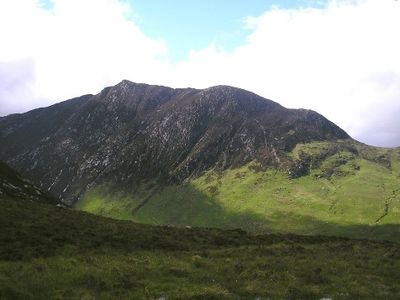
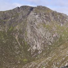
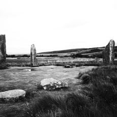
Caisteal Abhail, Mountain summit in North Ayrshire, Scotland.
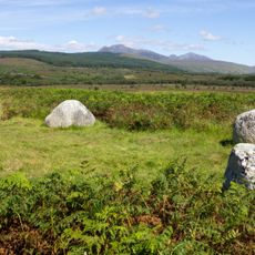
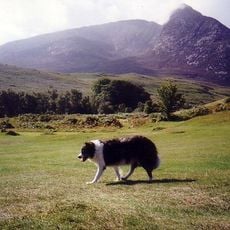
Caisteal Abhail is a mountain summit in North Ayrshire with an elevation of about 860 meters and a plateau scattered with multiple rock formations. These formations provide viewpoints across to neighboring peaks on the island of Arran.
The name comes from Scotland's Gaelic heritage and refers to the castle-like structure of the rock formations. For centuries, Highland shepherds used ancient paths crossing the mountain's slopes.
The mountain draws local climbers who maintain traditional routes and pass down Scottish climbing safety practices. These activities shape how visitors experience the place today.
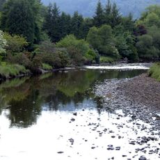
The main route to the summit starts at the North Sannox trailhead from a parking area and follows a burn through woodland sections as a guideline. Good footwear and appropriate clothing matter, as conditions can change quickly on the mountain.
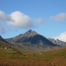
The summit is marked by several natural rock formations that together create a castle-like appearance. The largest formation marks the actual highest point and gives the mountain its distinctive name.
Location: North Ayrshire
Elevation above the sea: 859 m
GPS coordinates: 55.64989,-5.22931
Latest update: December 13, 2025 17:00
Firth of Clyde
14.5 km
Brodick Castle
8.1 km
Goat Fell
3.6 km
Machrie Moor Stone Circles
13.2 km
Lochranza Castle
7.3 km
Skipness Castle
14.8 km
Cìr Mhòr
1.3 km
Beinn Tarsuinn
3.2 km
Auchagallon Stone Circle
12.3 km
Moss Farm Road Stone Circle
13.5 km
St Brendan's Chapel
14.4 km
Arran Heritage Museum
8.6 km
1–27 Hamilton Terrace
14.4 km
Lamlash and Kilbride Parish Church
14.5 km
Corrie Harbour
5.7 km
Corrie Hotel
5.7 km
Brodick Golf Course
8.7 km
Corrie Golf Course
4.5 km
Arran, Pirnmill, Memorial To Rev John Kennedy
9.6 km
Dougarie Lodge Boat House
11.4 km
Brodick, Brodick Old Quay
8.1 km
Arran, Pirnmill, Pirnmill Church
9.6 km
Arran, Dougarie Lodge
11.2 km
Arran, Lochranza, Barking House
6.8 km
Arran, Lochranza Church
6.7 km
Brodick Castle
7.9 km
Arran, Cnoc A' Chlochair
8.7 km
Moss Farm, Machrie Moor, stone circles, cairns, hut-circles and fields
13.3 kmVisited this place? Tap the stars to rate it and share your experience / photos with the community! Try now! You can cancel it anytime.
Discover hidden gems everywhere you go!
From secret cafés to breathtaking viewpoints, skip the crowded tourist spots and find places that match your style. Our app makes it easy with voice search, smart filtering, route optimization, and insider tips from travelers worldwide. Download now for the complete mobile experience.
A unique approach to discovering new places❞
— Le Figaro
All the places worth exploring❞
— France Info
A tailor-made excursion in just a few clicks❞
— 20 Minutes