Chest opened
+${chestReward.xp} XP
Explorer
NOUVEAU ×${chestReward.collectible.quantity}
tapez pour fermer
Chest locked

Open chests in the app

Around Us is built for your phone — chests unlock when you walk, explore and capture nearby places.

Enable Location

We need your location to show you interesting places around you

Discover nearby places

Find interesting locations and hidden gems around you

Precise directions

Get accurate directions and distances to places

Your location is never shared with other users. It's only used when you tap the location button.

Imber

Log in to your account

Start exploring — it's free

Trusted by 72,889 travelers worldwide

Continue with Google
Continue with Apple
or

We will send you a code to connect

By continuing, you accept our Terms and Conditions and our Privacy Policy

Check your inbox

We've sent a pincode in your inbox. Please enter the code below.

Imber
Discussion Reviews 1 Photos
52.6k Popularity

Imber, Mock town in Heytesbury, United Kingdom.

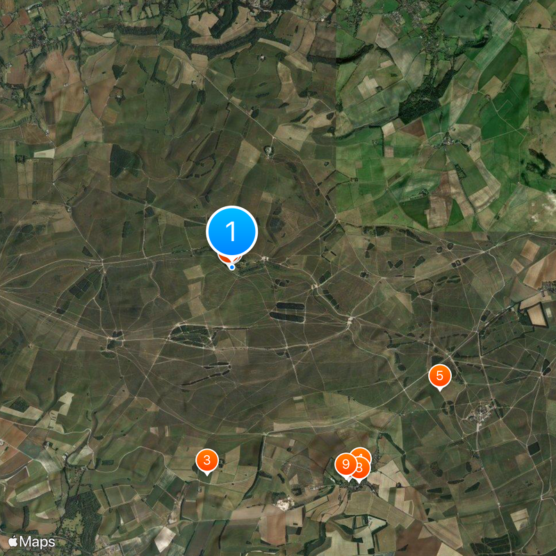
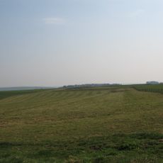
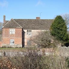
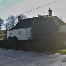
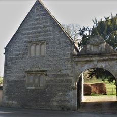
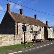
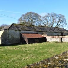
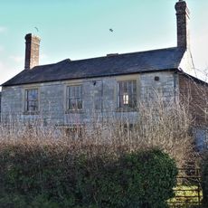
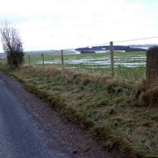
Imber is an abandoned settlement within a military training area on Salisbury Plain, containing empty houses and a preserved church. The place was once a working village with about 150 residents before it was completely cleared out.

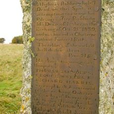
The Ministry of Defence evacuated all residents in 1943 to create a training ground for American forces during World War II. After the war ended, the evacuation was never reversed and the area remained under military control.

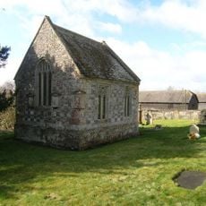
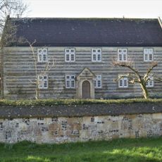
St Giles Church stands at the center and shows how important religion was to daily life for the former residents. It was more than a place of worship—it was where the community gathered and connected.

Visitors can access the site only on certain days throughout the year, mainly around Easter, Christmas, and August, depending on military activities. It's best to check access conditions in advance, as the training area can close at any time.

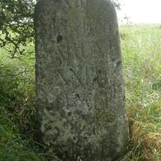
The place has no postal code and is instead identified using grid references for location within the training grounds. This shows how completely the military controls the space and how it remains separate from normal civilian systems.

The community of curious travelers

AroundUs brings together thousands of curated places, local tips, and hidden gems, enriched daily by 60,000 contributors worldwide.

Start exploring
Location
GPS coordinates
51.23400,-2.05100
Latest update
December 14, 2025 18:02
Around this place
St Giles' Church, Imber
United Kingdom

St Giles' Church, Imber

45 m
Knook Castle
United Kingdom

Knook Castle

4.3 km
Church of All Saints
United Kingdom

Church of All Saints

5 km
Milestone, Breach Hill; 230m S jcn Chitterne-Tilshead rd 7m E current track
United Kingdom

Milestone, Breach Hill; 230m S jcn Chitterne-Tilshead rd 7m E current track

5 km
Chapel Of St Mary
United Kingdom

Chapel Of St Mary

5 km
Two Monuments In Railed Enclosure, In The Churchyard, About 17 Metres South West Of The Tower Of Church Of St Giles
United Kingdom

Two Monuments In Railed Enclosure, In The Churchyard, About 17 Metres South West Of The Tower Of Church Of St Giles

74 m
Pear Tree House
United Kingdom

Pear Tree House

5.2 km
The Manor
United Kingdom

The Manor

5 km
White Hart House
United Kingdom

White Hart House

5.2 km
The Round House
United Kingdom

The Round House

5 km
Ingram, Wallis And Parham Monuments In The Churchyard About 16 Metres South West Of Chapel Of St Mary
United Kingdom

Ingram, Wallis And Parham Monuments In The Churchyard About 16 Metres South West Of Chapel Of St Mary

5 km
The Glebe House
United Kingdom

The Glebe House

5 km
Milestone About 200 Metres North Along Green Lane To West Of St Mary's House
United Kingdom

Milestone About 200 Metres North Along Green Lane To West Of St Mary's House

4.7 km
The Coach House
United Kingdom

The Coach House

5 km
Manor Farm House
United Kingdom

Manor Farm House

4.8 km
The Old Malthouse
United Kingdom

The Old Malthouse

5.2 km
Gateway At The Gatehouse
United Kingdom

Gateway At The Gatehouse

4.9 km
The King's Head
United Kingdom

The King's Head

5.1 km
Stable To South Of The Manor
United Kingdom

Stable To South Of The Manor

5 km
98, Chitterne Road
United Kingdom

98, Chitterne Road

5.2 km
Elm Farm
United Kingdom

Elm Farm

5.1 km
Milestone By Junction Of Footpath From Great Cheverell And Lane To Coulston
United Kingdom

Milestone By Junction Of Footpath From Great Cheverell And Lane To Coulston

4 km
Chitterne House
United Kingdom

Chitterne House

4.9 km
Chitterne Lodge
United Kingdom

Chitterne Lodge

4.9 km
Milestone About 1 Mile South West Of Chitterne
United Kingdom

Milestone About 1 Mile South West Of Chitterne

5.1 km
Robber's Stone
United Kingdom

Robber's Stone

4.5 km
Bowl barrow: one of a dispersed group of five barrows adjacent to the Imber-Warminster track
United Kingdom

Bowl barrow: one of a dispersed group of five barrows adjacent to the Imber-Warminster track

2.4 km
Milestone, Coulston Hill; 45m W jcn by-way to Baynton Hill Farm
United Kingdom

Milestone, Coulston Hill; 45m W jcn by-way to Baynton Hill Farm

5.1 km
Show the full map
Reviews
Share your experience

No review yet

Discussions
Start a discussion...

No discussion yet

« Imber - Mock town in Heytesbury, United Kingdom » is provided by Around Us (aroundus.com). Images and texts are derived from Wikimedia project under a Creative Commons license. You are allowed to copy, distribute, and modify copies of this page, under the conditions set by the license, as long as this note is clearly visible.

Discover hidden gems everywhere you go!

From secret cafés to breathtaking viewpoints, skip the crowded tourist spots and find places that match your style. Our app makes it easy with voice search, smart filtering, route optimization, and insider tips from travelers worldwide. Download now for the complete mobile experience.

Around Us App Screenshot

A unique approach to discovering new places

Le Figaro

All the places worth exploring

France Info

A tailor-made excursion in just a few clicks

20 Minutes

Around Us
Travel Guide & Maps
Download

Send to your phone

QR Code
1

Open the camera app on your mobile.

2

Point at the QR code with your camera. A notification will appear.

3

Tap the notification to open the link.