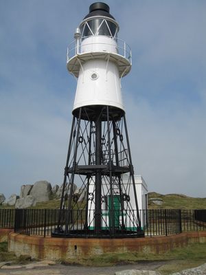
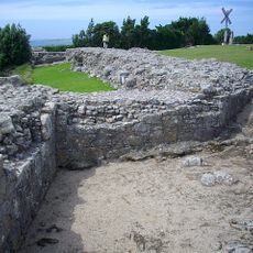
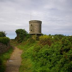
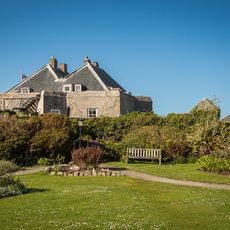
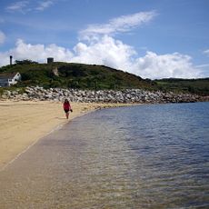
Peninnis Lighthouse, Grade II listed lighthouse on Peninnis Head, St Mary's, Great Britain
Peninnis Lighthouse is a 14-meter steel tower located on St. Mary's island in the Scilly Isles, featuring a black lattice-work lower section and a white upper section with a balcony. The structure stands on a rocky headland at the southernmost point of the island, where it has guided ships for over a century.
The lighthouse was built in 1911 to replace the older light on St. Agnes island. Following its automation in 1922, it became one of the first gas-powered automated lighthouses in Britain.
The lighthouse marks the southernmost point of St Mary's island and guides vessels entering St Mary's Sound and Hugh Town harbour.
The lighthouse sits on an exposed rocky headland with strong winds and rough conditions, especially during storms. Plan your visit during calm weather and wear sturdy footwear for the rocky terrain.
Inside the tower remains the original rotating lens that is no longer in use, while a modern LED lantern mounted on the exterior rail now handles navigation duties. This dual arrangement shows how the historic structure has adapted to current operations.
Location: St. Mary's
Inception: 1911
Height: 14 m
GPS coordinates: 49.90460,-6.30350
Latest update: December 14, 2025 11:40
St Mary's Old Church, St Mary's
680 m
Star Castle
1.7 km
St Mary's Church, St Mary's
1.3 km
Harry's Walls
1.5 km
Buzza Tower
1.1 km
Isles of Scilly Museum
1.4 km
Lower Moors
1.3 km
Garrison Tower
1.6 km
Church of St Mary (Methodist)
1.3 km
Buzza Hill Dolmen
1.1 km
Former Wesleyan Methodist Chapel
1.5 km
Giant's Castle, St Mary's
1.5 km
Star Castle
1.7 km
Late 19th-early 20th century Woolpack Battery on The Garrison, St Mary's
1.5 km
The Atlantic Hotel
1.6 km
Post Office
1.5 km
Porthcressa Beach
1.3 km
Town Hall
1.4 km
The Bishop And Wolf Public House
1.4 km
The Old Quay, Old Town Bay, St Mary's
796 m
Old Town War Memorial
646 m
Newman House
1.9 km
Post-medieval breastwork, curtain wall and associated defensive structures on the periphery of The Garrison, St Mary's
1.6 km
The Pier
1.7 km
World War II pillbox west of Porth Hellick, 90m north of Drum Rock, St Mary's
1.8 km
Carn Leh
536 m
Woolpack Battery
1.5 km
World War II pillbox and Civil War battery at Tolman Point, St Mary's
788 mVisited this place? Tap the stars to rate it and share your experience / photos with the community! Try now! You can cancel it anytime.
Discover hidden gems everywhere you go!
From secret cafés to breathtaking viewpoints, skip the crowded tourist spots and find places that match your style. Our app makes it easy with voice search, smart filtering, route optimization, and insider tips from travelers worldwide. Download now for the complete mobile experience.
A unique approach to discovering new places❞
— Le Figaro
All the places worth exploring❞
— France Info
A tailor-made excursion in just a few clicks❞
— 20 Minutes