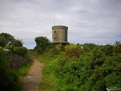
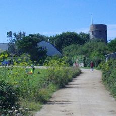
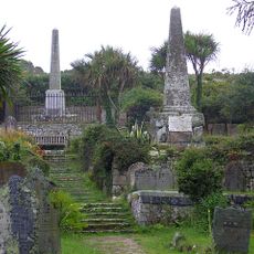
Buzza Tower, Grade II listed tower on St. Mary's, England.
Buzza Tower is a stone tower located on Buzza Hill with sheltered seating areas and views across the Isles of Scilly landscape. Inside, a camera obscura projects real-time images of the surrounding environment onto a viewing surface.
The tower was originally built as a windmill in 1821 and later converted into a memorial for King Edward VII during its 1912 restoration. This change marked a shift from industrial use to commemorative purpose.
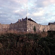
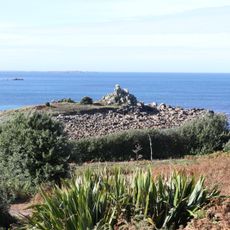
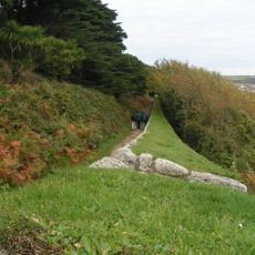
The tower serves as a gathering place where visitors come to take in views across the islands. Its presence on the hilltop has become part of how locals and travelers experience St. Mary's landscape today.
The site is easily accessible with seating areas where you can rest and take in the surroundings. The elevated location provides clear views, making it a good spot to understand the layout of the islands.
The tower features a camera obscura installed in 2014 that projects live images of the surroundings onto an interior wall. This optical device brings together an old scientific principle with contemporary visitor experience.
Location: St. Mary's
GPS coordinates: 49.91342,-6.31074
Latest update: December 14, 2025 17:40
St Mary's Old Church, St Mary's
569 m
Star Castle
769 m
St Mary's Church, St Mary's
243 m
Peninnis Lighthouse
1.1 km
Harry's Walls
616 m
Isles of Scilly Museum
362 m
Lower Moors
677 m
Garrison Tower
841 m
Church of St Mary (Methodist)
204 m
Buzza Hill Dolmen
47 m
Former Wesleyan Methodist Chapel
463 m
Star Castle
770 m
Late 19th-early 20th century Woolpack Battery on The Garrison, St Mary's
878 m
The Atlantic Hotel
516 m
Post Office
490 m
Taylor's Island
1.1 km
The Old Quay, Old Town Bay, St Mary's
759 m
The Bishop And Wolf Public House
399 m
Town Hall
342 m
Old Town War Memorial
583 m
Porthcressa Beach
373 m
Newman House
843 m
Post-medieval breastwork, curtain wall and associated defensive structures on the periphery of The Garrison, St Mary's
879 m
The Pier
607 m
Carn Leh
837 m
Woolpack Battery
998 m
World War II pillbox west of Porth Hellick, 90m north of Drum Rock, St Mary's
1.7 km
World War II pillbox and Civil War battery at Tolman Point, St Mary's
1 kmVisited this place? Tap the stars to rate it and share your experience / photos with the community! Try now! You can cancel it anytime.
Discover hidden gems everywhere you go!
From secret cafés to breathtaking viewpoints, skip the crowded tourist spots and find places that match your style. Our app makes it easy with voice search, smart filtering, route optimization, and insider tips from travelers worldwide. Download now for the complete mobile experience.
A unique approach to discovering new places❞
— Le Figaro
All the places worth exploring❞
— France Info
A tailor-made excursion in just a few clicks❞
— 20 Minutes