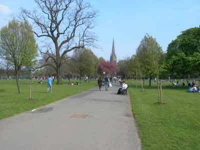
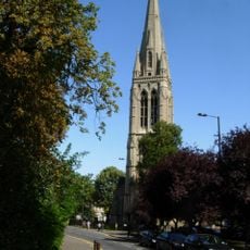
Clissold Park, Victorian urban park in Stoke Newington, England
Clissold Park is a Victorian-era urban park in Stoke Newington featuring two lakes called Beckmere and Runtzmere, along with sports facilities and children's play areas. The grounds also contain animal enclosures with deer and goats, plus a skatepark bowl.
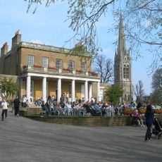
The park opened in 1889 on what was once Jonathan Hoare's private estate, a City merchant who constructed Clissold House in the late 1700s. The transformation from private grounds to public space marked a shift in how this land served the community.
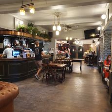
The Grade II listed Clissold House serves as a café and event space where locals and visitors gather for community celebrations. The building anchors the park as a social gathering point woven into neighborhood life.
Tennis courts, a skatepark bowl, and a splash pad open from June through September offer varied activities for different visitors. Multiple children's play areas are distributed throughout, making it easy to find something suitable for each group.
A herd of fallow deer has called the park home since its earliest days, an uncommon feature for an urban space. These animals remain a living connection to the site's deeper past.
Location: London Borough of Hackney
Inception: 1889
GPS coordinates: 51.56111,-0.08806
Latest update: December 7, 2025 20:40
St Mary, Stoke Newington
252 m
Old Church of St Mary
232 m
Stoke Newington Municipal Buildings And Surrounding Walls
336 m
The Neighbours
481 m
Rose and Crown
301 m
Clissold Park
18 m
War memorial at the Church of St Mary
223 m
130, Stoke Newington Church Street N16
540 m
183, Stoke Newington Church Street N16
355 m
177-181, Stoke Newington Church Street N16
365 m
137, Stoke Newington Church Street N16
496 m
117, Stoke Newington Church Street N16
564 m
Stoke Newington Library
369 m
Refreshment Rooms, Clissold Park
124 m
Engine House Of Metropolitan Water Board
557 m
Forecourt Wall To Church And Rectory Of St Mary
242 m
Ancillary Building To North Of Engine House Of Metropolitan Water Board
592 m
K2 Telephone Kiosk Outside Number 137
572 m
Park Crescent
215 m
Walls And Railings To Former Metropolitan Water Board Pumping Station; West Side Of Green Lanes From K2 Kiosk North For 15 Bays; East Side Of Green Lanes From Boundary With 212 Green Lanes North For 13 Bays
552 m
Tomb Of Anna Laetitia Barbauld, Churchyard Of Old Church Of St Mary
224 m
Tomb Of James Stephen, Churchyard Of Old Church Of St Mary
244 m
Post Office Pillar Box At East Corner Of King's Crescent
485 m
Stone Near East Gate Of Park
157 m
Bilney Lodge
512 m
St Mary's Rectory
254 m
8, Lordship Road N16
514 m
Pillar Box Outside Numbers 169-191
480 mVisited this place? Tap the stars to rate it and share your experience / photos with the community! Try now! You can cancel it anytime.
Discover hidden gems everywhere you go!
From secret cafés to breathtaking viewpoints, skip the crowded tourist spots and find places that match your style. Our app makes it easy with voice search, smart filtering, route optimization, and insider tips from travelers worldwide. Download now for the complete mobile experience.
A unique approach to discovering new places❞
— Le Figaro
All the places worth exploring❞
— France Info
A tailor-made excursion in just a few clicks❞
— 20 Minutes