Swineford Lock

Log in to your account

AroundUs is a community-driven map of interesting places, built by curious explorers like you. It grows with every review, story, and photo you share.
Connect to save your favorite spots, contribute locations, and create personalized routes.
Continue with Google
Continue with Apple
Continue with X
Continue with Facebook
Continue with email
By continuing, you accept our Terms and Conditions and our Privacy Policy
Create an account

Swineford Lock

Add to collection
Map
Suggest a change
Share

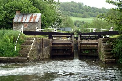
Swineford Lock, Canal lock in Bath and North East Somerset, England

Swineford Lock is a canal lock on the Bristol Avon Navigation that helps boats move between different water levels. The structure connects the Kennet and Avon Canal to the river system, allowing vessels to pass through sloped sections of the waterway.

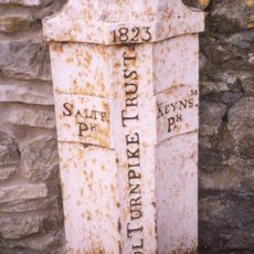
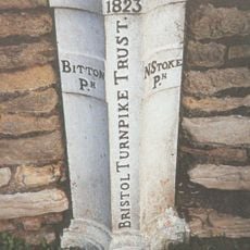
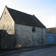
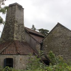
The lock was constructed in the early 1720s as part of an ambitious project to improve navigation on the Bristol Avon. The waterway later supported factories and mills that depended on water power for their operations.

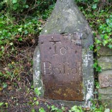
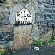
The lock remains visible as a working part of the waterway system that locals and visitors encounter along the towpath. It shows how water transport shaped commerce and daily life in this area for centuries.

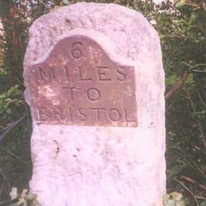
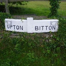
You can watch the lock operate from the towpath, which is part of a regional walking and cycling route. The path is flat and easy to walk, making it suitable for a leisurely stroll or a break during longer journeys.

In its early years, the site supported brass and copper crafts that relied on water power for processing. This industrial link made the lock a vital part of the local economy until the 1800s.

GPS coordinates: 51.41830,-2.44575

Latest update: December 14, 2025 18:06

Photos
Around this place
Saltford Manor House
United Kingdom

Saltford Manor House

2.1 km
St Mary's Church, Saltford
United Kingdom

St Mary's Church, Saltford

1.5 km
Church of St Martin
United Kingdom

Church of St Martin

1.3 km
The Old Crown Inn
United Kingdom

The Old Crown Inn

1.9 km
Parish Church of St Mary
United Kingdom

Parish Church of St Mary

1 km
United Reformed Church
United Kingdom

United Reformed Church

1.2 km
Church of St Nicholas
United Kingdom

Church of St Nicholas

2.2 km
Dovecote, To South West Of St Nicholas' Church
United Kingdom

Dovecote, To South West Of St Nicholas' Church

2.2 km
The Upton Inn
United Kingdom

The Upton Inn

957 m
Pixash Lane Bridge (MLN1/112 63)
United Kingdom

Pixash Lane Bridge (MLN1/112 63)

2.1 km
Milepost At National Grid Reference St 6977 6815
United Kingdom

Milepost At National Grid Reference St 6977 6815

1 km
Saltford Library
United Kingdom

Saltford Library

2 km
Large univallate hillfort with a bowl barrow and pillow mounds 970m west of The Bungalow
United Kingdom

Large univallate hillfort with a bowl barrow and pillow mounds 970m west of The Bungalow

1.8 km
Cold Bath House Approximately 170 Yards To South Of Fieldgrove House
United Kingdom

Cold Bath House Approximately 170 Yards To South Of Fieldgrove House

2 km
Parish Boundary Marker At Ngr St 678 673
United Kingdom

Parish Boundary Marker At Ngr St 678 673

2.1 km
Boundary Post At Swineford Opposite Somerset House
United Kingdom

Boundary Post At Swineford Opposite Somerset House

124 m
Coach House And Stable To North Of Upton House
United Kingdom

Coach House And Stable To North Of Upton House

1.1 km
Milestone At Ngr St 674 678
United Kingdom

Milestone At Ngr St 674 678

2.1 km
Milestone At National Grid Reference St6929 6889
United Kingdom

Milestone At National Grid Reference St6929 6889

193 m
Milestone, Bath Road, nr top of hill going into Saltford from Bath
United Kingdom

Milestone, Bath Road, nr top of hill going into Saltford from Bath

2.1 km
Milestone Opposite Number 116
United Kingdom

Milestone Opposite Number 116

1.4 km
Direction Signs At Cross Roads Half A Mile North West Of Beach
United Kingdom

Direction Signs At Cross Roads Half A Mile North West Of Beach

2.3 km
Roman camp 405m west of The Bungalow
United Kingdom

Roman camp 405m west of The Bungalow

2.3 km
Guidestone, Upton Cheney, N of village at ST6991771034
United Kingdom

Guidestone, Upton Cheney, N of village at ST6991771034

2.3 km
Guidestone, Bath Road, jct Cherry Garden Road (A4175)
United Kingdom

Guidestone, Bath Road, jct Cherry Garden Road (A4175)

2.2 km
Guidestone, Bath Road, jct Brewery Hill (turn to Upton Cheney)
United Kingdom

Guidestone, Bath Road, jct Brewery Hill (turn to Upton Cheney)

776 m
Milestone, Bath Road, by jcn Golden Valley Lane
United Kingdom

Milestone, Bath Road, by jcn Golden Valley Lane

1.1 km
Saltford Brass Mill
United Kingdom

Saltford Brass Mill

1.9 km
Show the full map
Reviews

Visited this place? Tap the stars to rate it and share your experience / photos with the community! Try now! You can cancel it anytime.

« Swineford Lock - Canal lock in Bath and North East Somerset, England » is provided by Around Us (aroundus.com). Images and texts are derived from Wikimedia project under a Creative Commons license. You are allowed to copy, distribute, and modify copies of this page, under the conditions set by the license, as long as this note is clearly visible.

Discover hidden gems everywhere you go!

From secret cafés to breathtaking viewpoints, skip the crowded tourist spots and find places that match your style. Our app makes it easy with voice search, smart filtering, route optimization, and insider tips from travelers worldwide. Download now for the complete mobile experience.

Around Us App Screenshot

A unique approach to discovering new places

Le Figaro

All the places worth exploring

France Info

A tailor-made excursion in just a few clicks

20 Minutes