St Mary's Church, Saltford

Log in to your account

AroundUs is a community-driven map of interesting places, built by curious explorers like you. It grows with every review, story, and photo you share.
Connect to save your favorite spots, contribute locations, and create personalized routes.
Continue with Google
Continue with Apple
Continue with X
Continue with Facebook
Continue with email
By continuing, you accept our Terms and Conditions and our Privacy Policy
Create an account

St Mary's Church, Saltford

Add to collection
Map
Suggest a change
Share

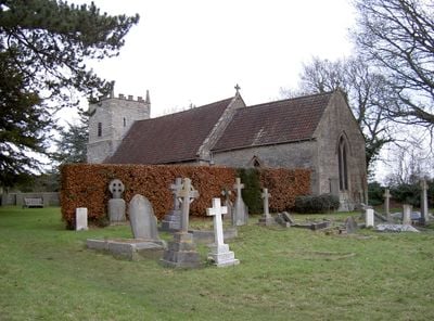
St Mary's Church, Saltford, Anglican church in Saltford, England.

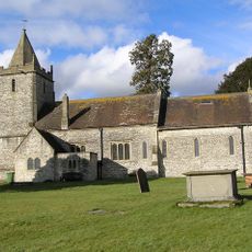
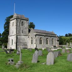
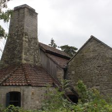
St Mary's Church is a stone building in Saltford with Norman elements, including a carved font and a gallery with an organ. The church tower rises prominently above the main roof and defines the village skyline.

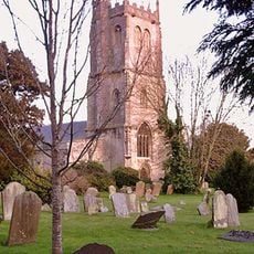
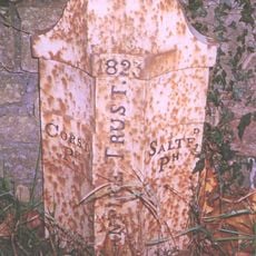
The building dates to the early 12th century and ranks among the oldest religious sites in Somerset. During the English Civil War, it suffered damage, and the rector of that era vanished without trace.

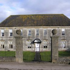
The church maintains strong connections with Saltford School, where the rector delivers weekly assembly addresses to students every Monday afternoon.

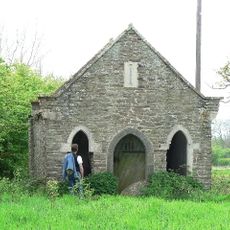
You can reach the church via a square next to the former school building, which now serves as a community center. The approach is straightforward and the church sits centrally within the village.

During the English Civil War's Battle of Lansdown, the church experienced damage, and the rector of that period disappeared without any trace.

Location: Saltford

Inception: 12 century

GPS coordinates: 51.40566,-2.45340

Latest update: December 14, 2025 18:02

Photos
Around this place
Saltford Manor House
United Kingdom

Saltford Manor House

650 m
Kelston Park
United Kingdom

Kelston Park

2.2 km
Swineford Lock
United Kingdom

Swineford Lock

1.5 km
Church of St Martin
United Kingdom

Church of St Martin

2.4 km
The Old Crown Inn
United Kingdom

The Old Crown Inn

1.5 km
Parish Church of St Mary
United Kingdom

Parish Church of St Mary

1.9 km
Church of All Saints
United Kingdom

Church of All Saints

2.4 km
Church of St Nicholas
United Kingdom

Church of St Nicholas

1.5 km
Dovecote, To South West Of St Nicholas' Church
United Kingdom

Dovecote, To South West Of St Nicholas' Church

1.4 km
The Upton Inn
United Kingdom

The Upton Inn

2.4 km
Pixash Lane Bridge (MLN1/112 63)
United Kingdom

Pixash Lane Bridge (MLN1/112 63)

1.7 km
Parish Boundary Marker At Ngr St 678 673
United Kingdom

Parish Boundary Marker At Ngr St 678 673

752 m
Cold Bath House Approximately 170 Yards To South Of Fieldgrove House
United Kingdom

Cold Bath House Approximately 170 Yards To South Of Fieldgrove House

2.4 km
Milepost At National Grid Reference St 6977 6815
United Kingdom

Milepost At National Grid Reference St 6977 6815

1.4 km
Boundary Post At Swineford Opposite Somerset House
United Kingdom

Boundary Post At Swineford Opposite Somerset House

1.6 km
Saltford Library
United Kingdom

Saltford Library

519 m
The Turnpike
United Kingdom

The Turnpike

1.1 km
Milestone At Ngr St 674 678
United Kingdom

Milestone At Ngr St 674 678

1.2 km
Boundary Marker At St 6914 6621
United Kingdom

Boundary Marker At St 6914 6621

1.4 km
Milestone At National Grid Reference St 6924 6520
United Kingdom

Milestone At National Grid Reference St 6924 6520

2.4 km
Milestone At National Grid Reference St 6973 6579
United Kingdom

Milestone At National Grid Reference St 6973 6579

2.1 km
Manor Farmhouse
United Kingdom

Manor Farmhouse

2.5 km
Milestone Opposite Number 116
United Kingdom

Milestone Opposite Number 116

2.3 km
Milestone, Bath Road, nr top of hill going into Saltford from Bath
United Kingdom

Milestone, Bath Road, nr top of hill going into Saltford from Bath

611 m
Milestone At National Grid Reference St6929 6889
United Kingdom

Milestone At National Grid Reference St6929 6889

1.6 km
Milestone, Bath Road, by jcn Golden Valley Lane
United Kingdom

Milestone, Bath Road, by jcn Golden Valley Lane

2.1 km
Guidestone, Bath Road, jct Brewery Hill (turn to Upton Cheney)
United Kingdom

Guidestone, Bath Road, jct Brewery Hill (turn to Upton Cheney)

1.9 km
Saltford Brass Mill
United Kingdom

Saltford Brass Mill

523 m
Show the full map
Reviews

Visited this place? Tap the stars to rate it and share your experience / photos with the community! Try now! You can cancel it anytime.

« St Mary's Church, Saltford - Anglican church in Saltford, England » is provided by Around Us (aroundus.com). Images and texts are derived from Wikimedia project under a Creative Commons license. You are allowed to copy, distribute, and modify copies of this page, under the conditions set by the license, as long as this note is clearly visible.

Discover hidden gems everywhere you go!

From secret cafés to breathtaking viewpoints, skip the crowded tourist spots and find places that match your style. Our app makes it easy with voice search, smart filtering, route optimization, and insider tips from travelers worldwide. Download now for the complete mobile experience.

Around Us App Screenshot

A unique approach to discovering new places

Le Figaro

All the places worth exploring

France Info

A tailor-made excursion in just a few clicks

20 Minutes