RAF Menwith Hill, Military intelligence station in Harrogate, England
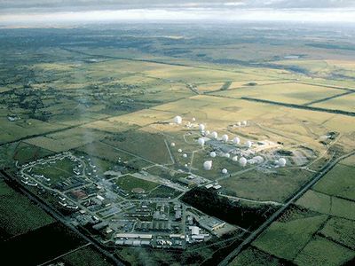
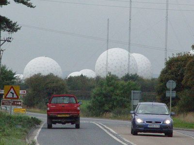
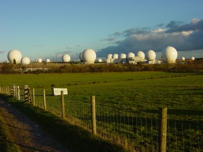
The base sits on open land in North Yorkshire, where tall white domes shaped like giant golf balls stand out against the green countryside and protect sensitive satellite equipment from the weather all year round.
Built in the 1950s during the Cold War, this site began as a small listening post and grew over the decades into one of the largest intelligence stations outside the United States, expanding its role in global communications monitoring.
The white domes have become a local landmark and a symbol of secrecy, often appearing in debates about privacy and surveillance, while nearby residents continue to organize peaceful protests questioning the station's activities and lack of transparency.
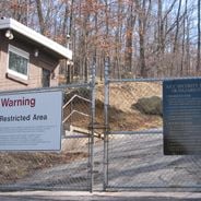
The base operates around the clock with hundreds of British and American staff who work behind secure fences, and the site includes its own small community with a bowling alley, general store, and fast-food restaurant for personnel living there.
This station is part of the ECHELON network that intercepts communications from space, and its 33 radomes create a surreal contrast between the quiet rural landscape and the high-tech intelligence work happening just out of public view.
Location: North Yorkshire
Operator: Royal Air Force
Part of: ECHELON
Address: 2884+5R, Menwith Hill, Harrogate HG3 2RF, UK
GPS coordinates: 54.00792,-1.68559
Latest update: December 12, 2025 17:44
This collection brings together underground military sites, strategic bunkers, and highly secured installations across the world. Many of these places were built during the Cold War, when nuclear threats pushed governments to create protected command centers deep under mountains or in remote areas....
John O'Gaunt's Castle
2.7 km
Medieval royal hunting lodge known as John of Gaunt's Castle, immediately north west of Haverah Park Top
2.7 kmOldstead
2.3 km
Southfield Farmhouse
2.5 km
Milepost At Se 2242 5618
1.9 km
Milepost At Se 2096 5612
846 m
Guidestone, Thornthwaite Bridge
3 km
Guidestone, W of B6451, Menwith Hill Road
2.6 km
Guidestone, Back Road, High Birstwith
1.7 kmFogfield House And Attached Barn
2.7 kmKettlesing Grange
1.7 kmFringill Top Farmhouse And Attached Barn
1.9 kmMenwith Field House And Attached Barn
2.9 kmField Barn At Day Lair
2.6 kmStocks
2.8 kmManor House With Front Garden Wall
2.2 kmEast End Manor
3 kmCragg Hall With Barn And Outbuilding
2.2 kmThe Holme
2.7 kmWesleyan Chapel
2.8 kmLaburnum House And Barn
2.9 kmWest Syke Manor
2.9 kmBarn And Outbuildings Approximately 5 Metres West Of East End Manor
3 kmIvy House Farmhouse
1.7 kmWar Memorial
2.1 kmDay Ash House With 2 Blocks To Rear
2.7 kmPlane Trees Farmhouse And Outbuildings With Barn
3 kmBank Slack (camp)
2.5 kmVisited this place? Tap the stars to rate it and share your experience / photos with the community! Try now! You can cancel it anytime.
Discover hidden gems everywhere you go!
From secret cafés to breathtaking viewpoints, skip the crowded tourist spots and find places that match your style. Our app makes it easy with voice search, smart filtering, route optimization, and insider tips from travelers worldwide. Download now for the complete mobile experience.
A unique approach to discovering new places❞
— Le Figaro
All the places worth exploring❞
— France Info
A tailor-made excursion in just a few clicks❞
— 20 Minutes