Chest opened
+${chestReward.xp} XP
Explorer
NOUVEAU ×${chestReward.collectible.quantity}
tapez pour fermer
Chest locked

Open chests in the app

Around Us is built for your phone — chests unlock when you walk, explore and capture nearby places.

Enable Location

We need your location to show you interesting places around you

Discover nearby places

Find interesting locations and hidden gems around you

Precise directions

Get accurate directions and distances to places

Your location is never shared with other users. It's only used when you tap the location button.

Beddington

Log in to your account

Start exploring — it's free

Trusted by 72,888 travelers worldwide

Continue with Google
Continue with Apple
or

We will send you a code to connect

By continuing, you accept our Terms and Conditions and our Privacy Policy

Check your inbox

We've sent a pincode in your inbox. Please enter the code below.

Beddington
Discussion Reviews 1 Photos
14.7k Popularity

Beddington, Residential district in South London, United Kingdom

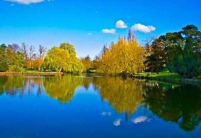
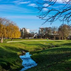
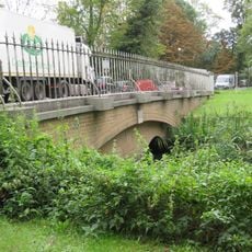
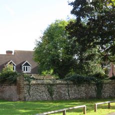
Beddington is a residential area spanning the London boroughs of Sutton and Croydon, featuring green spaces and parks throughout its neighborhoods. The River Wandle flows through the district, creating a natural feature that shapes its landscape.

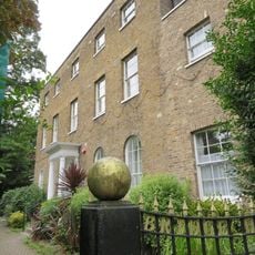
The area appeared in the 1086 Domesday Book as Beddinton(e), recorded as farmland controlled by Norman landholders including Robert de Watevile and Miles Crispin. It gradually transformed from rural countryside into the residential district it is today.

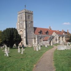
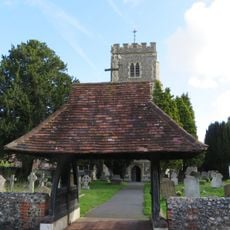
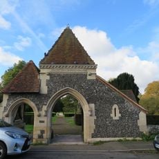
St Mary's Church displays layers of architectural styles from different centuries, with organ screens designed by William Morris that showcase his decorative vision. Walking through the church, you encounter the visual blend of these periods side by side.

Multiple Transport for London bus routes connect the area to central London, and the Tramlink network provides additional transit options from nearby stations. Walking through the parks is most enjoyable during warmer months when green spaces are at their best.

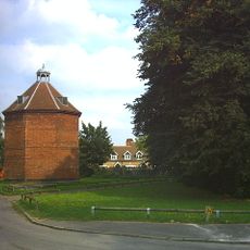
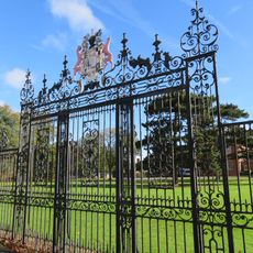
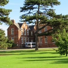
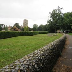
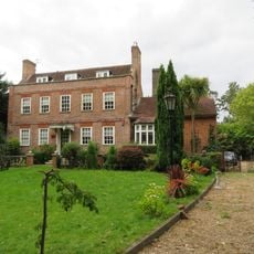
Beddington Park contains a grand historic hall and an 18th-century dovecote that are both Grade I listed buildings. Hidden within the park are the remains of a Tudor garden site that is archaeologically protected and not openly visible to visitors.

The community of curious travelers

AroundUs brings together thousands of curated places, local tips, and hidden gems, enriched daily by 60,000 contributors worldwide.

Start exploring
GPS coordinates
51.37100,-0.13200
Latest update
December 7, 2025 20:20
Around this place
Wandle Park
United Kingdom

Wandle Park

1.5 km
Parish Church of St Mary the Virgin
United Kingdom

Parish Church of St Mary the Virgin

557 m
Church of the Holy Trinity
United Kingdom

Church of the Holy Trinity

1.5 km
Carew Manor Dovecote
United Kingdom

Carew Manor Dovecote

607 m
Wandle Park
United Kingdom

Wandle Park

1.5 km
United Kingdom

Brandries Cottage

244 m
Wallington Bridge
United Kingdom

Wallington Bridge

1.4 km
335-347, Purley Way
United Kingdom

335-347, Purley Way

1.1 km
Gates And Wrought Iron Screen At West Entrance To Beddington Place
United Kingdom

Gates And Wrought Iron Screen At West Entrance To Beddington Place

621 m
Beddington Place (great Hall Only)
United Kingdom

Beddington Place (great Hall Only)

511 m
East Lodge
United Kingdom

East Lodge

652 m
Boundary Walls To Beddington Place Along East Side Of Churchyard And Along Church Lane
United Kingdom

Boundary Walls To Beddington Place Along East Side Of Churchyard And Along Church Lane

420 m
United Kingdom

Old Tithe Barn

1.2 km
351, Purley Way
United Kingdom

351, Purley Way

1.1 km
Beddington Place (2 End Wings)
United Kingdom

Beddington Place (2 End Wings)

540 m
Lychgate At West Entrance To Churchyard Of St Mary's
United Kingdom

Lychgate At West Entrance To Churchyard Of St Mary's

603 m
Wall To South West Of Beddington Park Cottages
United Kingdom

Wall To South West Of Beddington Park Cottages

588 m
Lychgate At Entrance To West Churchyard Extension
United Kingdom

Lychgate At Entrance To West Churchyard Extension

615 m
Boundary Walls To Extension Of Churchyard To West Of Church Road
United Kingdom

Boundary Walls To Extension Of Churchyard To West Of Church Road

660 m
United Kingdom

Rear Garden Walls To Brandries Cottage And Former Kitchen Garden Walls And Gate To Camden House

222 m
United Kingdom

Garden Walls At Beddington Place (Carew Manor Special School) To North Of Orangery Walls

526 m
Lamp Standard In Churchyard To South West Of Church Tower
United Kingdom

Lamp Standard In Churchyard To South West Of Church Tower

575 m
Wandle Bank
United Kingdom

Wandle Bank

1.5 km
United Kingdom

258, London Road

1.4 km
United Kingdom

Churchyard Walls

599 m
282, London Road
United Kingdom

282, London Road

1.4 km
United Kingdom

Camden House

142 m
United Kingdom

Orangery Wall At Bedddington Place

420 m
Show the full map
Reviews
Share your experience

No review yet

Discussions
Start a discussion...

No discussion yet

« Beddington - Residential district in South London, United Kingdom » is provided by Around Us (aroundus.com). Images and texts are derived from Wikimedia project under a Creative Commons license. You are allowed to copy, distribute, and modify copies of this page, under the conditions set by the license, as long as this note is clearly visible.

Discover hidden gems everywhere you go!

From secret cafés to breathtaking viewpoints, skip the crowded tourist spots and find places that match your style. Our app makes it easy with voice search, smart filtering, route optimization, and insider tips from travelers worldwide. Download now for the complete mobile experience.

Around Us App Screenshot

A unique approach to discovering new places

Le Figaro

All the places worth exploring

France Info

A tailor-made excursion in just a few clicks

20 Minutes

Around Us
Travel Guide & Maps
Download

Send to your phone

QR Code
1

Open the camera app on your mobile.

2

Point at the QR code with your camera. A notification will appear.

3

Tap the notification to open the link.