Allt yr Esgair, Mountain summit in Brecon Beacons National Park, Wales.
Allt yr Esgair is a summit in the Brecon Beacons formed by a sandstone and mudstone ridge running northwest to southeast at 393 meters high. Views from the top encompass the River Usk valley and the rolling moorland that surrounds it.
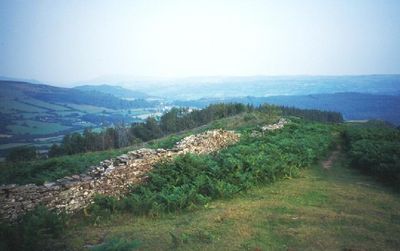
The summit shows evidence of an Iron Age hillfort and a Roman road that connected the military fort at Y Gaer to Gobannium in Abergavenny. These ancient routes reveal how this location served as a strategic position in the landscape.
The Welsh name Allt yr Esgair means wooded slope of the ridge, reflecting how local people have named landscape features for generations. The hill remains a familiar landmark for those living in the surrounding villages and farmland.
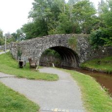
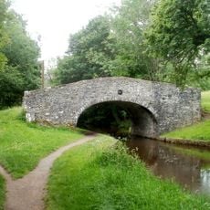
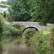
Multiple bridleways cross the hill offering routes for different ability levels and interests. A car park near the A40 provides straightforward access for those arriving by vehicle.
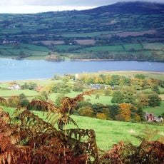
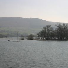
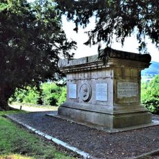
A viewfinder on the summit serves as a monument to Baroness White of Rhymney and helps visitors identify landmarks across the landscape. This installation makes it easy to spot Llangorse Lake and other features visible from this vantage point.
Location: Powys
Location: Tal-y-bont on Usk
Location: Llangors
Elevation above the sea: 392.6 m
GPS coordinates: 51.91085,-3.27181
Latest update: December 14, 2025 14:25
Treberfydd
1.2 km
Blaenllyfni Castle
2.4 km
Caeau Ty-mawr
2.1 km
Llangors Crannog
2.7 km
St Gastyn's Church
1.9 km
St Ffraed's Church
939 m
Church Of St Paulinus
3.4 km
White Hart Inn
2.1 km
Penuel Baptist Chapel
3.3 km
The Star Inn
2.1 km
Former skittle alley and tea-room
2.1 km
White Hart Bridge (Canal Bridge No.143) including attached retaining wall
2.2 km
Penawr Bridge (Canal Bridge No.151)
2.4 km
Gwynne Holford Monument in the churchyard to SW of Church of St Ffraed
955 m
Wenallt Lower Bridge
3.5 km
Pencelli Bridge
3.4 km
Castle Bridge (Canal Bridge No. 152)
3.1 km
Ashford Tunnel S Portal (Monmouthshire and Brecon Canal)
2.9 km
Cross Oak Bridge (Canal Bridge No.147)
1.9 km
Ashford tunnel N Portal (Monmouthshire and Brecon Canal)
2.6 km
Bwlch War Memorial
2.9 km
War memorial at Lower Cross Oak
2 km
Wenallt Upper Bridge
3.3 km
Pair of railway bridges over road and canal at Talybont
2.1 km
Old School House (also Known As Yr Hen Ysgol)
1.9 km
Penuel Chapel
3.3 km
Lychgate in churchyard of St Gastyn
1.9 km
Benciah Independent Chapel
1.9 kmVisited this place? Tap the stars to rate it and share your experience / photos with the community! Try now! You can cancel it anytime.
Discover hidden gems everywhere you go!
From secret cafés to breathtaking viewpoints, skip the crowded tourist spots and find places that match your style. Our app makes it easy with voice search, smart filtering, route optimization, and insider tips from travelers worldwide. Download now for the complete mobile experience.
A unique approach to discovering new places❞
— Le Figaro
All the places worth exploring❞
— France Info
A tailor-made excursion in just a few clicks❞
— 20 Minutes